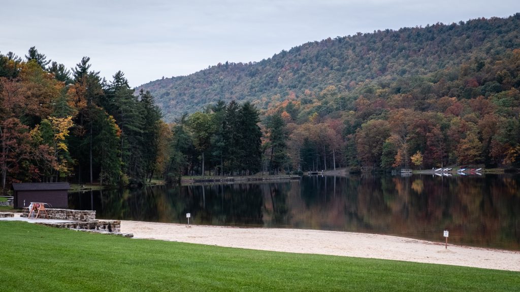
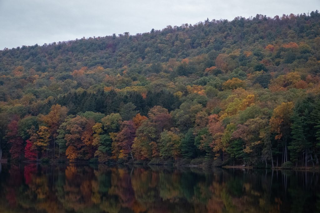
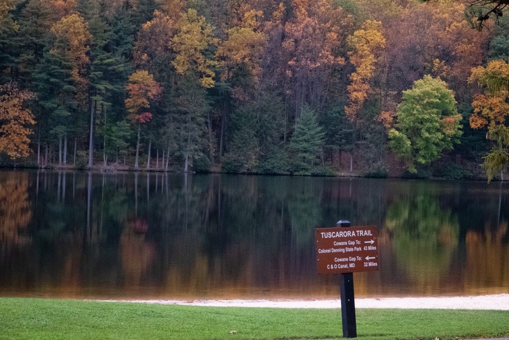
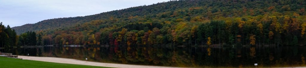
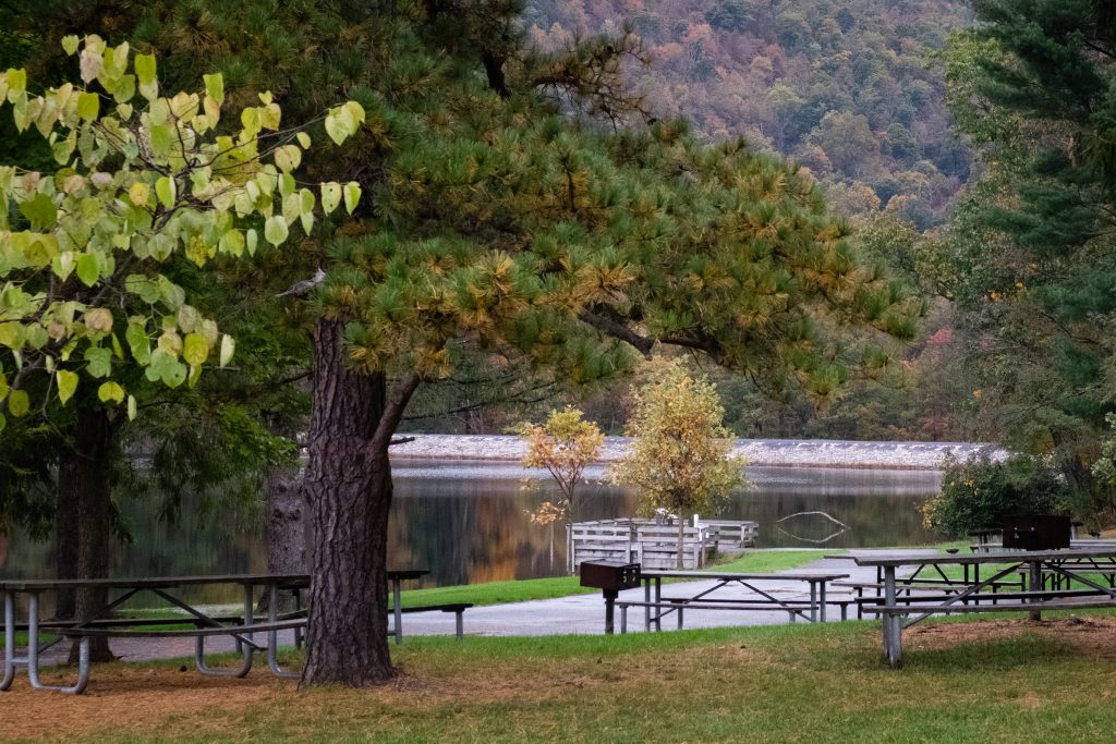
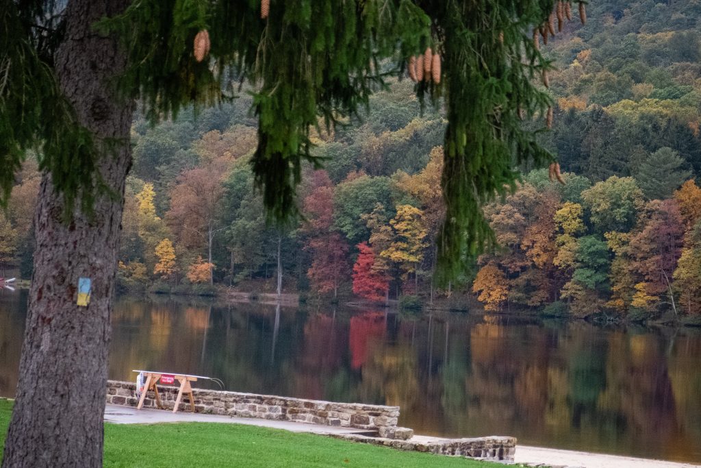
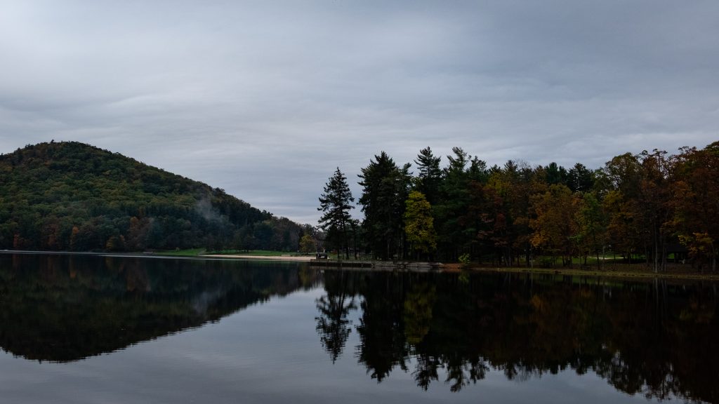
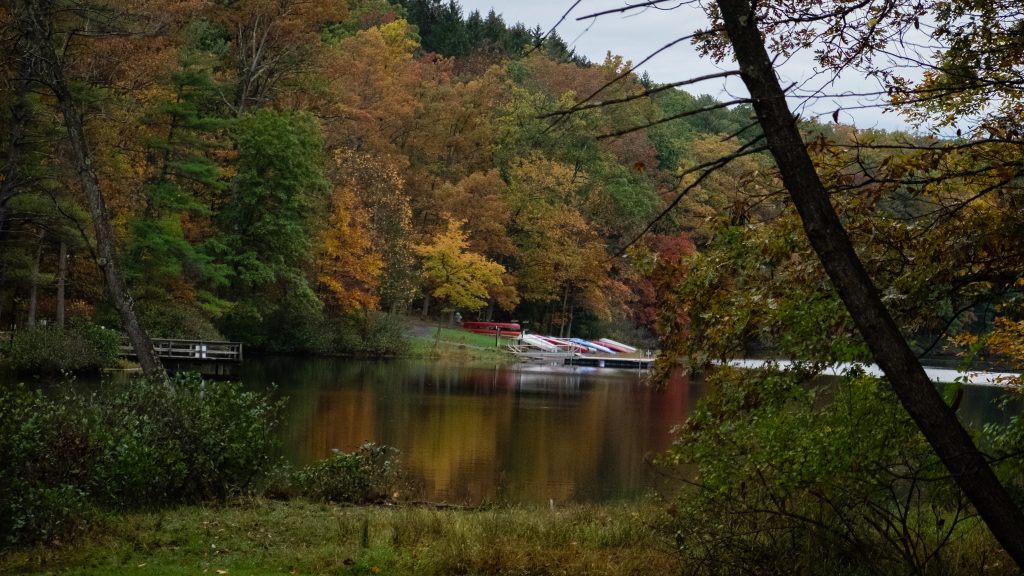
Cowans Gap State Park is a 1,085-acre park in the beautiful Allens Valley of Fulton County. A 42-acre lake, large campground, rustic cabins, and many hiking trails are prime attractions. The Buchanan State Forest surrounds the park, providing additional options for recreation and natural beauty in all seasons. The park features a full range of other activities such a fishing, boating, hunting, picnicking and swimming.
The beach in Autumn.It was a still day with great reflections on the water.A panoramic view.A dam and the fishing pier.Autumn silence.
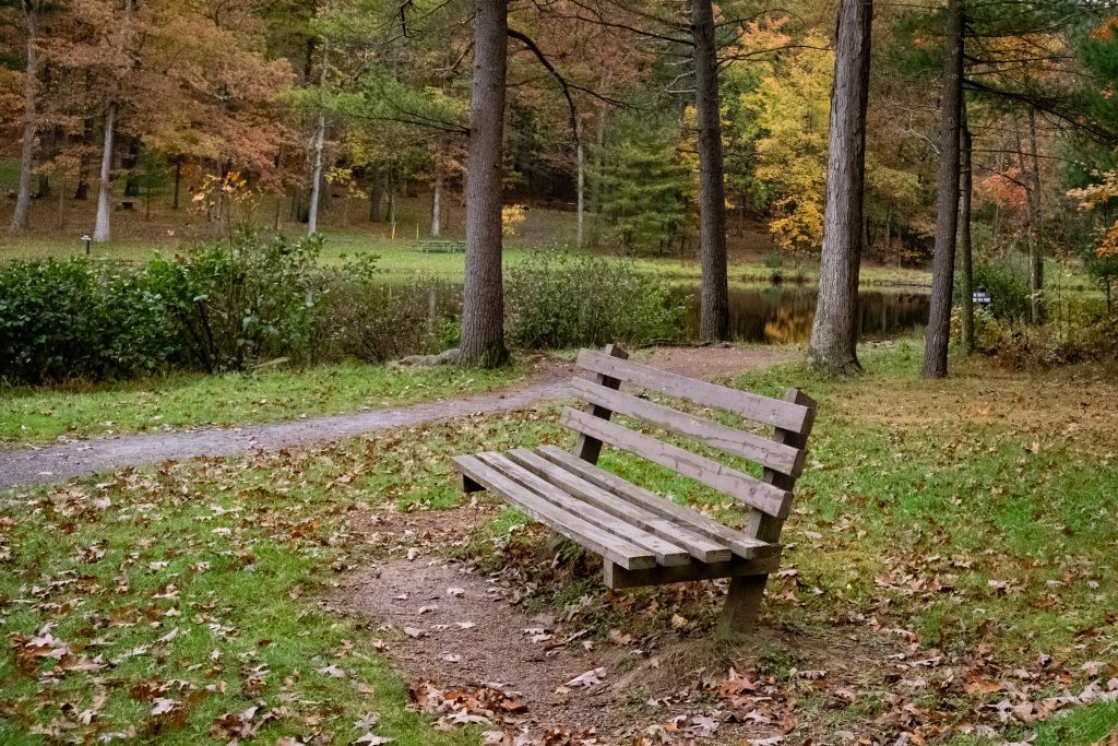
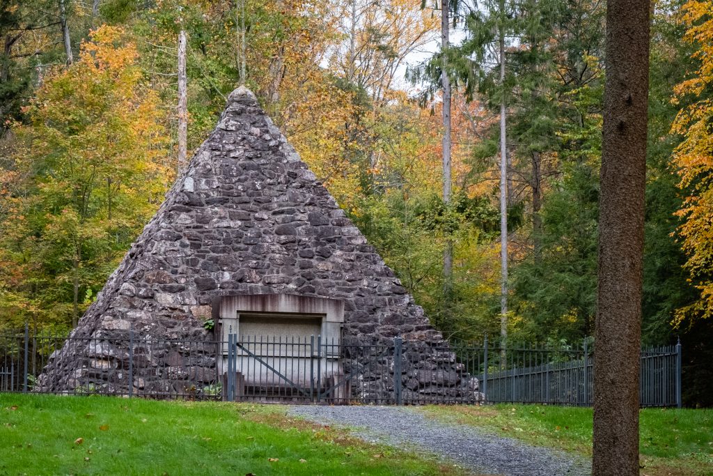
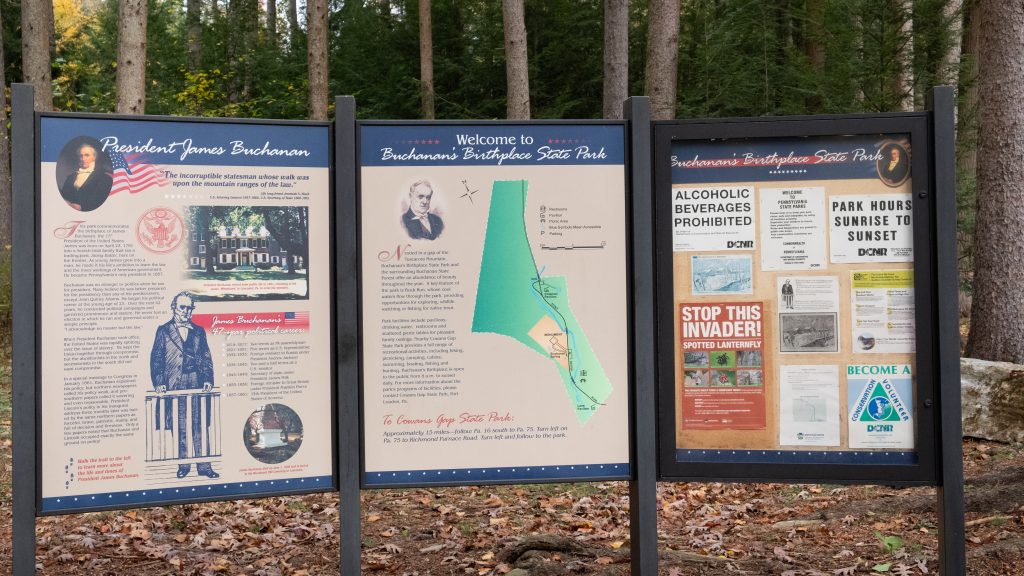
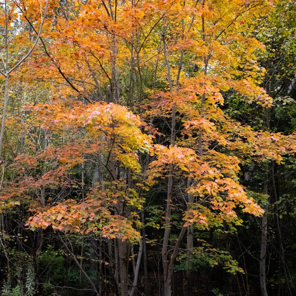
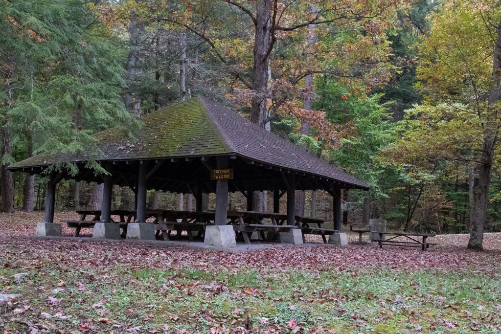
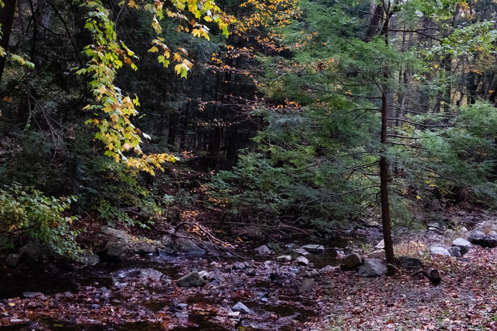
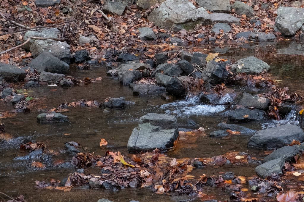
Buchanan’s Birthplace State Park is an 18.5-acre park nestled in a gap of Tuscarora Mountain in Franklin County. The park and the surrounding forested mountains offer an abundance of beauty throughout the year. In addition to President Buchanan’s memorial, there are picnic pavilions and picnic tables. Buck Run flows through the park and hosts a population of native trout.
James Buchanan Jr. was a lawyer and politician who served as the 15th president of the United States from 1857 to 1861. He previously served as secretary of state from 1845 to 1849 and represented Pennsylvania in both houses of the U.S. Congress.
The memorial.Lovely fall colors.Picnic pavilion.Buck Run.
If you head west on Route 30 past Gettysburg, you will come across two state parks. The larger of the two is Caledonia State Park. The 1,125-acre park is in Adams and Franklin counties, between Chambersburg and Gettysburg along the Lincoln Highway (US 30). It is situated within South Mountain, the northern terminus of the well-known Blue Ridge Mountain of Maryland and Virginia. The soils on either side of South Mountain are ideal for fruit production, proven by the abundance of orchards in the surrounding area.
Some unique features at Caledonia are a golf course and the Totem Pole Playhouse. It also provides hiking, camping, and hunting and hosts the Pennsylvania Forest Heritage and Discovery Center.
Forest Heritage and Discovery CenterA spartan camp setup,Let’s enjoy some fall color …… in the nearby Michaux State Forest as well.
Nearby Mont Alto State Park is a quiet, 24-acre park which features a pavilion, picnicking, and trout fishing. Mont Alto is the oldest park still in the Pennsylvania state park system.
A unexpected event greeted me on my way home from a fairly unsuccessful trip to take some photographs. I came upon a fireworks display in celebration of Exton Community Day at Exton Park. I have no idea if this event is usually at this time of year, but it was nice to see fireworks a little earlier in the evening and with good weather.
Here are a few shots from around Lake Nockamixon. I happened to stop there on my way home from Ralph Stover State Park. The 5,286-acre Nockamixon State Park is in Bucks County and is convenient to Philadelphia and its suburbs. Tohickon Creek, Three Mile Run, and Haycock Run feed the 1,450-acre Lake Nockamixon, which is a rest stop for migrating waterfowl and popular with boaters and anglers. There is a marina and 24 hour fishing in designated areas. You can stay the night in a cabin or enjoy the activities of the park for the day. Popular activities include picnicking, swimming in the pool, hiking, biking, disc golfing, hunting, fishing, birdwatching and boating.
The marina is one of my favorite areas of the park.I think I prefer the sailboat.An adaptive kayak launch to the right. A rare win for handicapped access in PA.Water looks a little choppy but still fun. A interesting barn I found on the way home.
Ralph Stover State Park provides access to Tohickon Creek, which flows through the 45-acre park. It contains a scenic picnic area, and the nearby High Rocks section is a lovely overlook of creek. When high water conditions exist, Tohickon Creek offers a challenging course for closed-deck canoes and kayaks, especially during the end of March and the beginning of November, when there are planned whitewater releases from Lake Nockamixon. Fishing is also available in Tohickon Creek.
This is also one of the most popular areas in southeastern Pennsylvania for climbing. The cliffs and trails at High Rocks are a joint ownership by the state and Bucks County. Within Ralph Stover and Tohickon Valley parks, the cliff faces are made of a common Bucks County rock, red Brunswick shale, which formed along an ancient fault line. Ranging from 30 ft to 150 ft high and extending about ¾ mile long, High Rocks offers close to 100 climbing routes consisting mostly of top rope and traditional climbing. Some areas along the trail closer to the creek edge may be conducive to bouldering.
Here comes the rant. While I am not particularly disabled, I do have tremendous difficulty walking on steep, uneven or eroded surfaces, even over short sections. I had hoped to see the view from High Rocks due to its short distance from the parking lot. It was my main objective in visiting here. I was very sad to discover, that due to trail conditions, even this short walk was inaccessible for someone with difficulty walking. This should be an ideal location for providing some type of handicapped access, at least to the first observation point. However, handicapped access seems to be a low priority of DCNR and the county park systems in this state and many types of opportunities are off limits. Whether this due to funding limitations, desire to limit access for environmental reasons, or indifference, enjoying the outdoors is limited to the able bodied or those that can hike on over uneven terrain. While I certainly don’t expect everything to be made accessible, I think there are specific spots where it could be easily done without substantially changing the experience of visiting those places. You can find the view from High Rocks through Google image search. That is what I had to settle for.
There is a road that runs through the park between High Rocks and main part of the park. This road, however, is impassable due to bridge construction. There were two signs directing you to High Rocks from the main picnic area, but they only got you about half way there and there was no signage at some key turns. If you are going to block a bridge, you need to clearly mark alternate routes.
This bridge, at least, was okay.As close to the view as I was able to get. So close but yet so far.Don’t even think about travelling through the park.
From Ralph Stover, I headed up River Road (Route 32), along the way I found the lovely Tinicum Park, which is part of the Buck County Parks system. The historic 126-acre Tinicum Park includes playgrounds, picnicking, hiking, ball fields, boating, fishing, ice skating, a disk golf course and group and family camping at eight campsites. You may even run into a polo match here.
The Erwin-Stover House is on the property.The barn is available as a rental.The grass must have gotten quite a haircut.Moving the bales.
River Road also provides access to entry points for Delaware Canal State Park and Delaware River boat access ramps.
Trees and forested areas can be some of the most difficult to photograph. For me, it’s primarily the challenge of finding the strong focal point. The woods in Promised Land State park are some of my favorites. Let’s take a drive around the Upper Lake.
A lake in the picture never hurts.I love how this spot emphasis the boggy and marshy qualities of the Poconos.I would love this dock.
Looming over the town of Nicholson, Pennsylvania is the Tunkhannock Creek Viaduct, a railroad bridge completed in 1915. It is a concrete deck arch bridge on the Nicholson Cutoff rail segment of the Norfolk Southern Railway Sunbury Line that spans Tunkhannock Creek. Measuring 2,375 feet (724 m) long and 240 feet (73.15 m) tall when measured from the creek bed (300 feet (91.44 m) from bedrock), it was the largest concrete structure in the world when completed in 1915 and still merited “the title of largest concrete bridge in America, if not the world” 50 years later. Built by the Delaware, Lackawanna and Western Railroad, the bridge is owned today by Norfolk Southern Railway and is still used daily for regular through freight service. Apparently almost half of the bulk of this behemoth is underground, in the form of bridge pillars up to 138 feet (142 m) below ground.
The bridge was listed on the National Register of Historic Places on April 11, 1977. In 1975, the American Society of Civil Engineers or ASCE designated the bridge as a Historic Civil Engineering Landmark. ASCE recognized the bridge as “not only a great feat of construction skill” but also a “bold and successful departure from contemporary, conventional concepts of railroad location in that it carried a mainline transversely to the regional drainage pattern, effectively reducing the distance and grade impediments…”
The bridge towers over the town of Nicholson.A view further upstream.The cows don’t seem to notice the vast structure.
I also swung by Lackawanna State Park on my way back from the bridge. The 1,445-acre park is ten miles north of Scranton. The focus is the 198-acre Lackawanna Lake, which is surrounded by picnic areas and multi-use trails winding through forest. Boating, camping, fishing, mountain biking, and swimming are popular recreation activities here.
I’ve always wanted a canoe mooring on a lake.At least these geese don’t mind the weather.Another rainy late spring day ….Great spot for a picnic and a boat trip.
Nestled in the far north of Susquehanna County not far from the New York line, Salt Springs State Park feels like one of the more remote state parks in Pennsylvania. It is well known for its deep gorge with three waterfalls, old growth hemlock trees and the salt spring which gives the park its name. It is unusual among state parks in that it is managed by the Friends of Salt Springs State Park, a volunteer organization. The Friends also own and operate an adjacent tract of land. Prior to becoming a park, Salt Springs was the homestead of the Wheaton family. The park offers hiking, camping, picnicking, and educational programming.
A beautiful waterfall. The bank is eroded away by flooding and it takes some scrambling to reach the falls.Beautiful spot for a picnic.Dramatically perched trees along the gorge.The BarnAn organic garden.This is a private residence. The Wheaton House is to the left in the back.A lovely little bridge from the camping area.
I visited on a rainy day which cut short some of my planned activities. I had intended to find the salt spring which is near the main homestead. From looking at photos and video on the internet, this spring is gurgle bubbling up through a pipe in a small hole in the ground. It does not seem like a main feature of the park which bears its name.
The park is lovely, especially along Salt Springs Road.
A lovely view over the fields.There is a great mix of green here.A calmer section of Fall Brook.
Prompton State Park and the Varden Conservation Area are located near each other in northeastern Pennsylvania’s Wayne County. Prompton State Park provides boat launching and picnicking facilities for the 290-acre Prompton Lake, which is operated by the U.S. Army Corps of Engineers. There are twenty-six miles of hiking trails which surround the lake and a disc golf course.
Morning mists on Prompton Lake ….A little disc golf by the lake.A view of the substantial dam.The west branch of Lackawanna Creek.Half mast for Memorial Day.
A gift from veterinarian Dr. Mead Shaffer, the 444-acre Varden Conservation Area is in an area that was once a remote section of the state, but which is now beginning to feel pressure from development. The land is conserved as open space with opportunities for low impact recreation and educational use. It is a great place to learn about Pennsylvania’s natural history. There is picnicking by and fishing in the pond. There is also hiking in the two tracts which constitute this conservation area. I visited the Tannery Road Tract.
The lovely pond can be used for fishing.Morning mists on an unseasonably cool day.Beautiful irises are indicative of the seasonal flora of this area.
I made my third trip to Promised Land State Park this past Memorial Day weekend. I love the Bear Wallow Cabin area, a cluster of former CCC cabins that still are largely original construction with hand made wood furniture. I also like the proximity of the Wildlife Observation Station to these cabins. The weather was unseasonably cold and raining so most of time was spent travelling around to other nearby sights to get a feel for those places. In this post, I will focus on some of the logistics of the park.
Promised Land contains two lakes with multiple boat launches, a beach with concession, boat rental, hiking and horseback riding. There are opportunities for hunting and fishing in season. The park is mostly surrounded by the Delaware State Forest. It is unusual in that most of the town of Promised Land is within the boundaries of the park and privately owned cabins are tucked away around the lakes.
Cabin number 2, named Buchanan. The cabins come in varying sizes, This is a smaller one.The bathrooms for Cabin 1 and 2. Each cabin has its own bathroom which is unusual in a state park.
The cabins have an oven, fridge, microwave, coffee maker and electrical outlets. Heat is by wood stove and there is no running water. The bathrooms are modern with toilet, shower, and sink and are heated. The park has multiple campgrounds and a variety of different camping options as well.
The interior looking toward the bedroom.An old drop down desk.A bench near the Bear Wallow boat launch on the Lower Lake.The statue in front of the Masker Museum, which focuses on the CCC.