

It feels like the season is a bit late this year. However, the early bulbs and the forsythia are finally making an effort.


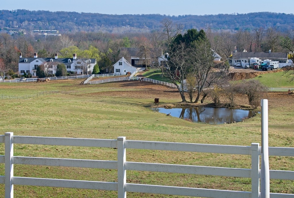
Below are some early Spring scenes from around Valley Forge.
It feels like the season is a bit late this year. However, the early bulbs and the forsythia are finally making an effort.
Below are some early Spring scenes from around Valley Forge.
This winter has been particularly harsh, with prolonged periods of below average temperatures that have kept me trapped at home when the snow fails to melt around my car. I did, however, manage to travel to a farming area in northwestern Chester County to do some birding on New Year’s weekend.
This area is known for attracting winter migrant species that prefer open habitats, such as horned larks, Lapland longspurs, and snow buntings. I have had lucky seeing the horned larks before. This time, I saw the flocks of birds but had difficulty making out individuals with my binoculars or camera. However, a popular bird sound id app did pick up all of the species above, including the snow bunting and longspur. To access this site, one has to try to pull off by the side of the road and sit an wait. There was one other car during the time I was there. The locals must think we are crazy.
In terms of pictures, I had to content myself with scenes of the local area.


I made my way home via Marsh Creek State Park. Alas, the gull photos I took there were too distant and blurry.


A qucik trip into Lancaster County proved to a source a frustration. A higher level of traffic and lighting challenges did not yield the photographs I had hoped for. However, I took the opportunity to check out the rebuilt Smorgasbord and Restaurant at the Hershey Farm Resort. I had a very nice meal, and I am glad to see the business back in operation after a fire.
Here are some views of eastern Lancaster County in September.


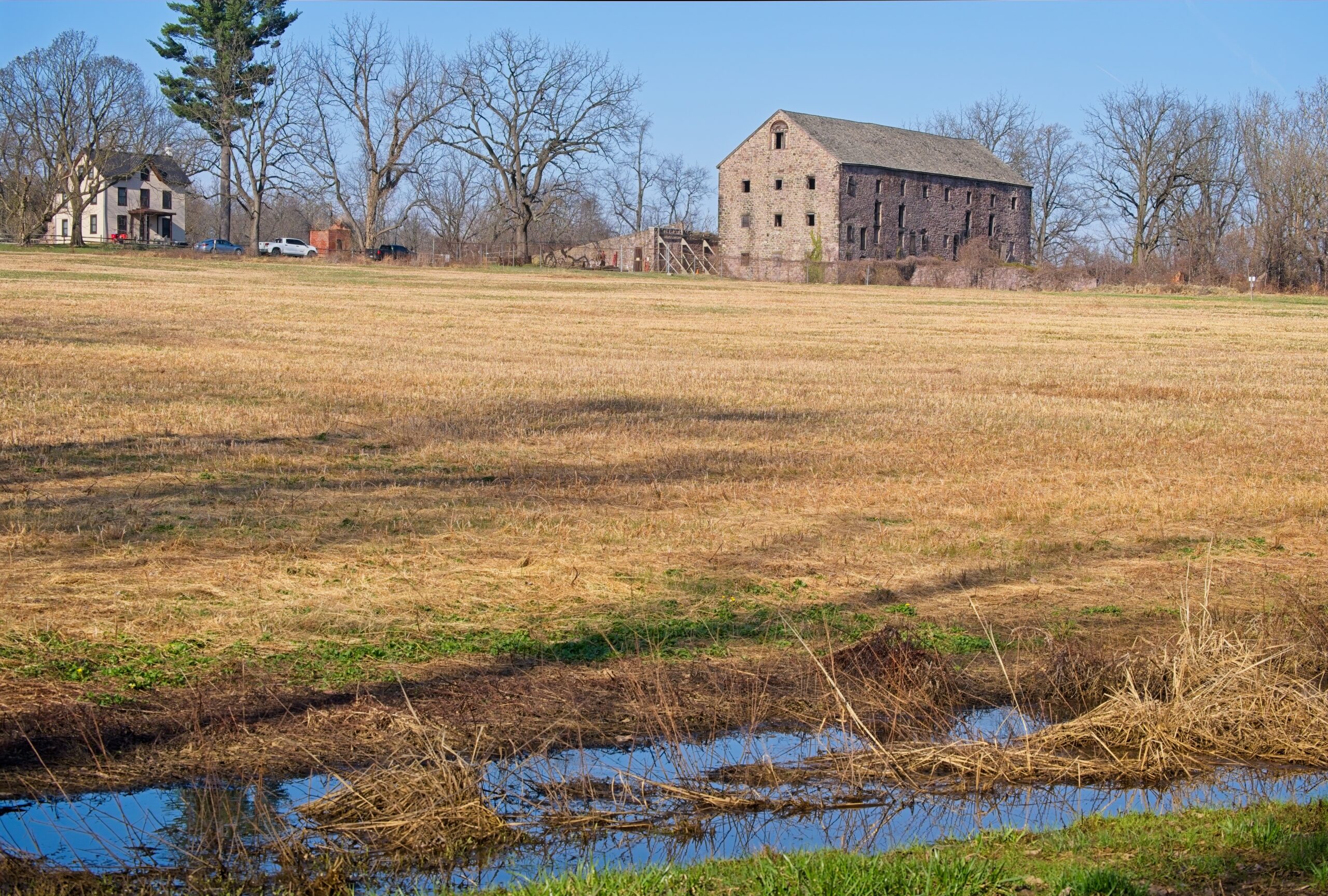
Today’s post takes us back to the area of the Octoraro watershed in southern Chester and Lancaster counties, with a focus on some of the farms and animals of the area.


It was interesting to see a photography exhibit at the Brandywine Museum of Art. “Robert Frank and Todd Webb: Across America, 1955” ran from February 09, 2025 to May 08, 2025. I made a point of seeing it before it left.
More details about the exhibit can be found at the Museum’s website. In 1955, two photographers, Robert Frank and Todd Webb, received separate fellowships from the Guggenheim Foundation for U.S. survey projects. The exhibit includes over 100 photographs from these fellowships.
This is the type of documentary-like photographic work that I find interesting. Webb stated that he wished to “depict vanishing Americana and what is taking place” – sentiments in line with what I am trying to achieve with this blog. Much of the small town and rural landscape continues to be eaten up by development, and documenting this moment in time is very important.
I ended up recording a lot more of Webb’s work, which is better composed and exposed compared to the grainy, off-kilter work of Frank. Frank’s work is, however, better known and often depicts the grittier side of American life. Webb’s work has more of a nostalgic, Rockwell-like feel. The works encompass photos from Portland, Maine to New York City to San Francisco and everywhere in between. I was pleasantly surprised to find several work depicting Pennsylvania by Webb. If you can find a catalog, several other shots taken in the state are included.
Apologies for the light blub reflections here. I am still getting used to some new photo processing software. I have just done some cropping and straightening of camera phone photos.


Now, for some fun. Here are some of my favorite pieces from the Museum.


The Bedford County area has some interesting rural scenes, such as this barn with an unusual star made from repurposed farm equipment.


The town of Bedford contains some interesting sights for the traveler. The Bedford Village Archeological Site is an archaeological site was once occupied by a Monongahela culture village. Today, the site is the location of Old Bedford Village, an open-air museum, containing a variety of historic structures transported to the site from the surrounding towns of Bedford, Everett, and Rainsburg.


Adjacent to Old Bedford Village is the Claycomb Covered Bridge. It was was built in 1880 in Reynoldsdale and was moved to its present location in 1975. It is a burr truss design, 126 feet long, which has been reinforced with steel to support bus traffic that frequents Old Bedford Village. The structure is unpainted and the roof is constructed of Cedar shakes. The deck consists of crossboard planks and the sides are totally enclosed. It sits on poured concrete abutments.


Near the entrance to Old Bedford Village, I couldn’t resist a stop at the Penguin, which has a large menu of hard and soft ice cream and other treats.


The Kuerner Farm, also known as Ring Farm, is located in Chadds Ford. It is notable for its association with artist Andrew Wyeth, who created about one-third of his work, more than 1,000 paintings and drawings, on subjects he found there during a span of seventy-seven years.
In 1926, Karl Kuerner and his wife Anna rented the farm, which they bought in 1940. Karl had been a sheepherder near the Black Forest in his native Germany, and had been a machine gunner in the German Army during World War I. Andrew Wyeth’s first painting of the farm was completed in 1932, when Wyeth was just fifteen years old. The farm was listed in the National Register of Historic Places and declared a National Historic Landmark in 2011.The property abuts the Brandywine Battlefield, another National Historic Landmark. The farm is open to public tours, operated by the Brandywine River Museum.
I had a previous opportunity to photograph a wide shot of the farm , but I was recently able to get on one of the public tours. The first stop on the tour was the farmhouse,


Here are a few views of my drive through Mercer and Crawford Counties on my way from Pymatuning Reservoir to Lake Erie.


Before we head to western Pennsylvania, let’s take a look at some shots from a nice Spring day in Lancaster County. It was a good day for photography, the sun was shining and the cows seemed happy.


