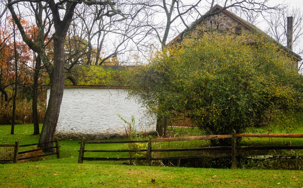
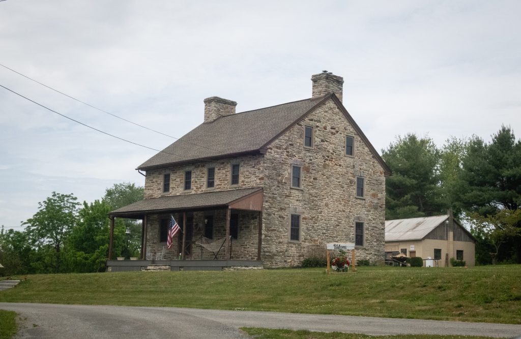
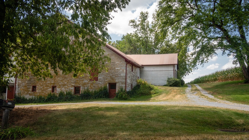
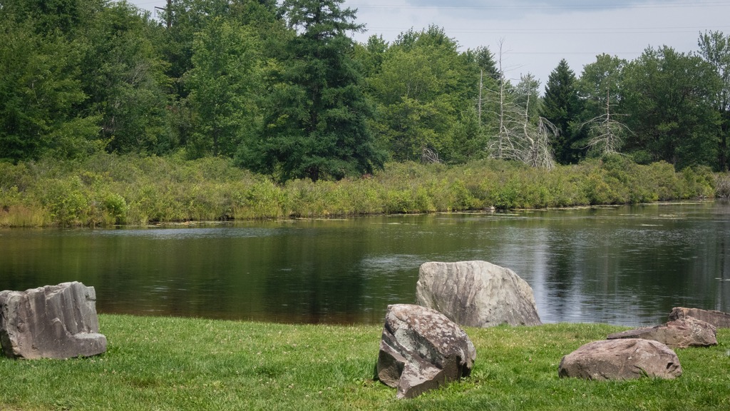
Gunkle Spring Mill is a historic American gristmill complex constructed in 1793. It is located in East Whiteland Township, Chester County and was listed on the National Register of Historic Places in 1978. The mill was built in 1793 by Michael and Chatharina Gunkle. It is a 2 1⁄2-story, banked stone structure with a gable roof. Also located on the property are a 2 1⁄2-story, stuccoed stone miller’s house, a one-story stone spring house, a one-story stone smokehouse, and a one-story stone carriage house.
Gunkle was a German immigrant from Philadelphia who purchased 974 acres (394 ha) in 1792 in East Whiteland, where he constructed and operated the gristmill, along with a saw mill and a fulling mill. By 1872 the mill processed 1,800 short tons (1,600 t) of flour, feed, corn, and oats yearly. At the peak of its productivity, the mill ran 18 hours a day. The mill remained in continuous operation into the 1940s.
Christiana is a borough in Lancaster County, Pennsylvania, United States. Present-day Christiana was once known as Nobleville. The present name is after Christiana Noble, the wife of a first settler. It is notable as the site of the Christiana railroad depot, constructed by the Pennsylvania Railroad.
In 1851, the town was the site of the Battle of Christiana, also called the Christiana riot. On September 11, 1851, Christiana was the site of the Battle of Christiana (also called the Christiana Riot), in which the local residents defended with firearms a fugitive slave, killing the slaveowner. Southerners demanded the hanging of those responsible, who were accused of treason and making war on the United States, but after the first defendant was acquitted, the government dropped the case. The trial was the first nationally covered challenge to the Fugitive Slave Act of 1850. Today, the town is the sight of the Christiana Underground Railway Center.
Underground Railroad Center – hours are seasonal so check before heading out.
Some other views from the town and the surrounding area:
Pennsylvania recently announced the designation of three new state parks. As facilities at these parks are still under development, we will take a brief look at two of them here.
The 1,700-acre Big Elk Creek State Park in southern Chester County. The majority of the park consists of lovely farmlands and forest. The park acts as a wildlife corridor and provides refuge for an array of threatened and endangered species. The park’s namesake, Big Elk Creek, traverses the park and is a high-quality stream. Visitors currently may access passive recreational activities, including trail hiking, bird watching, horseback riding, fishing, and hunting.
The 1,044-acres of Susquehanna Riverlands State Park lie in York County, along the confluence of Codorus Creek with the beautiful Susquehanna River. It is nearly six miles northwest of Wrightsville, Pennsylvania. The park features multiple rock outcrop vistas over the river and nearly a mile of riverfront along the Susquehanna with 1.5 miles along Codorus Creek. An approximately 2.75-mile-long portion of the Mason-Dixon Trail traverses the park. This 200-mile-long trail connects the Appalachian Trail at Whiskey Springs in Cumberland County with Chadds Ford along the Brandywine River. The cliffs overlooking the river are also popular for rock climbing.
Codorus Furnace is a reconstructed iron furnace that is very close to Susquehanna Riverlands State Park and makes a nice stop if you are visiting the park. Erected in 1765, the Codorus Furnace was once owned by James Smith of York, a signer of the Declaration of Independence. Cannon balls were cast in the original furnace during the Revolutionary War and the War of 1812. In 1837, iron was floated downstream to Philadelphia and Baltimore to service early manufacturing. The furnace ceased operations in 1850. The Codorus Furnace is currently owned and maintained by the Conservation Society of York County.
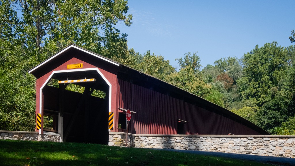
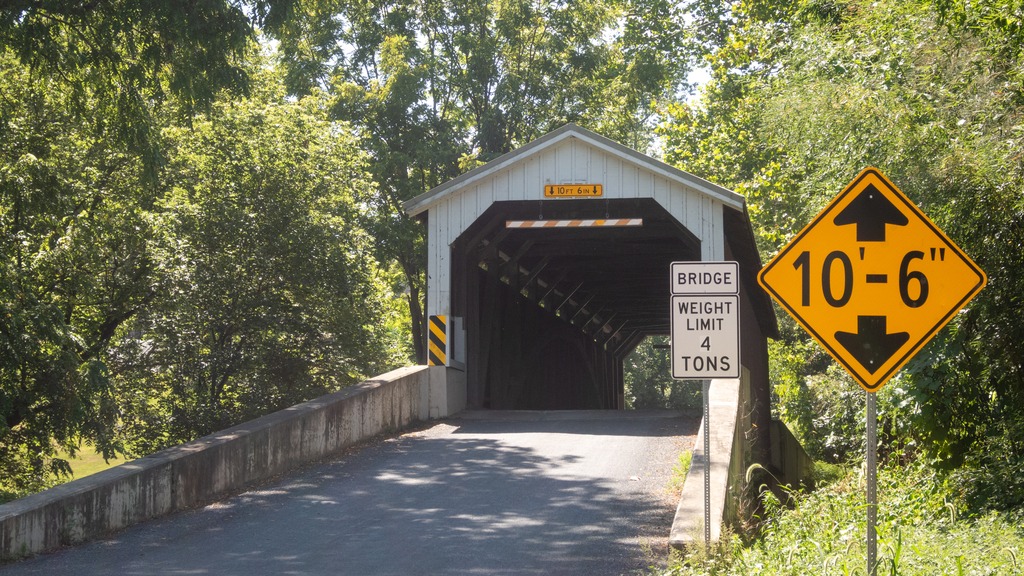
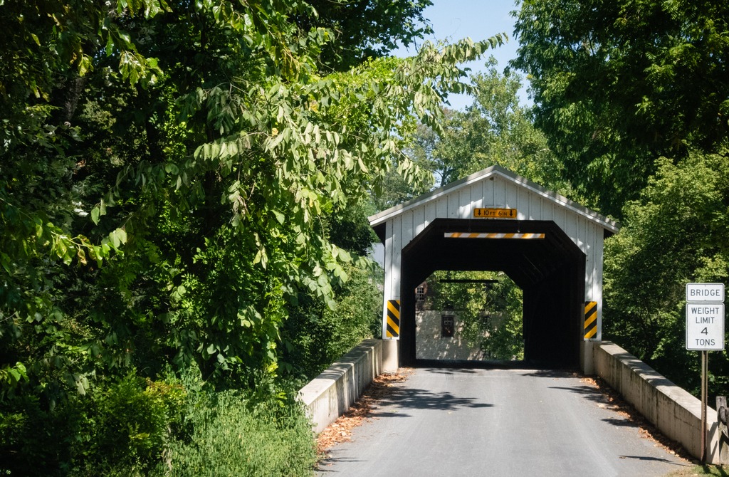
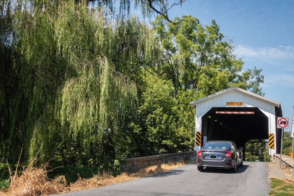
The trek around Lancaster County’s to view its covered bridges continues. This post will contain looks at quite a few of the bridges in the western part of the county with some nearby views. First are pair of bridges that are quite close to each other.
Forry’s Mill Covered Bridge is a covered bridge that spans Chiques Creek in West Hempfield. A county-owned and maintained bridge, its official designation is the Big Chiques #7 Bridge. The bridge has a single span, wooden, double Burr arch trusses design with the addition of steel hanger rods. The deck is made from oak planks. The bridge’s WGCB Number is 38-36-28. In 1980 it was added to the National Register of Historic Places as structure number 80003512. Forry’s Mill Covered Bridge was originally built in 1869 by Elias McMellen for a cost of $2969. The bridge required repairs in 1925 to its sides and floor.
Its partner is Seigrist’s Mill Covered Bridge, an 88-foot (27 m), Burr Arch Truss covered bridge over Chiques Creek between Rapho and West Hempfield Townships. Owned and maintained by the county, its official designation is the Big Chiques #6 Bridge. The bridge’s World Guide to Covered Bridges Number is 38-36-37. It was listed on the National Register of Historic Places as structure number 80003513 in 1980. The bridge is less than a mile away from the Forry’s Mill Covered Bridge. The bridge was built in 1885 by James C. Carpenter. It was named after the Siegrist family who lived nearby.
Heading farther south, we come across a trio of bridges on Pequea Creek. The Colemanville Covered Bridge spans the Creek. After Hunsecker’s Mill Covered Bridge, it is Lancaster County’s second-longest single-span covered bridge still in use. It is also referred to as the Martic Forge Covered Bridge and Pequea #12 Bridge. The bridge has a single span, wooden, double Burr arch trusses design with the addition of steel hanger rods. The deck is made from oak planks. The bridge’s WGCB Number is 38-36-26. In 1980, it was added to the National Register of Historic Places as structure number 80003534. The Colemanville Covered Bridge was originally built in 1856 by James C. Carpenter at a cost of $2,244. After being damaged twice by flooding, it was partially rebuilt in 1938 by Edmund Gardner and in 1973 by David Esh. Lancaster county completely rebuilt the bridge in 1992 for $350,000. During the restoration process the bridge was raised by 6 feet (1.8 m) and moved west a few feet to protect it from damage in potential future flooding.
Baumgardener’s Covered Bridge is a covered bridge that also spans Pequea Creek. A county-owned and maintained bridge, its official designation is the Pequea #10 Bridge. The bridge has a single span, wooden, double Burr arch trusses design with the addition of steel hanger rods. The deck is made from oak planks. The bridge’s WGCB Number is 38-36-25. It was listed on the National Register of Historic Places on December 11, 1980. Baumgardener’s Covered Bridge was built in 1860 by Davis Kitch at a cost of $1,284. In 1987 the bridge was restored after it was damaged in a flood the previous year. During this restoration process, which cost $200,000, the bridge was raised by 4 feet (1.2 m) and lengthened by 9 feet (2.7 m) to protect it from damage in potential future flooding.
Finally, we come to Lime Valley Covered Bridge, which spans Pequea Creek. A county-owned and maintained bridge, its official designation is the Pequea #8 Bridge. The bridge has a single span, wooden, double Burr arch trusses design with the addition of steel hanger rods. The deck is made from oak planks.
The bridge’s WGCB Number is 38-36-23. Added in 1980, it is listed on the National Register of Historic Places as structure number 80003535. It was built in 1871 by either Joseph Cramer or Elias McMellen at a cost of $3,500. The bridge was a twin to another covered bridge built in 1857 by Silas Wolverton that was located 200 ft (61 m) to the west of the Lime Valley Covered Bridge.
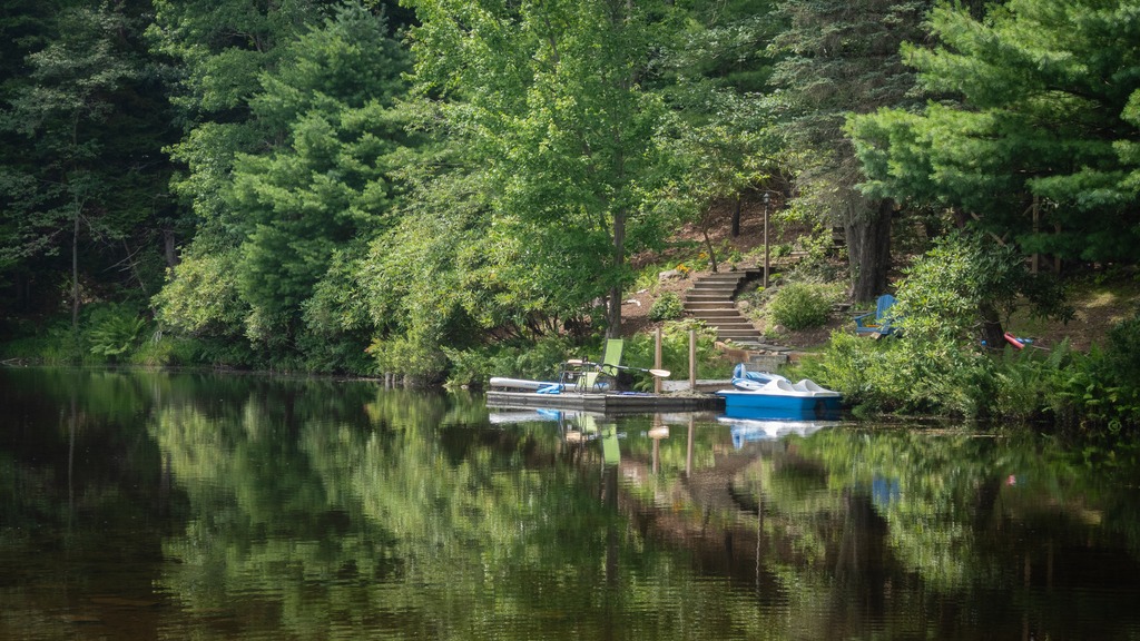
My annual trip to Lake Naomi in the Poconos with some friends occurred back in August. I took the opportunity to stop at a few locations along the way.
My first stop was the Little Gap Covered Bridge. The bridge was built around 1860, and the structure is a seventy-three-foot, Burr truss-span that crosses the Aquashicola Creek. The bridge incorporated elements of the Howe truss in its construction. A nearby restaurant, the “Covered Bridge Inn,” takes its name from the bridge. In 2011, the bridge was damaged by a hit and run driver.
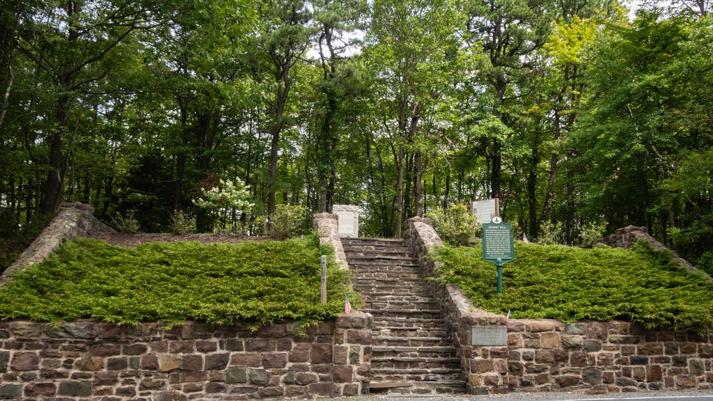
A second stop, very close to Lake Naomi, is the Hungry Hill historic site on the Sullivan Trail. The site is a Revolutionary War memorial and gravesite of an unknown soldier of the Revolutionary War.
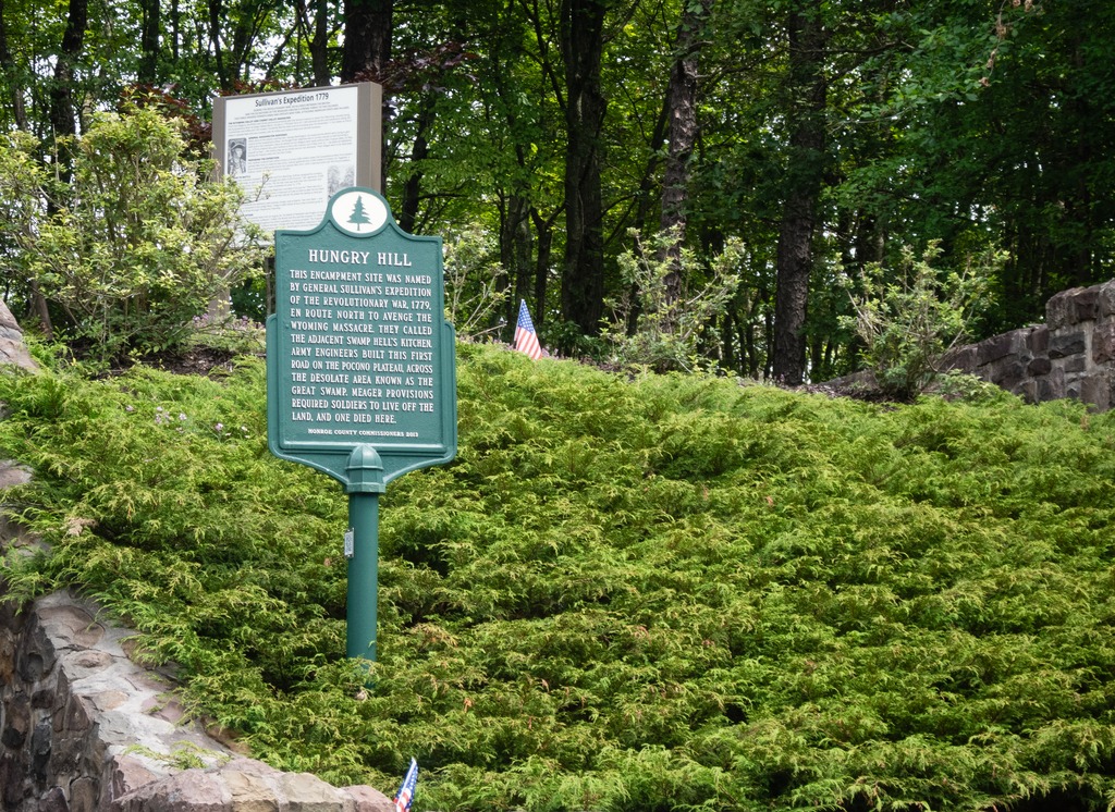
The inscription on the plaque reads: “This encampment site was named by General Sullivan’s expedition of the Revolutionary War, 1779, en route north to avenge the Wyoming Massacre. They called the adjacent swamp Hell’s Kitchen. Army engineers built this first road on the Pocono Plateau, across the desolate area known as the Great Swamp. Meager provisions required the soldiers to live off the land, and one died here.”
The Mill at Anselma in Chester Springs, Pennsylvania has been a National Historic Landmark since 2005, and an operational Mill before the United States of America began. It is an independent, non-profit historic site today. Nestled along the Pickering Creek, the Mill site preserves over 250 years of Chester County’s industrial history. The Mill retains its original Colonial-Era power train, as well as multiple layers of industrial equipment ranging from the late 1700s to the mid 1900s. The 22 acre property and surviving historical buildings demonstrate a heritage engineered to last. It is open to the public and hosts educational and entertaining events. It is free to walk around the grounds.
I photographed the mill in black and white using an old Canon A2E on Kentmere 400 film. I developed these myself. I am chuffed that they are usable (not that terrible).
My mother grew up in Pittsburgh, but my grandmother’s family were Slovak coal miners who settled in the town of Perryopolis. I finally got to visit this town recently, although I probably should have made more if an effort when I lived in Pittsburgh back in the early 90s.
George Washington purchased 1,644 acres (6.65 km2) here when land first became available. He visited in 1770 and said, “as fine a land as I have ever seen, a great deal of rich meadow; it is well watered and has a valuable mill seat.” The mill would eventually be completed in 1776. Once the mill was finished, it encouraged other business to come to the area to support and augment the business of the mill.
Washington hoped to develop the remainder of Perryopolis, drawing up plans for the streets to be laid out in the shape of a wagon-wheel. Washington’s estate sold the land after his death; in 1814 Perryopolis, previously known as “New Boston”, was officially laid out using Washington’s plans and named for Oliver Hazard Perry for his victory on Lake Erie during the War of 1812.
In the late 19th century, the area around Perryopolis was first mined for coal. Until the 1950s, coal industries would be the area’s primary economic activity, served by the Washington Run branch of the P&LE Railroad that continued on to Star Junction. However, Perryopolis developed differently from other nearby mining towns. Instead of housing laborers, Perryopolis was mainly inhabited by foremen and white collar workers who were associated with the mining industry.
An unexpected town square.
The Gue House in Perryopolis, PA is a log home originally built sometime around 1820 and then reconstructed in 1976. The Gue House is the only log home still standing in Perryopolis and represents the type of house built by early settlers of the town. No exact date exists for this structure but it was of the early 1800’s. This is the type of home one of the first settlers of Perryopolis would have lived in. Local legend has it that this was the first complete two-story log cabin in Pennsylvania. It is owned by the Perryopolis Parks and Recreation Authority and operates as a part of the Time Gift Shop and Visitors Center, and currently houses the Gue House Gallery.
The Gue House, the only remaining log home.
St. Nicholas Byzantine Catholic Church, also known as St. Nicholas Greek Catholic Church, is an historic Catholic church. It was built between 1912 and 1918, and is a 30 feet by 60 feet yellow brick building in the Byzantine Revival style. It has a cruciform plan and the gabled roof is topped by four onion domes. The church served a community of Rusyns who originally settled in the area prior to 1907. It was added to the National Register of Historic Places in 1997.
St. Nicholas Byzantine Catholic Church, one of the town’s several buildings on the National Register of Historic Places.St. John the Baptist Catholic Church
I managed to take a short drive around Erie during the time I was there.
The Bicentennial Tower on the waterfront.The best view I could get of the brig Niagara since the maritime museum was closed at the time.The Erie Land Lighthouse.High and dry.The beautiful Russian Old Rite Orthodox Church.
The following two historic homes were moved and reconstructed on their current sites.
VON BUSECK HOUSE — C. 1815 This saltbox-style farmhouse was built c.1815 in west Millcreek on what is now known as 5021 West 38th Street, south of Wheaton Road. The land was owned by Irish immigrant John Nicholson (1764–1828), and the family of John Wheaton owned the building for a time. For over 150 years it was owned by Louis Von Buseck (1812–1893) and his descendants. Louis was born Ludwig Heinrich Von Buseck in Germany, the second son of Baron Carl Philip Von Buseck.
The Von Buseck House.
HON. JUDAH COLT HOUSE — C. 1820 One of Erie County’s earliest citizens, Hon. Judah Colt (1761–1832), settled at what is now known as Colt Station in 1796. He moved to the Borough of Erie in 1804 as the agent for the county’s first land developer, Pennsylvania Population Company. Colt served as burgess of Erie in 1813 and 1820–1821. He built this Federal-style house c.1820 at the southwest corner of East 4th and French streets where he entertained the Marquis De Lafayette (1757–1834) on June 3, 1825. This was also home to his nephew Thomas G. Colt (1805–1861), the last Burgess and the first mayor for the city of Erie. The house was moved to 345 East Front St. in 1890.
The Davis Hollow Cabin was featured as a location in the film The Pale Blue Eye as the home of detective Augustus Landor. The cabin is located in Moraine State Park very near a marina. Originally built in 1780, the cabin is one of the historic facilities along the North County Trail. Over the years, the cabin fell into disrepair and nature took its toll. In 2005 a group of volunteers got together to conserve the cabin (the Friends of Davis Hollow Cabin). The cabin is available for rent in the warmer months.
I somehow was expecting this building to be a lot more isolated. In the film, it is usually depicted under a blanket of snow with a wide offset view of the front of the building. Here are some different views of the building in Spring and some of the nearby “reality” adjacent to the marina.
We will return back to eastern Pennsylvania for a couple of weeks after our swing through the western part of the commonwealth. Pennsylvania has quite a few old iron furnaces spread across the state. In fact, Hopewell Furnace National Historic Site lies near the border of Chester and Berks counties. Not far away is the site of the Warwick Iron Furnace. The site is part of Warwick Furnace Farms, a historic district that includes the ruins of the early iron furnace owned by Anna Rutter Nutt, widow of Samuel Nutt. The ironmaster’s house and workers’ houses, as well as a historic farmhouse and barns now used in the operation of a working farm.
Anna Rutter Nutt was the daughter of Thomas Rutter, who erected the first ironwork in Pennsylvania. Samuel Nutt bought the original tracts of land with partners William Branson and Mordecai Lincoln, the great great grandfather of Abraham Lincoln. The furnace was managed by George Taylor when the first Franklin Stoves were cast here. The furnace operated through the 1860s and supplied the iron used in the iron-clad ship the USS Monitor during the Civil War. The 786 acre historic district was listed on the National Register of Historic Places in 1976.
I visited back in early Spring. The landscape around here is lovely and well worth a trip.