

This is a weekend to remember all our blessings – the people, places and things that make life worthwhile. I am grateful that this Commonwealth has such and abundance of natural beauty and wonderful people,

This is a weekend to remember all our blessings – the people, places and things that make life worthwhile. I am grateful that this Commonwealth has such and abundance of natural beauty and wonderful people,
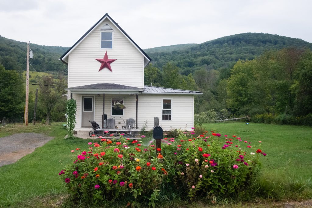
Here are some scenes from lovely Tioga County from this past summer. Next week we will be taking a break from northcentral Pennsylvania for a series of locations that a bit farther afield.


There are some fantastic locations in Pennsylvania that have escaped my notice, even after all these years. Perhaps, in the case of our next location, it is because it’s almost all the way to the New York State line.
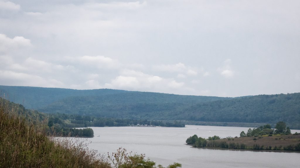
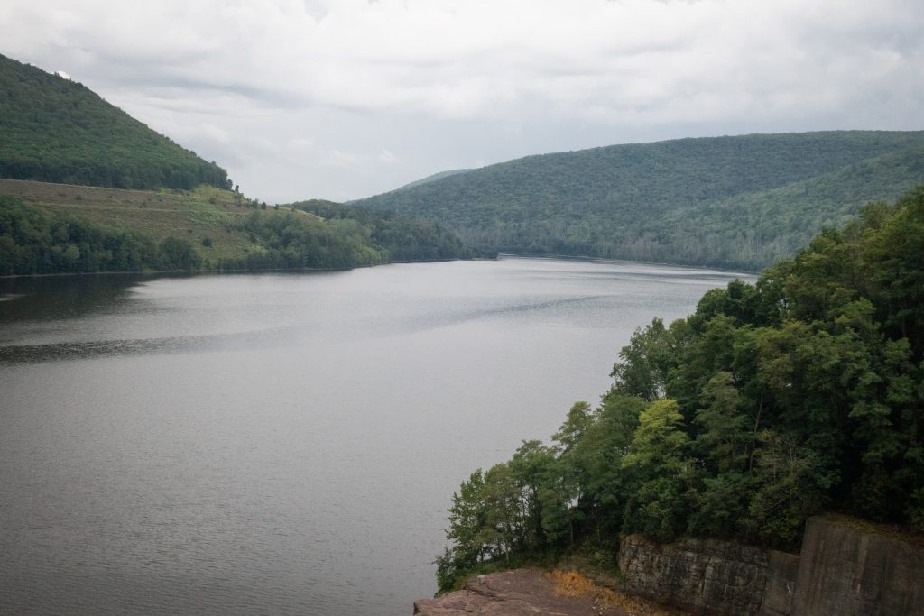
Tioga-Hammond Lakes are twin lakes in north central Pennsylvania with overnight and day use facilities in a scenic environment, southwest of Tioga, PA and north of Wellsboro on PA on Route 287. The recreation area has camping, a swimming beach, sand volleyball court, playground, boat launches, field sports area, a camp store, trails hunting, display gardens, archery trail, scenic overlooks and picnic facilities including grills and picnic shelters. There area is administered by the US Army Corps of Engineers.
The lakes were formed by the building of two separate dams, one on the Tioga River and one on Crooked Creek. They are connected by a channel cut through the rock which has its own weir on the Tioga Reservoir side. This unusual arrangements allows acid polluted water to mix with cleaner water from the other stream, increasing overall water quality downstream.


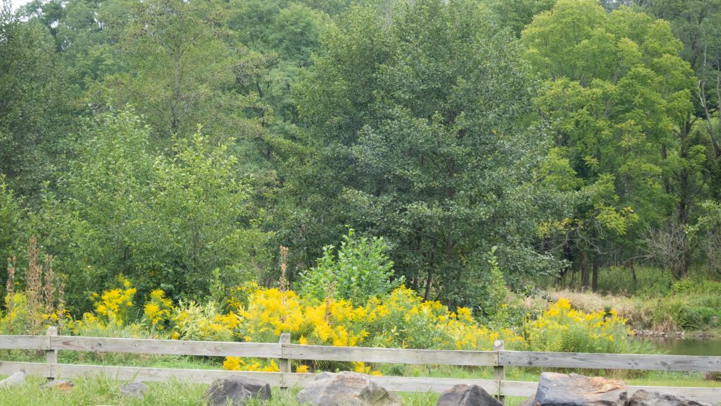


The 407-acre Hills Creek State Park, located in scenic Tioga County, contains abundant wildlife such as osprey, loon, and waterfowl which visit the lake that contains a variety of warmwater fish species. Camping, cabins, swimming, and picnicking make this an ideal spot for a day trip or family vacation. Hiking, fishing and hunting are also available.


Knapp’s Covered Bridge is a Burr arch truss covered bridge over Brown’s Creek in Burlington Township, Bradford County. It was built in 1853 and is 95 feet (29.0 m) long. The bridge was placed on the National Register of Historic Places in 1980 and had a major restoration starting in 2000. Knapp’s Bridge is named for a local family, and is also known by as the Luther’s Mills Covered Bridge (for the nearby village of Luther’s Mills) and as the Brown’s Creek Covered Bridge.


The surrounding countryside also provides some nice sightseeing, like this pretty church with its barn across the road and the nearby farmland.


Mt. Pisgah State Park lies in Bradford County not very far west of Towanda. The 1,302-acre park is along Mill Creek, at the base of Mt. Pisgah, with an elevation 2,260 feet. A dam on Mill Creek forms Stephen Foster Lake, named after the famous composer and onetime local resident. The 75-acre lake provides fishing, boating, and skating. The park is also well developed with a swimming pool and snack bar, playground and picnic facilities, and the usual hiking, hunting and winter sports activities.


The Bradford County Veterans Memorial Park sits at the end of the bridge which brings Route 6 into Towanda. As the title states, this is probably the best small town veterans memorial that I have seen. It has great statuary and a very sophisticated design.


In another vein, I encountered this memorial park just outside of Towanda. The number of flags here on Labor Day weekend was impressive. I believe flags are generally placed on the graves of veterans.


On my way to dinner, I had a chance to photograph some of the great buildings in the town of Towanda, the county seat of Bradford County on a Labor Day weekend. This town has some beautiful Victorian homes, some of which have been repurposed into businesses. This place could be a movie set.


The area around the French Azilum historic site is lovely. It is just one more reason to visit the area. I think these pictures speak for themselves, so I will leave this as a picture blog.


French Azilum is Located on a horseshoe bend in the Susquehanna River near present-day town of Wysox. It provided a refuge for a group of French exiles in the autumn of 1793 and spring of 1794. Some of the refugees left France to escape persecution during the French Revolution. Others fled the colony of Santo Domingo (Haiti) to escape the slave uprising there. The French refugees, mostly nobility and gentry, even believed that it might be possible for the Queen of France, Marie Antoinette, and her two children to come to Azilum if they got out of France alive. In the plans of the settlement there was a house built for the queen, called La Grand Maison.
A consortium of investors in Philadelphia purchased sixteen hundred acres of land from the English and German settlers to establish Azilum. They also purchased several thousand additional acres in subsequent years, extending south into Sullivan County and north nearly to the border of New York. Eventually 50 houses would be built. Although not grand, these houses had chimneys, wallpaper, window glass, shutters and porches. La Grand Maison, the most imposing structure, was the setting of many of the social gatherings, and housed Talleyrand and Louis Phillippe (future King of France) as guests.
The duration of the sophisticated French town in the wilderness was brief. Economic factors, including the bankruptcy of its investors, led to the settlement’s decline. By the late 1790’s many of the French had moved to southern cities or returned to Santo Domingo. In 1803 Napoleon made it possible for the exiles to return to France. A few families, including the LaPortes, remained. These families and their descendants helped to settle nearby communities. None of the almost 100 buildings from Azilum, including houses, a chapel, a theatre and several shops, remain.
Today, the historic site contains over twenty acres that were part of the original settlement. Although no structures from the original settlement survive, an original foundation has been left exposed for public viewing . A reconstructed and relocated log cabin, circa 1790, serves as a small museum with artifacts pertaining to the settlement and a video about the establishment of Azilum. The LaPorte house, the summer home of the son of one of the original settlers, still stands. Visitors can see several outbuildings, part of the de Siebert and LaPorte Farms, and outdoor exhibits. The site is only open during the summer. One should check opening times before visiting.

The house was built in 1836 by John LaPorte, son of Bartholomew LaPorte, who was one of the principal settlers at Azilum.


