

Here are too many pictures of the rapids at Ohiopyle State Park, the visitor center, and the Youghiogheny River.


Here are too many pictures of the rapids at Ohiopyle State Park, the visitor center, and the Youghiogheny River.
Ryerson Station State Park is in Greene County in the southwestern corner of Pennsylvania, near the West Virginia border. It seems to sit off by itself down in that corner. It is near Moundsville, WV, a place I have been to, but that is a story for another day. The 1,164-acre park features the fanciest state park swimming pool I have ever seen, campground, hiking, fishing, picnicking, and winter activities.


Next we have an interesting feature – the remains of an old reservoir. I don’t think I’ve ever seen one quite like this. You can see where the hole was created in the dam to allow the stream to run again. The lake appears to have been fairly shallow.


Near the Pittsburgh metro area, Raccoon Creek State Park is one of Pennsylvania’s largest and most visited state parks. It began as a Recreational Demonstration Area operated by the National Park Service in the 1930s during the Civilian Conservation Corps (CCC) era. The park encompasses 7,572 acres and features the beautiful 101-acre Raccoon Lake. Facilities are a mix of modern and rustic with group camps from the CCC era.


The nearby Hillman State Park is managed for hunting by the Pennsylvania Game Commission. Hiking trails are open to the public. Horseback riding, cycling and other activities are also available. The park also has a model airplane field, an unusual feature. I actually screwed up when visiting here. It looks like one of the main features of the park is a covered bridge, and I managed to miss it.


Our next stop in the swing through western Pennsylvania is McConnells Mills State Park. The signature of this park is a 19th century gristmill and adjacent covered bridge. It occupies 2,546 acres of the spectacular Slippery Rock Creek Gorge, which is a National Natural Landmark. Created by the draining of glacial lakes thousands of years ago, the gorge has steep sides while the valley floor is littered with huge boulders. Scenic overlooks and waterfalls are popular natural attractions.
The park has distinctive geology. The bedrock formed more than 300 million years ago as layers of sand, mud, and peat built up in what was a coastal area. After becoming rock, these different layers were lifted to the surface in several mountain-building events. The different strengths of these rocks cause them to erode differently, helping to make the varied landscape of the park. The gorge and the dramatic topography of the park were created by glaciers during the past two million years.


The Cleland Rock Scenic Vista – unfortunately this has become a bit overgrown.

Moraine State Park in Butler County, which features the 3,225-acre Lake Arthur with 42 miles of shoreline, is a landscape that has endured the effects of continental glaciers and massive mineral extraction. This popular park hosts more than one million boaters, picnickers, hikers, bikers, horseback riders, cabin renters, and swimmers each year. The 16,725-acre park was restored from prior coal mining and oil and gas drilling practices. Unfortunately, it was not a very nice day when I visited in early May.


Jennings Environmental Education Center is one of several state parks specifically dedicated to providing environmental education and recreational programs to the community. This site provides a unique combination of prairie and forest environs, which offer a wide array of resource and educational opportunities. One of the park’s main features, the 20-acre prairie ecosystem, is home to distinctive prairie plants and the endangered massasauga rattlesnake. The most noteworthy and spectacular prairie flower is the blazing star. Jennings was the first reserve established in Pennsylvania to protect an individual plant species and remains the only public and protected prairie in the commonwealth.
The prairie wildflowers are best enjoyed in late July and early August. I did not get very good shots at this site, due to the weather and the time of year.


Presque Isle State Park is a 3,200-acre sandy peninsula that extends into Lake Erie and is the state’s only “seashore.” It offers a beautiful coastline and many year round recreational activities, including swimming, boating, fishing, hiking, bicycling, and in-line skating. It is a significant birding hotspot. The Tom Ridge Environmental Center is near the entrance to the park.
The neck of the peninsula is attached to the mainland four miles west of downtown Erie. The peninsula creates Presque Isle Bay, a wide and deep harbor for the city of Erie. The bay attracts many pleasure boats and worldwide freight traffic, making Erie an important Great Lakes shipping port.
A National Natural Landmark, Presque Isle is a favorite spot for migrating birds. Because of the many unique habitats, Presque Isle contains a greater number of the state’s endangered, threatened, and rare species than any other area of comparable size in Pennsylvania.


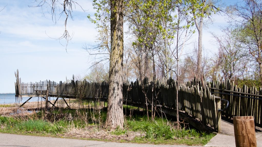


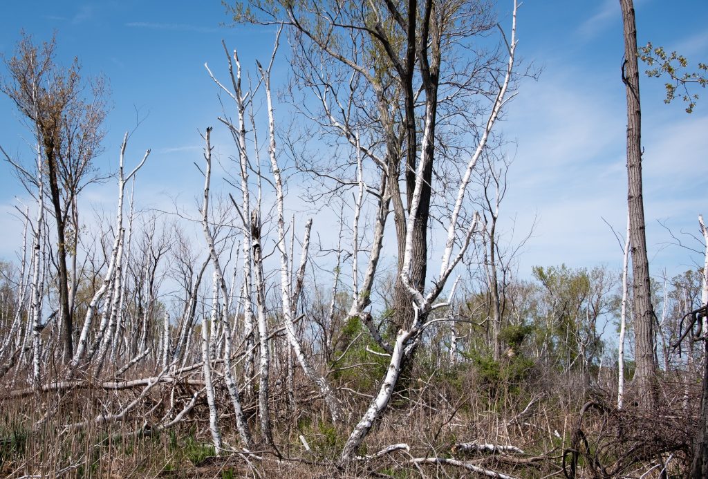


West along the shores of Lake Erie is the 587-acre Erie Bluffs State Park. The park offers one mile of shoreline, 90-foot bluffs overlooking Lake Erie, and access to Elk Creek, a shallow stream steelhead fishery. Significant natural features include several plant species of conservation concern, uncommon black oak woodland/savannah habitat, Great Lakes region sand barren ecosystems, and forested wetlands.


My trip through western Pennsylvania led me through two parks with some of the largest lakes in the state.
Maurice K. Goddard State Park in Mercer County contains the 1,680-acre Lake Wilhelm, which is popular with anglers and boaters. Many recreational activities, such as hiking, hunting, cycling, skating and picnicking, attract visitors in all seasons. The large lake, abundant wetlands, old fields, and mature forests provide a diversity of habitats for wildlife, especially waterfowl, eagle, and osprey.


Pymatuning State Park in Crawford County, at 16,892 acres, is one of the largest state parks. The 17,088-acre Pymatuning Reservoir (partially shared with Ohio) is the largest lake in the commonwealth. It is one of the most visited state parks in Pennsylvania. The many recreational opportunities include boating, fishing, swimming, and camping. In addition to the state park facilities, the Pennsylvania Fish and Boat Commission operates a fish hatchery and visitor center, and the Pennsylvania Game Commission has wildlife viewing areas.
My first stop was the dam at the southern end of the lake. It is the largest earthen dam that I have seen. The area around the lake is one of the few places that bald eagles nested continuously during their years of decline.


Oil Creek State Park lies in northwestern Pennsylvania in the Oil Creek Valley. It is the site of the world’s first commercial oil well. The park preserves the history of the early petroleum industry by interpreting oil boomtowns, oil wells, and early transportation. The scenic creek carves a valley of deep hollows, steep hillsides, and wetlands and provides opportunities for kayaking, wildlife watching and fishing. Hiking is a popular activity here, and a 36 mile loop trail has two shelter areas that support backpackers.
At the time of my visit, work on the Petroleum Center Bridge blocked egress through the park. However, following the detour to the other side of the park is well worthwhile.


On the hill above Oil City is Murray’s Scenic View, overlooking the city and Oil Creek. It is a very nice view, and there is even a small restaurant for a drink or a snack.


On my travels I took a drive through the Allegheny National Forest on Route 59. I was particularly interested in the dam, which I did not remember viewing on a previous trip. Forest surrounds the 7,647-acre reservoir that spans the border between Pennsylvania and New York. In Pennsylvania, the reservoir is completely surrounded by the Allegheny National Forest, and in New York State by Allegany State Park and the Allegany Indian Reservation of the Seneca Nation. At normal summer pool level the reservoir is 27 miles long, 14 miles in Pennsylvania and 13 miles in New York, with 91 miles of shoreline, and a maximum depth of 130 feet.


The 862-acre Chapman State Park includes the 68-acre Chapman Lake on the West Branch of Tionesta Creek. Adjacent to state game lands and the Allegheny National Forest, Chapman is an oasis of recreational facilities in a vast area of wilderness. There is a lake with swimming, a campground and other activities available.


The Clarion River area is one of the most scenic in Pennsylvania. One of its jewels is a 13-mile stretch of the the river that flows through Cook Forest State Park and is popular for canoeing, kayaking, and tubing.
The 8,500-acre Cook Forest State Park and 3,136-acre Clarion River Lands lie in Clarion, Forest and Jefferson Counties. The Cook Forest Association was formed in the 1920s to save the few areas of surviving old growth timber. Endorsed by national natural resource groups and Governor Gifford Pinchot, the association raised $200,000, which helped the commonwealth purchase 6,055 acres from A. Cook Sons Company in 1927 for $640,000. Cook Forest became the first Pennsylvania state park acquired to preserve a natural area. It was later designated a National Natural Landmark.


I also visited Clear Creek State Park which is 11 miles from Cook Forest. The park encompasses 1,901 acres in Jefferson County and occupies a scenic portion of the Clear Creek Valley from PA 949 to the Clarion River. It has camping, rustic cabins, and Clarion River access for fishing and boating.


Latest Posts
Search
Feels like: 61°F
Wind: 0mph NNW
Humidity: 83%
Pressure: 30.37"Hg
UV index: 0