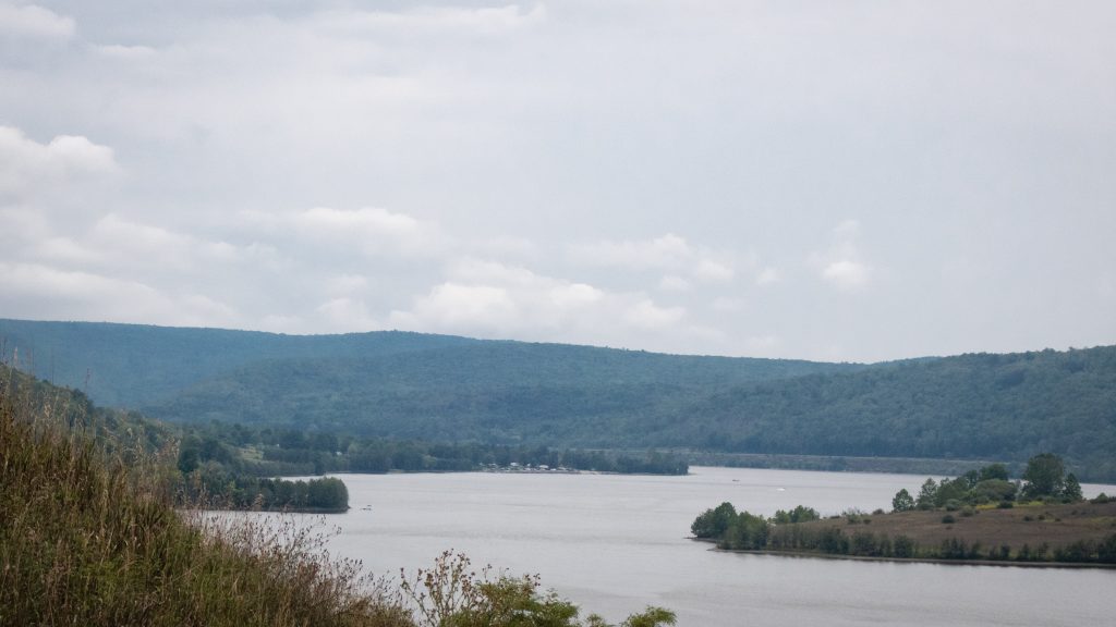
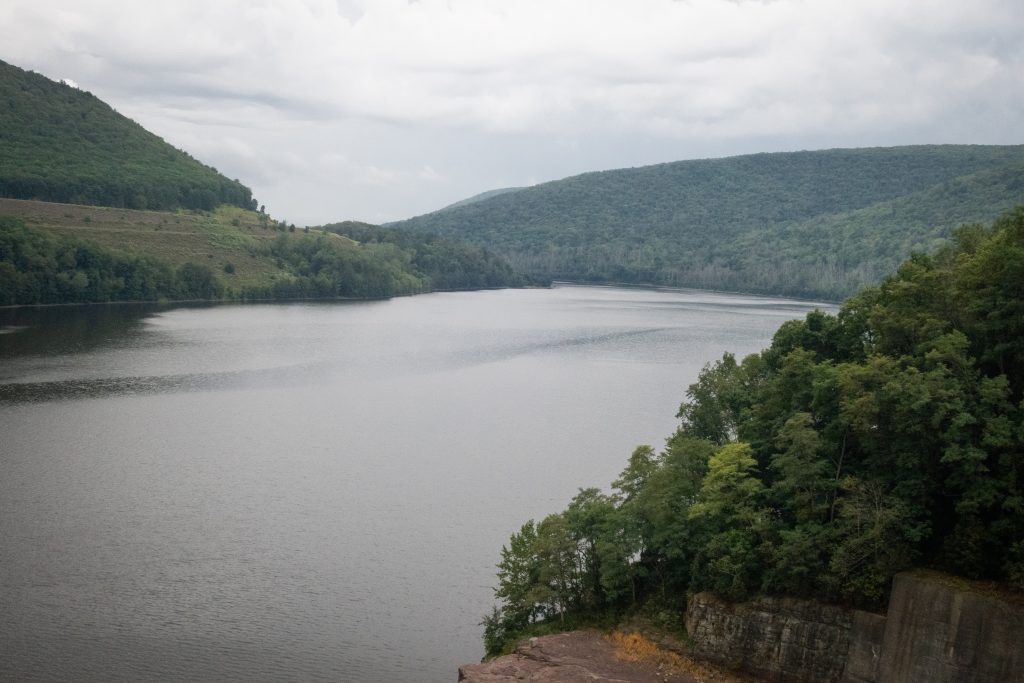
This week we are taking a look at Green Lane Park, a location I have visited many times before. I usually go there to view waterfowl. This spot could be so much better, though. There is a long shoreline here, but only a few spots are safe to pullover and observe wildlife. Several times, I saw waterfowl but I was unable to stop and get a better look. These shots are from within the park, around Green Lane, and along Route 29.
This post also contains photos that are part of my experimental old tech efforts. I used an Olympus D380 of mine to take these shots. This camera is a 2 MP “beast” and was released in March, 2002. It does tend to overexpose on auto settings.
Ott’s Exotic Plants in SchwenksvilleThe Duck Inn in Graterford
I swung by some bridges in Northumberland County on my way to visit relatives. The Himmel’s Church Covered Bridge crosses over Schwaben Creek on Middle Creek Road, east of Rebuck, Northumberland County. It was built in 1874, and rehabilitated in 1973. It is a King post truss style wooden covered bridge, with a length of 44 feet. It currently remains in use to automobile traffic.
The Bridge is located near the site of the Schwaben Creek werewolf, according to local folklore. It was added to the National Register of Historic Places on August 8, 1979. It has a unique candy stripe color scheme in addition to the King post architecture which gives it a distinctive look.
Keefer Station Covered Bridge is a historic wooden covered bridge located at Upper Augusta Township in Northumberland County. It is a 109 foot long, Burr arch truss bridge, constructed in 1888. It crosses the Shamokin Creek. It was listed on the National Register of Historic Places in 1979. The open spaces under the eaves also give this bridge a unique look.
Here is a look around the area near my aunt’s farm in Greenwood Township, Columbia County from the opening weekend of rifle deer season. Sadly, no one had any luck that weekend.
Some curious cattle on my grandparent’s old farm.Muddy Run runs through the farm.The neighbors have a nice looking eagle carving.My cousin’s house is quite windy, and the flag takes a beating. It has to be replaced often.The pond at this property is relatively new.One of the fanciest dairy farms in the County (no relation).
This post features a quick series of covered bridges in northwestern Lancaster County, the home of the largest number of covered bridges in the state. The first up is Schenk’s Mill Covered Bridge (or Shenk’s Mill Covered Bridge). It is a covered bridge that spans Big Chiques Creek. The bridge has a single span, wooden, double Burr arch truss design with the addition of steel hanger rods. The deck is made from oak planks. It is painted red and both approaches to the bridge are painted white. It is one of only 3 covered bridges in the county with horizontal side boards. It is listed on the National Register of Historic Places. The bridge was built in 1847 by Charles Malhorn and Levi Fink. It was rebuilt in 1855 and is 80 feet long.
Shenk’s Mill Covered Bridge
The Shearer’s Covered Bridge is a covered bridge that also spans Big Chiques Creek. The bridge has a single span, wooden, double Burr arch truss design. It is the only covered bridge in the county painted entirely in red in Lancaster County, on both the inside and outside, including both approaches. The other all red bridge, Pool Forge Covered Bridge, is only painted on the outside. It is one of only 3 covered bridges in the county with horizontal side boards. It is listed on the National Register of Historic Places. The bridge was built in 1847 by Jacob Clare. It was rebuilt in 1855 and stayed its original location until it was moved in 1971 to its present location in the Manheim Memorial Park. It is 86 feet long.
Shearer’s Mill Covered Bridge
The Pinetown Bushong’s Mill Covered Bridge is a covered bridge that spans the Conestoga River. The bridge is also known as the Pinetown Amish Covered Bridge, Pinetown Covered Bridge, Nolte’s Point Mill Bridge and Bushong’s Mill Bridge.
The bridge has a single span, wooden, double Burr arch truss design with the addition of steel hanger rods. The deck is made from oak planks. It is listed on the National Register of Historic Places. The bridge was built in 1867 by Elias McMellen at a cost of $4,500. In 1972, it was destroyed as a result of flooding caused by Hurricane Agnes. Due to a tremendous response of area residents who signed a petition for its reconstruction, it was among the first covered bridges to be restored after Agnes. In the spring of 1973, the bridge was rebuilt by the nearby Amish. To prevent damage due to future flooding, they raised the bridge to 17 feet 6 inches above the average water line. Lititz Run joins the Conestoga River at this site. It is 124 feet long.
Pinetown Amish Covered Bridge
The Kauffman’s Distillery Covered Bridge, or Sporting Hill Bridge, is a covered bridge that spans Chiques Creek. The bridge has a single span, wooden, double Burr arch truss design with the addition of steel hanger rods. The deck is made from oak planks.
It is registered on the National Register of Historic Places. Kauffman’s Distillery Covered Bridge was originally built in 1857 at a cost of $1,185 by James C. Carpenter. The bridge was named after the Kauffman’s Distillery Mill which operated in the late 1800s. In 1874, the bridge was rebuilt by Elias McMellen at a cost of $1,620. It is 84 feet long.
Kauffman’s Distillery Covered Bridge
Hunsecker’s Mill Covered Bridge is a covered bridge located in Lancaster County, Pennsylvania, United States. The bridge has a single span, wooden, double Burr arch truss design. The bridge, which spans the Conestoga River, is 180 feet long, making it the longest single span covered bridge in the county. The original bridge was built in 1843 by John Russell at a cost of $1,988. It is a double Burr Arch truss system. It has been swept away in flooding numerous times, most recently in 1972 after Hurricane Agnes. Waters lifted the original structure off its abutments and carried it downstream. In 1973, following destruction from the hurricane, it was rebuilt at a cost of $321,302. While Schenck’s covered bridge is one of 3 bridges with horizontal siding boards, the Hunsecker’s Mill bridge may be the only one in Lancaster County with horizontal floor boards which give a unique vibration upon crossing. A detailed scale model (~7′ long), complete with stone abutments, was donated to the Lancaster Mennonite Historical Society and may be available for viewing.
Hunsecker’s Mill Covered Bridge
Erb’s Mill Covered Bridge is a covered bridge that spans Hammer Creek. The bridge has a single span, wooden, double Burr arch truss design with the addition of steel hanger rods. The deck is made from oak planks. It was added to the National Register of Historic Places in 1980. The bridge was originally built in 1849 for a cost of $700. It was built on the Erb family’s tract of land in the farming region along Hammer Creek. In 1887 the bridge was rebuilt by John G. Bowman for $1744. It is 70 feet long.
Erb’s Mill Covered Bridge
The Bucher’s Mill Covered Bridge (or Butcher’s Mill Covered Bridge) is a covered bridge that spans Cocalico Creek. After the Landis Mill Covered Bridge, it is the second shortest covered bridge in the county. The bridge has a single span, wooden, double Burr arch truss design with the addition of steel hanger rods. The deck is made from oak planks.
It is registered on the National Register of Historic Places. Bucher’s Mill Covered Bridge was built in 1891 by Elias McMellen, using single span, wooden, double Burr arch truss construction, at a cost of $1167. A year later, in 1892, the bridge was damaged heavily in a flood and was rebuilt by McMellen for $1025. At only 64 feet long, it is one of the shortest covered bridges in Lancaster County.
There are some fantastic locations in Pennsylvania that have escaped my notice, even after all these years. Perhaps, in the case of our next location, it is because it’s almost all the way to the New York State line.
Tioga-Hammond Lakes are twin lakes in north central Pennsylvania with overnight and day use facilities in a scenic environment, southwest of Tioga, PA and north of Wellsboro on PA on Route 287. The recreation area has camping, a swimming beach, sand volleyball court, playground, boat launches, field sports area, a camp store, trails hunting, display gardens, archery trail, scenic overlooks and picnic facilities including grills and picnic shelters. There area is administered by the US Army Corps of Engineers.
The lakes were formed by the building of two separate dams, one on the Tioga River and one on Crooked Creek. They are connected by a channel cut through the rock which has its own weir on the Tioga Reservoir side. This unusual arrangements allows acid polluted water to mix with cleaner water from the other stream, increasing overall water quality downstream.
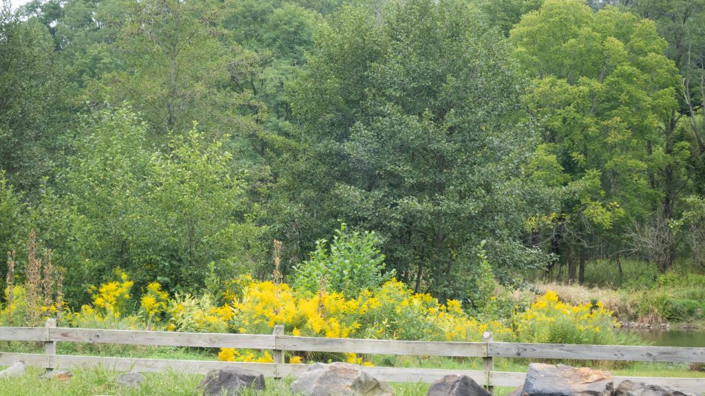
A view of the channel.Near one of the boat launches at the Ives Run Beach Area and campground.Some looks out over the reservoirs.Tioga Reservoir Overlook.The recreation area abuts state game lands near Crooked Creek.Unusual and nice osprey nest platform viewing area.Fishing the Tioga.The goldenrod was everywhere that weekend.
I left Austin and proceeded south to Sizerville State Park. This park reminds me of Hyner Run or Reeds Gap. It is a quiet park with a small campground and a pool. Alas, the pool at Reeds Gap is gone, but this type of park remains one of my favorites. The 368 acre Sizerville is surrounded by Elk State Forest and near large blocks of additional state forest land. If it wasn’t so far, I’d like to come back here.
The drive up to Salt Run Vista was worth it. Yes, someone must drive up here to mow this.Salt Run VistaTrees on the way down the mountain to Sizerville.A bonus vista – the narrower view at Crooked Run Vista.
I then made the long journey to Kettle Creek State Park. In retrospect, I should have done this the day before as continuation of my trip to Ole Bull, but now I know better. The park consists of 1,793 acres along Kettle Creek in western Clinton County. The park is in a valley surrounded by mountainous terrain and wilderness. Many of the existing recreational facilities arose from a joint flood control project developed by the U.S. Army Corps of Engineers and the former Pennsylvania Department of Environmental Resources. The park offers camping, boating, hunting, fishing, hiking, and other activities.
Another dam.A dam with a flag.Looking down over the edge to the lake. It’s further than it looks.The valley with the lake is pretty.A family paddle.
I thought I might be able to save some time getting to Sinnemahoning State Park by driving up to Kettle Creek Vista then cutting across the ridge and down the other side. Of course there were no roads down into the other valley, because there was another lake, with (you guessed it) another dam.
Kettle Creek Vista.
I made the trek back down the valley to highway north to Sinnemahoning State Park. The park, located near the center of the Pennsylvania Wilds’ scenic steep valleys region, encompasses 1,910 acres of beautiful scenery and outstanding wildlife habitat. Situated in Cameron and Potter counties, the park is nestled between the green-shouldered ridges of Pennsylvania’s Elk State Forest and Susquehannock State Forest. The park is long and narrow and includes lands on both sides of First Fork Sinnemahoning Creek — a major tributary to the Sinnemahoning Creek. At the southern end of the park, a 145-acre reservoir created by the George B. Stevenson dam provides fishing and boating opportunities. There is a campground and excellent wildlife viewing opportunities, including elk, bear, and large variety of birds.
Another valley with another dam.Park office and wildlife center.A look inside the Wildlife Center.
My trip on this Juneteenth weekend began in earnest when I turned left from Route 15 onto Route 44 in Lycoming County. I was soon at my first stop of the day.
Upper Pine Bottom State Park is one of the smallest parks in the state park system, measuring in at 5 acres. It provides picnic tables next to a stream and access to hunting and fishing. It also acts as an entry point for hiking and cross country skiing in the nearby Tiadaghton State Forest.
Yes, we are here.A nice place for a picnic, with a stream beyond.
My next stop was Ole Bull State Park which lies off Route 44 and a short distance down Route 144. Ole Bull State Park consists of 132 acres along the Kettle Creek Valley in Potter County in an area called the Black Forest because of its dense tree cover, mountainous terrain, and wilderness habitat. The park has a fascinating history. It is named for Ole Bornemann Bull, the famous Norwegian violinist who toured the United States in the 1850s. In 1852, Ole Bull purchased a large tract of land in Potter County and attempted to develop a series of Norwegian settlements. He began construction of a home, at what now is called Ole Bull Vista, which has never finished. After a year of severe hardships, the majority of the colony disbanded and moved west into Michigan and Wisconsin.
The park has swimming in Kettle Creek, a campground, and the usual array of state park activities.
The swimming area in Kettle Creek. I bet this was cold.A monument to Ole Bull, provided by the citizens of Norway, in 2002.A bridge over Kettle Creek to the campground.Further up Route 44 is Water Tank Vista.
Lyman Run State Park was next on the list. One of several parks in this area with a dam, it has a 45 acre lake, swimming, camping, boating and other activities.
Another “refreshing” dip.A view of the dam.Nice bridge to picnic area.
A daytime visit to Cherry Springs State Park followed. This park is well known for being one of the best spots on the east coast for dark nighttime skies and astronomical viewing. The park has a public astronomy field for short term viewing and an overnight field. There is also a campground and opportunities for hiking.
A stargazing dome at the park.A picnic area.A sunset view at Cherry Springs State Park.
This park is beloved, but I have to admit I was a bit disappointed when I returned the following night. The weather was fairly clear with low humidity, and the moon was below the horizon. However, I didn’t feel that the number of visible stars was significantly better than what I could see an hour from home in southeastern Pennsylvania. I didn’t attempt to photograph any. I have seen much better displays of stars during my adulthood in the Florida Keys and on the eastern shore of Maryland.
Near the park is Cherry Springs Vista, which sits directly on Route 44.
Cherry Springs Vista – this is one of my favorite types of views, all trees as far as the eye can see.
Adjacent to the Goshenville Blacksmith Shop is the Goshenville Wetlands, a nice place for a short walk and a dog friendly area. It is located in East Goshen Township, which lies in northeastern Chester County. Here are some early Spring photos of the wetlands and the nearby historic structures.
The first thing you notice from the parking area is the honey bee project. The Bees by the Blacksmith Shop is a public-private partnership that brought honey producing hives to this open space. The Watermark at Bellingham Senior Living sponsored the hives, and Carmen B’s Honey, a Township-based small business, manages and maintain the bees. The Watermark will introduce apiary education to its residents and begin using the honey in its recipes and cooking classes. The Township was also set to begin a youth apiary program. In 2022, a kids program complete with youth-sized beekeeper outfits so they can safely get close and see the inner workings of the hives will be started.
The walk provides open views over the wetland with a dry walkway and elevated platforms and walks over potentially damp areas. There is a nice view of Ridley Creek which runs along side the property.
The historic structures are adjacent to this area and are connected via the walking path. The Goshenville Historic District was listed on the National Register of Historic Places in 2000. The Blacksmith Shop was built in 1840 and is open to the public two days a week from April through October. An image of the shop is a symbol of East Goshen Township.
The Milton/Hickman Plank House in the foreground and the Blacksmith Shop beyond.The front of the Blacksmith Shop …and the back.
Adams County is home to four covered bridges. A visit to the bridges provides a focus for a drive outside Gettysburg for visitors to the area. As usual, covered bridges look best to me in Autumn.
The first up the Anderson Farm Covered Bridge. The builder of this bridge is unknown, the length is 79 ft., and the width is 14 ft. The bridge appears to be in very good shape and closed to all traffic. The bridge is used for storage by the present owners of the property This structure originally spanned Mud creek. It was moved to the point where it is today by a farmer named Anderson.
Heikes Covered Bridge is located approximately 2.5 miles north of Heidlersburg, between Tyrone and Huntington Township. The structure was built in 1892 and uses the Burr truss, and the builder is unknown. The bridge crosses Bermudian Creek and is 67 ft. long and 14 ft. wide. The bridge is not open to any traffic and is located on private land.
Jack’s Mountain Bridge is located on State Route 3021, Jack’s Mountain Rd., approximately 1.5 miles south west of Fairfield in Hamiltonban Township. The bridge was built in 1890 by Joseph Smith using the Burr truss. The structure is 75 ft. long and 14 ft. wide and crosses Tom’s Creek. The state owns this bridge, and it is open to all traffic. This is the only bridge in Adams County that is opened to vehicular traffic. The bridge has a red light at each end to control the traffic flow on this one lane structure.
Finally, the Sachs Covered Bridge is very near Gettysburg National Military Park. It is located on Twp. Route 405, Pumping Station Road, in Freedom Township, just south of State Route 305 and west of the Eisenhauer National Historic site and and Gettysburg National Military Park. The bridge was built in 1854 by David Spooner using the Town truss and and utilizing one span. The structure is 100 ft. long and 15 ft. wide, and it is only open to foot traffic. The bridge crosses Marsh Creek and is owned by Gettysburg Battlefield Preservation Association.
The bridge was known as Sauck’s during the Civil War, it was built using oak and pine. The bridge was repaired in 1997 after heavy rains washed the bridge from it’s foundation and carried it approximately one hundred yards downstream.
On July 3rd and 4th, 1863 , the bridge was used by a portion of the Confederate army, in retreat out of Gettysburg, but is said to have been used by both armies during the time of the Gettysburg conflict. Robert E. Lee had split his army into 2 sections, with one headed to Northwest toward Cashtown, while the other crossed Sauck’s Bridge and headed Southwest. The bridge is known to have been the site of a triple hanging at one end, and in close proximity to a crude post battle field hospital, the Sauck’s Covered Bridge is a favorite of ghost hunters.
What do you think they are talking about?Out fishing on a Fall day.
A bonus location is the historic Round Barn and Farmer’s Market on Cashtown Road, which I have featured on this blog before. While at the market, I picked up some delicious apple cider, cider donuts, and fresh apples. The market features many kinds of apples which are difficult to find.
Franklin County, Pennsylvania is home to two covered bridges. It was great to seem them in the Autumn, which is the Commonwealth’s best season (in my opinion. of course).
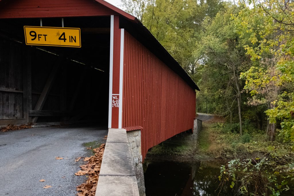
First up is the Martins Mill or Shindle Bridge which is reported to be the longest remaining Town truss covered bridge in Pennsylvania. It was reconstructed after the Hurricane Agnes flood of 197, but it is now closed to all traffic. It is still open to foot and bike trail users. The bridge was built in 1839 by Jacob Shirk. The length is 207 ft. with a width of 16 ft.. it crosses Conococheague Creek in Franklin County.
One the way to this bridge, I spotted some interesting cattle:
The Witherspoon Covered Bridge is the second covered bridge in Franklin County. The bridge was built in 1883 by S. Stouffer. It utilizes the Burr Truss in its construction. The bridge’s length is 87 ft., and the width is 14 ft. it crosses Licking Creek in Montgomery Township.