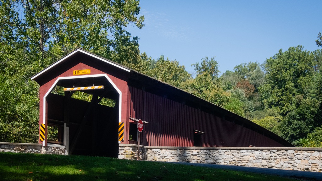
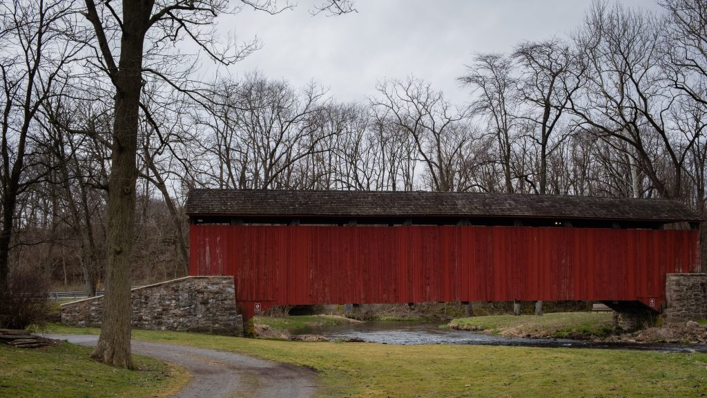
A short distance from the Chadds Ford area one enters the state of Delaware. Fred Smith’s Covered Bridge crosses the Brandywine Creek near the Brandywine tract of First State National Historic Park. It was reconstructed in 2002 after a fire in 1961. It is of the ever popular Burr Arch Truss design. The original Smith Bridge was built in 1839 and was a single span that crossed over Brandywine Creek, near Winterthur. It measured 154 feet long.
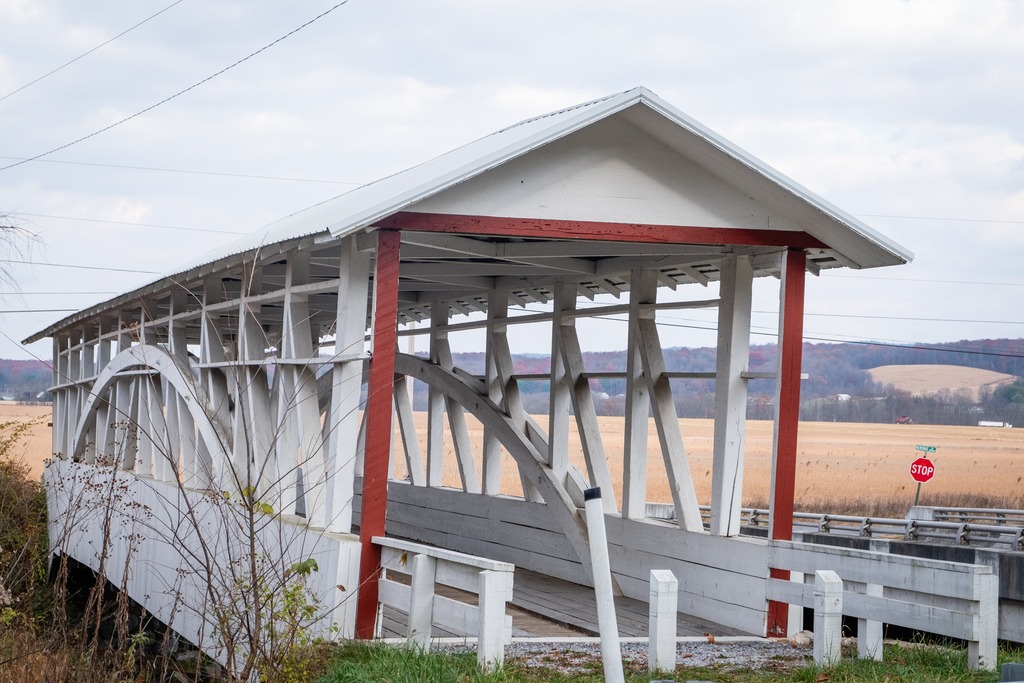
Heading south from Blue Knob, I visited several covered bridges in Bedford County. First up is the Osterburg Bowser Covered Bridge, a wooden covered bridge at East St. Clair Township. It is a 90-foot-long (27 m), Burr Truss bridge with a shallow gable roof. It crosses Bobs Creek, and it is one of 15 historic covered bridges in Bedford County. The bridge was listed on the National Register of Historic Places in 1980. It is an example of the bridges in this area that do not have complete sides.
The Osterburg Bowser Covered Bridge
I next made my way to Snooks Covered Bridge, a historic wooden covered bridge also located in East St. Clair Township Township. Built in 1883, it is a 75-foot-long (23 m), Burr Truss bridge with a shallow gable roof. It crosses Dunning Creek. It was listed on the National Register of Historic Places in (you guessed) 1980.
Snooks Covered Bridge
The Ryot Covered Bridge is wooden covered bridge that is located in West St. Clair Township. It was listed on the National Register of Historic Places in 1980. This bridge is a low to medium Burr Truss bridge with a shallow gable roof. It was damaged by fire in 2002, and reconstructed. The bridge was listed on the National Register of Historic Places in 1980.
A request to remove the bridge from the National Register was submitted after it was badly damaged by a fire in 2002. The bridge was set on fire by teenage arsonists in 2002. Most of the wooden parts of the bridge were badly damaged. The Ryot Bridge was rehabilitated only seven years earlier, so most of the added steel supports remained intact, along with the stone abutments. The bridge was restored by P. Joseph Lehman, Inc., at a total cost of $300,000.
The Ryot Covered Bridge
The Cuppett’s Covered Bridge, which was built by Cuppett brothers William & Philip on September 14, 1882, is a historic covered bridge that is located in Napier Township. Privately owned by the Cuppett family from the day it was built, the bridge took just five months to build for a total cost of $780. John Wayde did the masonry work, and Jeremiah Thompson completed the carpentry. Crossing Dunnings Creek, the 70-foot-long (21 m) bridge is a unique design with unusually low arches and low side walls which highlight the patented Burr Arch Truss system. The Cuppett’s Covered Bridge was listed on the U.S. National Register of Historic Places in 1980 by the United States Department of the Interior. The bridge was quite a popular spot for family photos when I was there.
The Cuppetts Covered Bridge, decorated for the season.
The Knisley Covered Bridge is a historic wooden covered bridge located at West St. Clair Township. It is an 80-foot-long (24 m), medium Burr Truss bridge with a shallow gable roof. It crosses Dunning Creek. The bridge was listed on the National Register of Historic Places in 1980.
Another westward trip in late fall gave me the opportunity to just about finish off my visits to Pennsylvania’s state parks. I headed north to Altoona from the Fort Littleton area and made a few stops along the way.
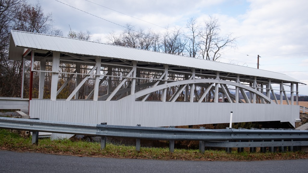
The first stop was actually a covered bridge – Hall’s Mill Covered Bridge. It is a wooden covered bridge which is located in Hopewell Township in Bedford County. It was listed on the National Register of Historic Places in 1980. The structure is a 91-foot-long (28 m), Burr Truss bridge with a medium pitched gable roof, and was built in 1872. It crosses Yellow Creek, and is one of fifteen historic covered bridges in Bedford County. It is one of several bridges that I saw in this area with open sides, except for the support beams.
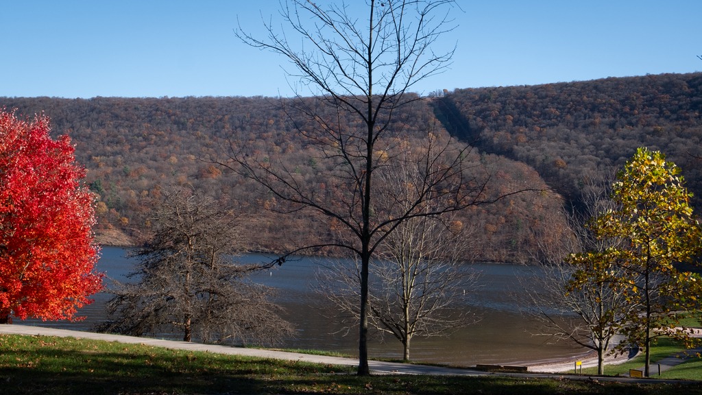
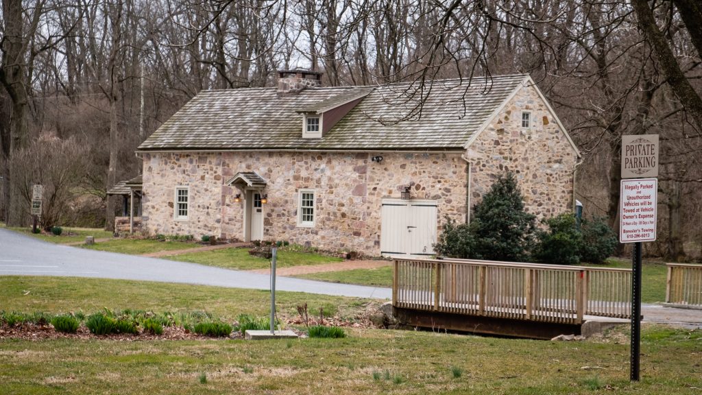
After viewing the bridge, I made my way to Warrior’s Path State Park. This park is one of two near Raystown Lake that I visited. The 349-acre park lies very near the famous path used by the Iroquois in raids and wars with the Cherokees and other American Indians in southern Pennsylvania.
The park is a seasonal, day-use area open from mid-April through the end of October that is fairly small and undeveloped. At other times of the year, visitors must park near the main gate and walk into the park. The park provided opportunities for hiking, boating, fishing and picnicking, wildlife viewing and volleyball. This finger of land is bounded on three sides by the Raystown Branch of the Juniata River, which empties into Raystown Lake approximately one mile downstream. The unique shape of the park was formed as a result of river meandering. This section of the river exhibits some of the best examples of natural stream meandering in the state.
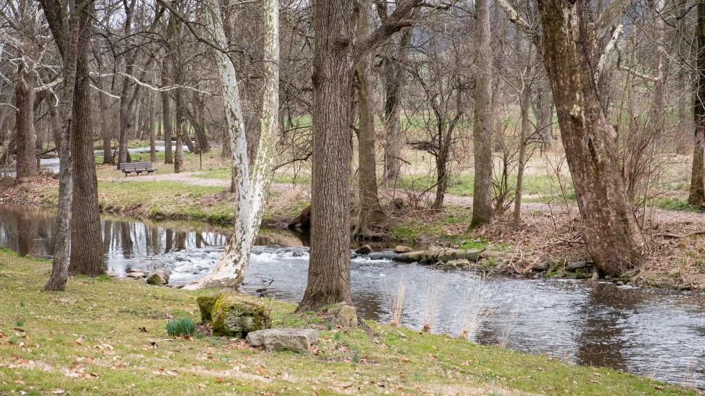
The Raystown branch of the Juniata.
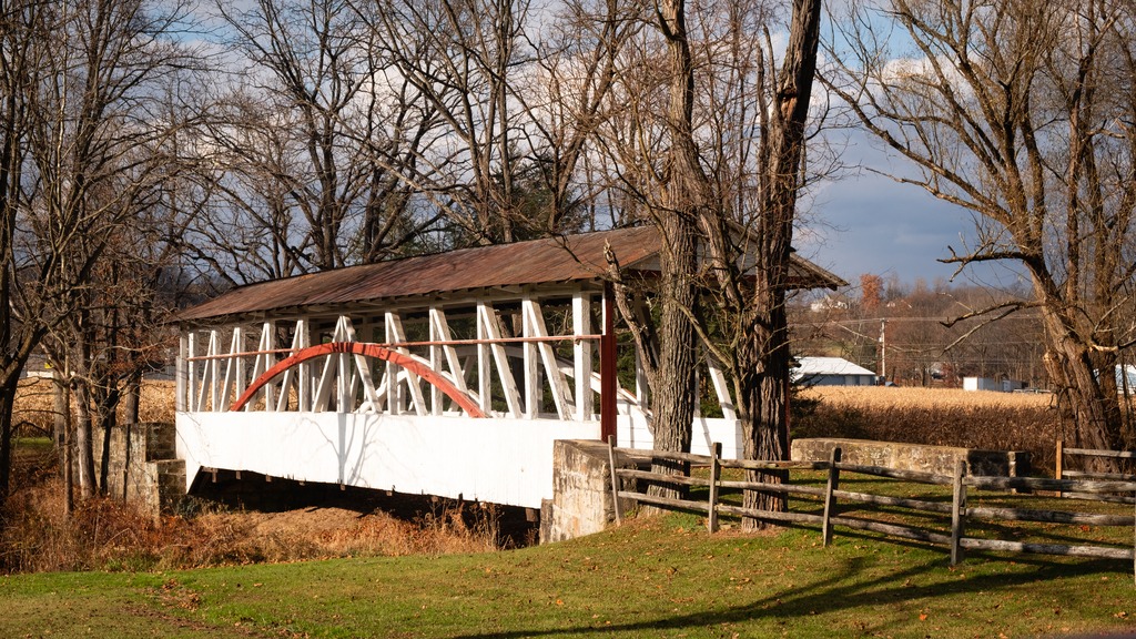
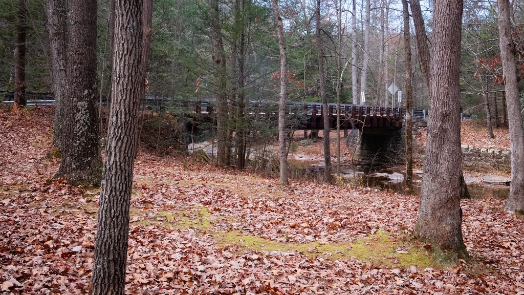
Trough Creek State Park in one of the loveliest in the Commonwealth. The 541-acre park is a scenic gorge formed as Great Trough Creek cuts through Terrace Mountain before emptying into Raystown Lake. Rugged hiking trails lead to wonders like Balanced Rock and Rainbow Falls. Rothrock State Forest and Raystown Lake border the park, making a large, contiguous area of public land for recreation. The park has a lovely campground and the usual state park activities.
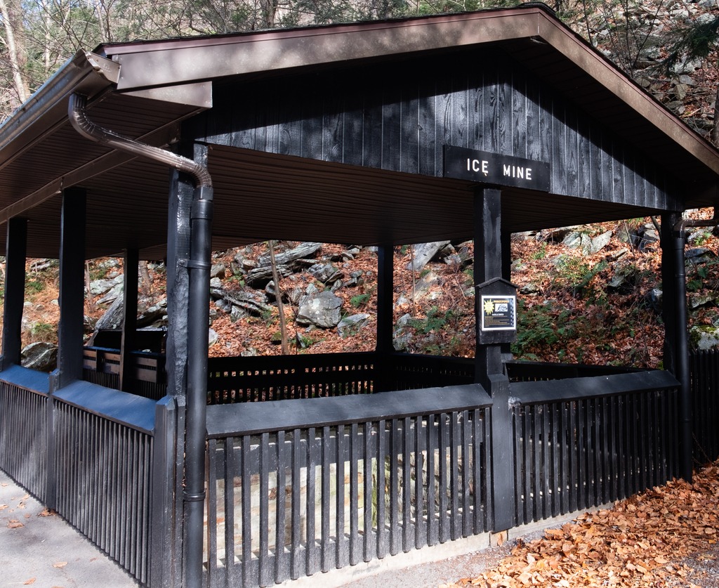
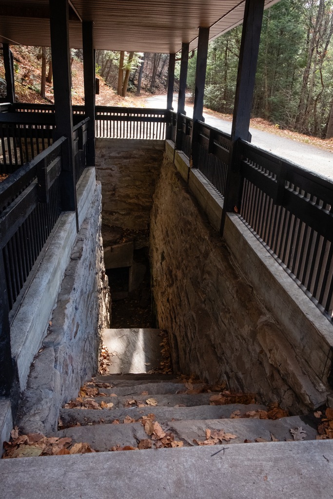
The Balanced Rock is one of Trough Creek’s best know sites.Trough CreekThe Ice MineThis park is full of interesting rock formations.
I finished my day with a brief visit to Raystown Lake, an Army Corp of Engineers facility. Raystown Lake is a reservoir in Huntingdon County, Pennsylvania. It is the largest lake that is entirely within Pennsylvania. The original lake was built by the Simpson family of Huntingdon as a hydroelectric project. The current 8,300-acre, 27 mile long Raystown Lake was completed in 1973 by the Army Corps of Engineers. The popular lake offers opportunities for boating, fishing, camping, hiking, swimming, and scenic beauty.
The trek around Lancaster County’s to view its covered bridges continues. This post will contain looks at quite a few of the bridges in the western part of the county with some nearby views. First are pair of bridges that are quite close to each other.
Forry’s Mill Covered Bridge is a covered bridge that spans Chiques Creek in West Hempfield. A county-owned and maintained bridge, its official designation is the Big Chiques #7 Bridge. The bridge has a single span, wooden, double Burr arch trusses design with the addition of steel hanger rods. The deck is made from oak planks. The bridge’s WGCB Number is 38-36-28. In 1980 it was added to the National Register of Historic Places as structure number 80003512. Forry’s Mill Covered Bridge was originally built in 1869 by Elias McMellen for a cost of $2969. The bridge required repairs in 1925 to its sides and floor.
Its partner is Seigrist’s Mill Covered Bridge, an 88-foot (27 m), Burr Arch Truss covered bridge over Chiques Creek between Rapho and West Hempfield Townships. Owned and maintained by the county, its official designation is the Big Chiques #6 Bridge. The bridge’s World Guide to Covered Bridges Number is 38-36-37. It was listed on the National Register of Historic Places as structure number 80003513 in 1980. The bridge is less than a mile away from the Forry’s Mill Covered Bridge. The bridge was built in 1885 by James C. Carpenter. It was named after the Siegrist family who lived nearby.
Heading farther south, we come across a trio of bridges on Pequea Creek. The Colemanville Covered Bridge spans the Creek. After Hunsecker’s Mill Covered Bridge, it is Lancaster County’s second-longest single-span covered bridge still in use. It is also referred to as the Martic Forge Covered Bridge and Pequea #12 Bridge. The bridge has a single span, wooden, double Burr arch trusses design with the addition of steel hanger rods. The deck is made from oak planks. The bridge’s WGCB Number is 38-36-26. In 1980, it was added to the National Register of Historic Places as structure number 80003534. The Colemanville Covered Bridge was originally built in 1856 by James C. Carpenter at a cost of $2,244. After being damaged twice by flooding, it was partially rebuilt in 1938 by Edmund Gardner and in 1973 by David Esh. Lancaster county completely rebuilt the bridge in 1992 for $350,000. During the restoration process the bridge was raised by 6 feet (1.8 m) and moved west a few feet to protect it from damage in potential future flooding.
Baumgardener’s Covered Bridge is a covered bridge that also spans Pequea Creek. A county-owned and maintained bridge, its official designation is the Pequea #10 Bridge. The bridge has a single span, wooden, double Burr arch trusses design with the addition of steel hanger rods. The deck is made from oak planks. The bridge’s WGCB Number is 38-36-25. It was listed on the National Register of Historic Places on December 11, 1980. Baumgardener’s Covered Bridge was built in 1860 by Davis Kitch at a cost of $1,284. In 1987 the bridge was restored after it was damaged in a flood the previous year. During this restoration process, which cost $200,000, the bridge was raised by 4 feet (1.2 m) and lengthened by 9 feet (2.7 m) to protect it from damage in potential future flooding.
Finally, we come to Lime Valley Covered Bridge, which spans Pequea Creek. A county-owned and maintained bridge, its official designation is the Pequea #8 Bridge. The bridge has a single span, wooden, double Burr arch trusses design with the addition of steel hanger rods. The deck is made from oak planks.
The bridge’s WGCB Number is 38-36-23. Added in 1980, it is listed on the National Register of Historic Places as structure number 80003535. It was built in 1871 by either Joseph Cramer or Elias McMellen at a cost of $3,500. The bridge was a twin to another covered bridge built in 1857 by Silas Wolverton that was located 200 ft (61 m) to the west of the Lime Valley Covered Bridge.
My annual trip to Lake Naomi in the Poconos with some friends occurred back in August. I took the opportunity to stop at a few locations along the way.
My first stop was the Little Gap Covered Bridge. The bridge was built around 1860, and the structure is a seventy-three-foot, Burr truss-span that crosses the Aquashicola Creek. The bridge incorporated elements of the Howe truss in its construction. A nearby restaurant, the “Covered Bridge Inn,” takes its name from the bridge. In 2011, the bridge was damaged by a hit and run driver.
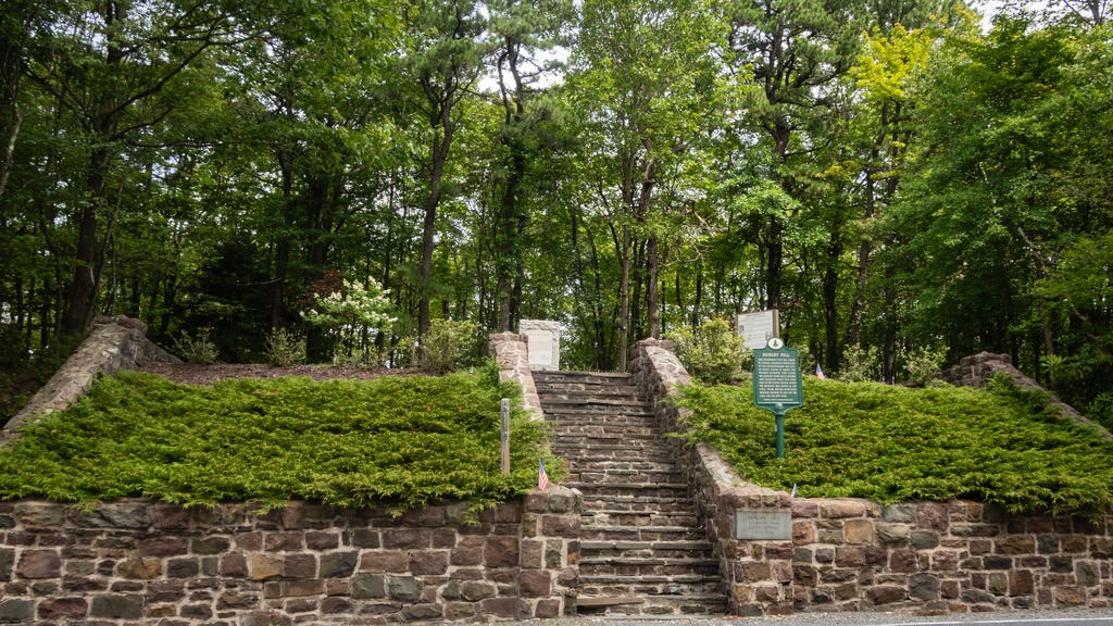
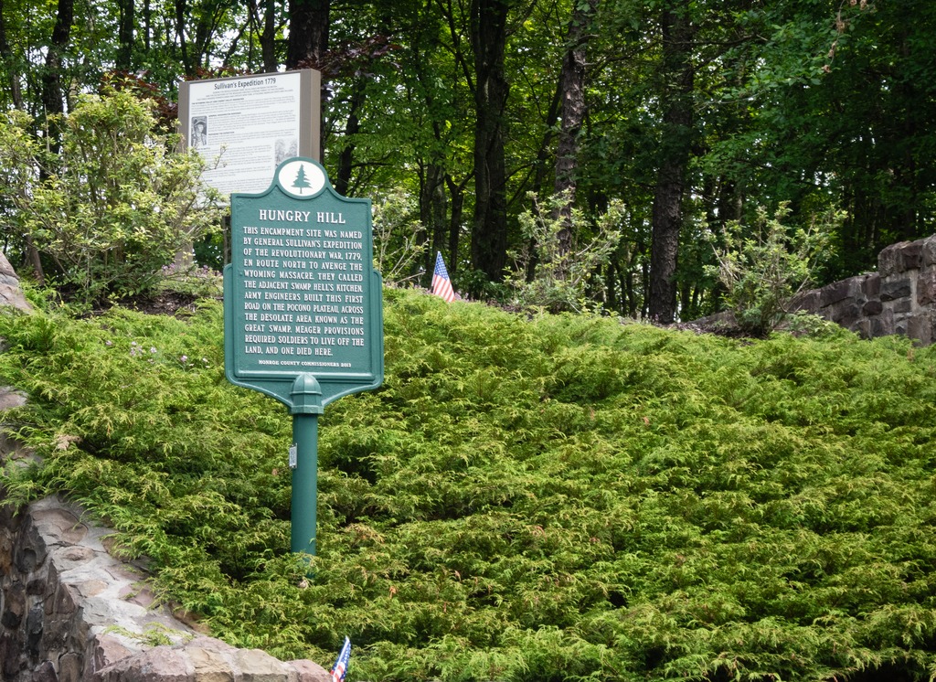
A second stop, very close to Lake Naomi, is the Hungry Hill historic site on the Sullivan Trail. The site is a Revolutionary War memorial and gravesite of an unknown soldier of the Revolutionary War.
The inscription on the plaque reads: “This encampment site was named by General Sullivan’s expedition of the Revolutionary War, 1779, en route north to avenge the Wyoming Massacre. They called the adjacent swamp Hell’s Kitchen. Army engineers built this first road on the Pocono Plateau, across the desolate area known as the Great Swamp. Meager provisions required the soldiers to live off the land, and one died here.”
Our next stop in the swing through western Pennsylvania is McConnells Mills State Park. The signature of this park is a 19th century gristmill and adjacent covered bridge. It occupies 2,546 acres of the spectacular Slippery Rock Creek Gorge, which is a National Natural Landmark. Created by the draining of glacial lakes thousands of years ago, the gorge has steep sides while the valley floor is littered with huge boulders. Scenic overlooks and waterfalls are popular natural attractions.
The park has distinctive geology. The bedrock formed more than 300 million years ago as layers of sand, mud, and peat built up in what was a coastal area. After becoming rock, these different layers were lifted to the surface in several mountain-building events. The different strengths of these rocks cause them to erode differently, helping to make the varied landscape of the park. The gorge and the dramatic topography of the park were created by glaciers during the past two million years.
The Cleland Rock Scenic Vista – unfortunately this has become a bit overgrown.
Today’s visit to Lancaster County includes some covered bridged and nearby views. First up is Weaver’s Mill Covered Bridge, which spans the Conestoga River. The 85-foot-long (26 m), 15-foot-wide (4.6 m) bridge was built in 1878 by B. C. Carter and J. F. Stauffer. It is also known as Isaac Shearer’s Mill Bridge. The bridge has a single span, wooden, double Burr arch trusses design with the addition of steel hanger rods. It is painted red, the traditional color of Lancaster County covered bridges, on both the inside and outside. Both approaches to the bridge are painted in the traditional white color. It was listed on the National Register of Historic Places in 1980.
Weaver’s Mill Covered Bridge
The Bitzer’s Mill Covered Bridge is a covered bridge that is also on the Conestoga River. It is the oldest bridge in the county still in use. A county-owned and maintained bridge, it is also called Martin’s Mill Bridge, Eberly’s Cider Mill Covered Bridge, and Fiand’s/Fiantz’s Covered Bridge.
The bridge has a single span, wooden, double Burr arch trusses design with the addition of steel hanger rods. The deck is made from oak planks. Added later, secondary steel I-beams support the bridge from underneath. The bridge is currently unpainted. It was formerly painted red on the outside, and the inside of the bridge was not painted. Both approaches to the bridge were painted white. In July 2006, the bridge sustained some damage to its sides including some missing or broken panels. The bridge was added to the National Register of Historic Places in 1980.
The bridge was built in 1846 by George Fink and Sam Reamsnyder at a cost of $1,115. They used a single span, wooden, double Burr arch truss construction. The bridge has historically been referred to by a number of names that reflected the various mill owners. In 1962, it was proposed to replace the bridge with a concrete span, but the plan was discontinued after much public outcry.
The Conestoga RiverAn impressive corn crib.
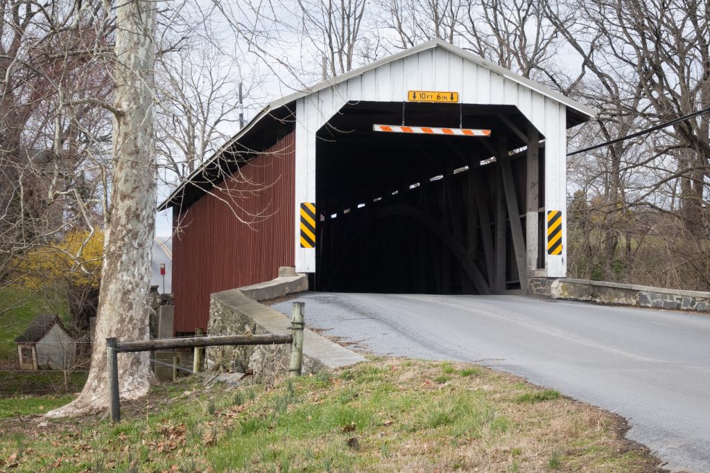
The Keller’s Mill Covered Bridge is a covered bridge that spans Cocalico Creek. It is also sometimes known as Guy Bard Covered Bridge (after a local jurist) and Rettew’s Covered Bridge (after the person that Rettew’s Road is named). Due to heavy road traffic on the aging, one-lane bridge, construction on a new steel and concrete bridge to bypass the covered bridge occurred in the summer of 2006. The bridge was disassembled and reassembled a few miles downstream to replace an existing one lane bridge. It was located at 40°10′11.4″N 76°12′16.8″W (40.16983, −76.20467) before being disassembled.
Keller’s Mill Covered Bridge was originally built by Elias McMellen in 1873 at a cost of US$2,075. After being swept away in flooding, the bridge was rebuilt in 1891, again by McMellen. It stayed there until it was disassembled and moved in 2006. The bridge was reconstructed in 2009. The bridge was reopened on Middle Creek Road in December, 2010. Keller’s Mill Covered Bridge has a single span, wooden, double Burr arch trusses design with the addition of steel hanger rods. The deck is made from oak planks. The bridge is the only all white bridge in the county, with no red. In fact, just about all covered bridges were whitewashed both inside and out. It is the only bridge to have survived the transition from whitewashing to the red color commonly used in barns throughout the county. The bridge is not painted on the inside.
It’s not that often that one comes across a covered bridge with an associated historic site. Poole Forge, in Eastern Lancaster County, is just such a place. The 26-acre site also has a preserved historic Ironmaster’s mansion, children’s playground, picnic pavilion, ball field, Nature Trail, Riparian Buffers, wildflower meadows, and many beautiful gardens along the Conestoga River. It is a national historic district and was listed on the National Register of Historic Places in 1993.
Poole Forge was part of the iron industry in Lancaster and nearby counties. James Old, a Welshman and iron master, purchased the property in 1775. He established and operated a forge here for twenty years. The pig iron was obtained from nearby furnaces such as Hopewell, Joanna, Elizabeth, and Cornwall. Poole Forge refined the iron, then sold it to blacksmiths, or sent it to markets in Philadelphia, where it was used to make armaments for the Revolutionary War. In 1795, he sold the forge to his son, Davis Old, and over the next half century, it continued operation through many changes of hands. In 1852, iron production was ended. The covered bridge dates to 1859.
First up are views of the covered bridge:
There are multiple fine Federal style buildings at this site.
The Leaman’s Place Covered Bridge spans Pequea Creek. A county-owned and maintained bridge, it is also known as Eshelman’s Mill Covered Bridge and Paradise Bridge. The bridge has a single span and a wooden, double Burr arch truss design with the addition of steel hanger rods. The deck is made from oak planks. It is painted red, the traditional color of Lancaster County covered bridges, on both the inside and outside. Both approaches to the bridge are painted in the traditional white color. It is listed on the National Register of Historic Places.
The land that the Leaman’s Place Covered Bridge is situated on was settled by the family of Mary Ferree in 1712, a land grant by William Penn in an area inhabited by the Pequaws Indians. It was not until 1845 that James C. Carpenter built the covered bridge across the Pequea Creek at a cost of $933. In 1893. Elias McMellan rebuilt the covered bridge at a cost of $2,431. The bridge was rehabilitated in 2004.
Pequea Creek
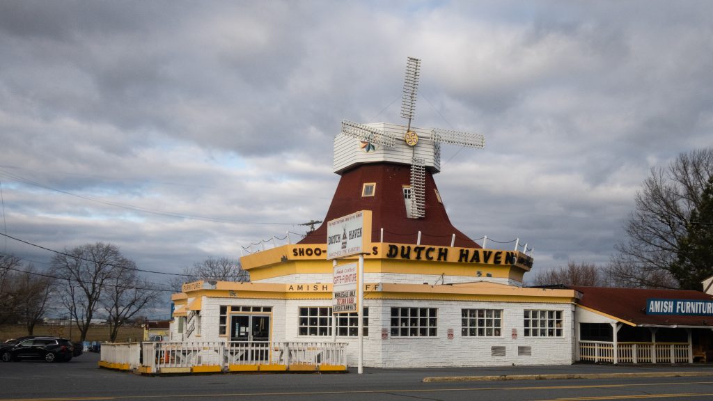
And for something different … Dutch Haven, a well known landmark on Route 30 with a great bakery and gift shop.
I swung by some bridges in Northumberland County on my way to visit relatives. The Himmel’s Church Covered Bridge crosses over Schwaben Creek on Middle Creek Road, east of Rebuck, Northumberland County. It was built in 1874, and rehabilitated in 1973. It is a King post truss style wooden covered bridge, with a length of 44 feet. It currently remains in use to automobile traffic.
The Bridge is located near the site of the Schwaben Creek werewolf, according to local folklore. It was added to the National Register of Historic Places on August 8, 1979. It has a unique candy stripe color scheme in addition to the King post architecture which gives it a distinctive look.
Keefer Station Covered Bridge is a historic wooden covered bridge located at Upper Augusta Township in Northumberland County. It is a 109 foot long, Burr arch truss bridge, constructed in 1888. It crosses the Shamokin Creek. It was listed on the National Register of Historic Places in 1979. The open spaces under the eaves also give this bridge a unique look.