• Adams County Beyond Gettysburg

    Adams County is home to four covered bridges. A visit to the bridges provides a focus for a drive outside Gettysburg for visitors to the area. As usual, covered bridges look best to me in Autumn.

    The first up the Anderson Farm Covered Bridge. The builder of this bridge is unknown, the length is 79 ft., and the width is 14 ft. The bridge appears to be in very good shape and closed to all traffic. The bridge is used for storage by the present owners of the property This structure originally spanned Mud creek. It was moved to the point where it is today by a farmer named Anderson.

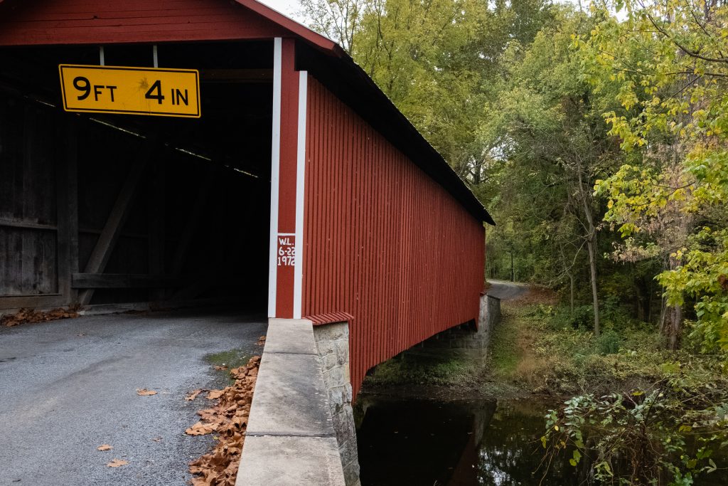
    Heikes Covered Bridge is located approximately 2.5 miles north of Heidlersburg, between Tyrone and Huntington Township. The structure was built in 1892 and uses the Burr truss, and the builder is unknown. The bridge crosses Bermudian Creek and is 67 ft. long and 14 ft. wide. The bridge is not open to any traffic and is located on private land.

    Jack’s Mountain Bridge is located on State Route 3021, Jack’s Mountain Rd., approximately 1.5 miles south west of Fairfield in Hamiltonban Township. The bridge was built in 1890 by Joseph Smith using the Burr truss. The structure is 75 ft. long and 14 ft. wide and crosses Tom’s Creek. The state owns this bridge, and it is open to all traffic. This is the only bridge in Adams County that is opened to vehicular traffic. The bridge has a red light at each end to control the traffic flow on this one lane structure.

    Finally, the Sachs Covered Bridge is very near Gettysburg National Military Park. It is located on Twp. Route 405, Pumping Station Road, in Freedom Township, just south of State Route 305 and west of the Eisenhauer National Historic site and and Gettysburg National Military Park. The bridge was built in 1854 by David Spooner using the Town truss and and utilizing one span. The structure is 100 ft. long and 15 ft. wide, and it is only open to foot traffic. The bridge crosses Marsh Creek and is owned by Gettysburg Battlefield Preservation Association.

    The bridge was known as Sauck’s during the Civil War, it was built using oak and pine. The bridge was repaired in 1997 after heavy rains washed the bridge from it’s foundation and carried it approximately one hundred yards downstream.

    On July 3rd and 4th, 1863 , the bridge was used by a portion of the Confederate army, in retreat out of Gettysburg, but is said to have been used by both armies during the time of the Gettysburg conflict. Robert E. Lee had split his army into 2 sections, with one headed to Northwest toward Cashtown, while the other crossed Sauck’s Bridge and headed Southwest. The bridge is known to have been the site of a triple hanging at one end, and in close proximity to a crude post battle field hospital, the Sauck’s Covered Bridge is a favorite of ghost hunters.

    What do you think they are talking about?
    Out fishing on a Fall day.

    A bonus location is the historic Round Barn and Farmer’s Market on Cashtown Road, which I have featured on this blog before. While at the market, I picked up some delicious apple cider, cider donuts, and fresh apples. The market features many kinds of apples which are difficult to find.

    The view across the road.
  • Franklin’s Covered Bridges

    Franklin County, Pennsylvania is home to two covered bridges. It was great to seem them in the Autumn, which is the Commonwealth’s best season (in my opinion. of course).

    First up is the Martins Mill or Shindle Bridge which is reported to be the longest remaining Town truss covered bridge in Pennsylvania. It was reconstructed after the Hurricane Agnes flood of 197, but it is now closed to all traffic. It is still open to foot and bike trail users. The bridge was built in 1839 by Jacob Shirk. The length is 207 ft. with a width of 16 ft.. it crosses Conococheague Creek in Franklin County.

    One the way to this bridge, I spotted some interesting cattle:

    The Witherspoon Covered Bridge is the second covered bridge in Franklin County. The bridge was built in 1883 by S. Stouffer. It utilizes the Burr Truss in its construction. The bridge’s length is 87 ft., and the width is 14 ft. it crosses Licking Creek in Montgomery Township.

  • That’s a Lot of Concrete (and a bonus park)

    Looming over the town of Nicholson, Pennsylvania is the Tunkhannock Creek Viaduct, a railroad bridge completed in 1915. It is a concrete deck arch bridge on the Nicholson Cutoff rail segment of the Norfolk Southern Railway Sunbury Line that spans Tunkhannock Creek. Measuring 2,375 feet (724 m) long and 240 feet (73.15 m) tall when measured from the creek bed (300 feet (91.44 m) from bedrock), it was the largest concrete structure in the world when completed in 1915 and still merited “the title of largest concrete bridge in America, if not the world” 50 years later. Built by the Delaware, Lackawanna and Western Railroad, the bridge is owned today by Norfolk Southern Railway and is still used daily for regular through freight service. Apparently almost half of the bulk of this behemoth is underground, in the form of bridge pillars up to 138 feet (142 m) below ground.

    The bridge was listed on the National Register of Historic Places on April 11, 1977. In 1975, the American Society of Civil Engineers or ASCE designated the bridge as a Historic Civil Engineering Landmark. ASCE recognized the bridge as “not only a great feat of construction skill” but also a “bold and successful departure from contemporary, conventional concepts of railroad location in that it carried a mainline transversely to the regional drainage pattern, effectively reducing the distance and grade impediments…”

    The bridge towers over the town of Nicholson.
    A view further upstream.
    The cows don’t seem to notice the vast structure.

    I also swung by Lackawanna State Park on my way back from the bridge. The 1,445-acre park is ten miles north of Scranton. The focus is the 198-acre Lackawanna Lake, which is surrounded by picnic areas and multi-use trails winding through forest. Boating, camping, fishing, mountain biking, and swimming are popular recreation activities here.

    I’ve always wanted a canoe mooring on a lake.
    At least these geese don’t mind the weather.
    Another rainy late spring day ….
    Great spot for a picnic and a boat trip.

  • Kurtz’s Mill Covered Bridge

    Kurtz’s Mill Covered Bridge is a covered bridge over Mill Creek in Lancaster County Central Park. The bridge is also known as the County Park Covered Bridge, Baer’s Mill Covered Bridge, Isaac Baer’s Mill Bridge, Keystone Mill Covered Bridge, Binder Tongue Carrier Covered Bridge, and Mill 2A Covered Bridge (that’s a lot of names). The bridge is used by road traffic from within the park to access a picnic pavilion.

    Kurtz’s Mill Covered Bridge

    The bridge has a single span, wooden, double burr arch trusses design with the addition of steel hanger rods. The deck is made from oak planks. It is painted red, the traditional color of Lancaster County covered bridges, on both the inside and outside. Both approaches to the bridge are painted in red with white trim. It has a 94 foot span.

    The span of the bridge from the trail below. Excuse the backlighting.

    The bridge was built in 1876 by W. W. Upp over the Conestoga River. In 1972, it was damaged by the floodwaters caused by Hurricane Agnes. It was repaired by David Esh in 1975 and moved to its present location in the Lancaster County Park over Mill Creek, a tributary of the Conestoga River. Unlike most historic covered bridges in the county, it is not listed on the National Register of Historic Places.

    The banks of Mill Creek

  • One Bridge to Rule Them All

    The Pomeroy-Academia Covered Bridge in Port Royal, Juniata County is the longest remaining covered bridge in Pennsylvania.

    The bridge was built in 1902 and is 278 feet long. It is a single-lane, double-span wooden covered bridge which crosses the Tuscarora Creek. Its design is based on the Burr truss developed by Theodore Burr, who was a preeminent bridge designer and builder. This bridge has been owned by the Juniata County Historical Societysince 1962. It was listed on the National Register of Historic Places in 1979.

    A view of the bridge. It is so long it has a center support.
    Let’s look inside.
    Looking toward the new road bridge.
    A view of Tuscarora Creek.

    Downstreem and off on the tributary Licking Creek, one finds the Lehman Covered Bridge, an historic covered bridge located near Port Royal in Juniata County. It is a Double Burr Arch truss bridge and was built in 1888. It measures 107 feet and has vertical siding, windows at eave level, and a gable roof. It was damaged during Hurricane Agnes in 1972, and subsequently rebuilt. It was listed on the National Register of Historic Places in 1979.

    To the south is the Delville Covered Bridge. This bridge is located at Dellville, Perry County. It is a 174-foot-long, three span, Burr truss bridge over Sherman Creek, constructed in 1889. It was listed on the National Register of Historic Places in 1980. On November 3, 2014, the bridge was significantly damaged in a fire that police believe to have been caused by arson. By early 2019, most of the structure has been completely restored back to its original condition.

    There is a nice little park around this bridge for a picnic.
    Sherman Creek.

    Some additional bridges on upstream on Sherman Creek are pictured in my blog post on Sherman’s Valley.

  • Sherman’s Valley: A Hidden Gem

    Nestled between the mountain ridges in Perry County is Sherman’s Valley. The valley is traversed by Route 274, with its heart in Blain, PA. I came here in search of a couple of covered bridges on Sherman Creek. The narrow valley feels remote due to its situation between two ridge lines. However, it is not to far from Carlisle and Harrisburg.

    It was, unfortunately, quite a gloomy morning when I was there. Here is a sampling of what I saw (and, or course, those covered bridges):

    Farm house across the road – like my grandparent’s former farm.
    The Mount Pleasant Covered Bridge.
    Sherman Creek
    The New Germantown Covered Bridge
    I see these stars all over the place on homes and barns. This one has a twist with the flag motif.
    Great red color on this barn.
    Nestled against the backdrop of mountains.
    I love how this house has been built around a log structure.
    Another great red barn.

  • Fall in Valley Forge

    Although it seems that fall color was late to arrive and short lived, Valley Forge National Historical Park has non the less supplied some nice views. Here is a sampling from a recent visit.

    Knox Covered Bridge, Tredyffrin Township, Chester County.


    Another view of the Knox Covered Bridge.


    View of General Knox’s Quarters from the Philander C. Knox Estate.


    Recently baled hay near the Knox estate.


    Historic pony truss bridge on Wilson Road over Valley Creek.


    Lafayette’s Headquarters, later used as a farmhouse and inn. Interesting to see three sections from different time periods.


    View of the hillside from the model airplane field at Valley Forge.

  • In Black and White

    Here are some black and white views of subjects in previous posts.


    Graveyard in the fields near my grandparent’s home.


    Train bridge near the Rupert covered bridge in Columbia County.

  • The Bridges of Columbia County

    Pennsylvania has 219 covered bridges, the most of any state in the US. The bridges were covered to protect the wooden structural supports and allow them to last longer. The also provided shelter for pedestrians and vehicles in bad weather. Columbia County has one of the largest concentrations of covered bridges in Pennsylvania. I photographed some of them on a recent trip.


    The Rupert covered bridge. I like the juxtaposition of the train line and the old covered bridge.


    A marked bike trail crosses the bridge.


    I love the bridges with windows.


    The train bridge adjacent to the Rupert covered bridge.


    The Wanich covered bridge.


    The Creasyville covered bridge.


    The Patterson covered bridge with some detail.


error: Content is protected !!