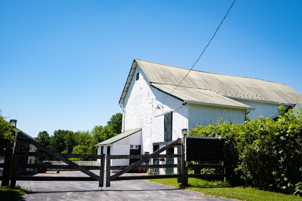
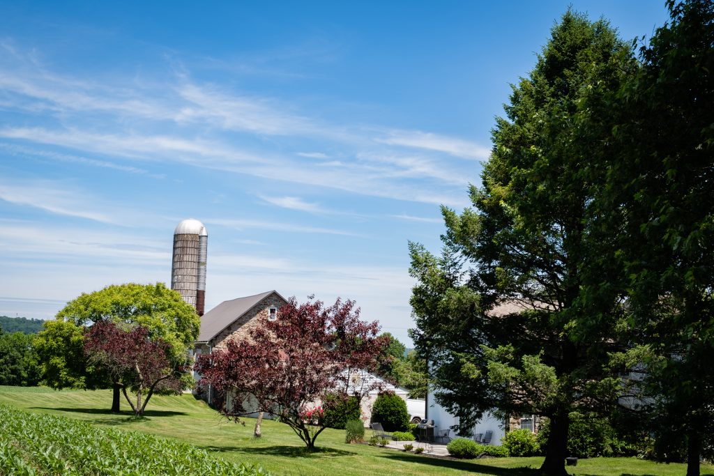
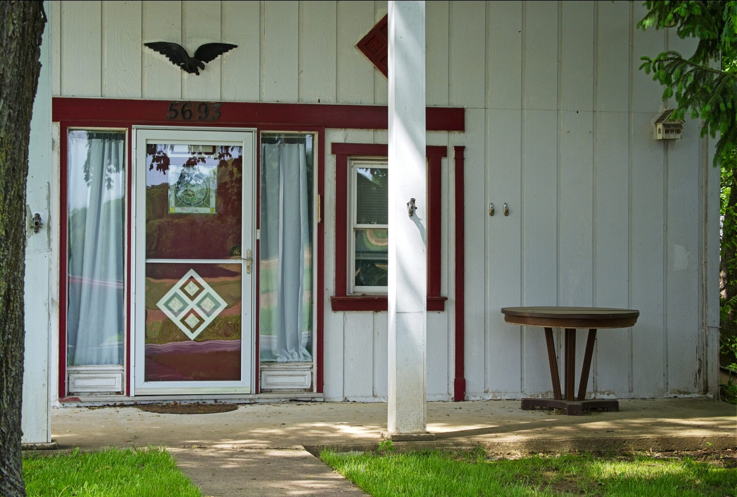
Today’s post takes us back to the area of the Octoraro watershed in southern Chester and Lancaster counties, with a focus on some of the farms and animals of the area.


Mount Davis (3,213 ft or 979 m) is the highest point in Pennsylvania. Located in the 5,685-acre (2,301 ha) Forbes State Forest near the hamlet of Markleton in Elk Lick Township, Somerset County, it lies on a gentle crest of a 30-mile (50 km) ridge line extending from central Somerset County southward into Garrett County, Maryland. The high point was named for John Nelson Davis, an early settler, American Civil War veteran, surveyor, and naturalist known for his studies of the mountain’s flora and fauna. During the Civil War, Davis served in Company E, 102nd Pennsylvania Infantry.
The summit of Mt. Davis may be ascended by car or a number of hiking trails. Its surroundings are noted for their patterns of unusual circular stone formed by periglacial action. A metal observation tower with a relief map of the region stands near the true high point.
I found this location surprising. It was not what I was picturing in my mind for many years. The area immediately surrounding the summit is state forest, however you can be a five minute drive from the summit and still be going through farmland, which doesn’t make the peak seem that prominent or that high. I guess the surrounding area is at a pretty high elevation.


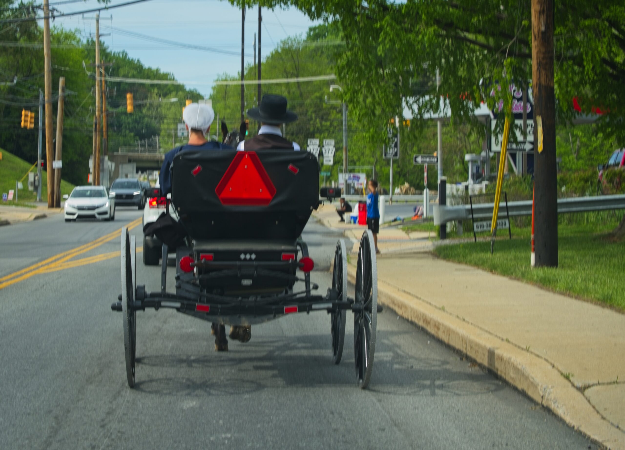
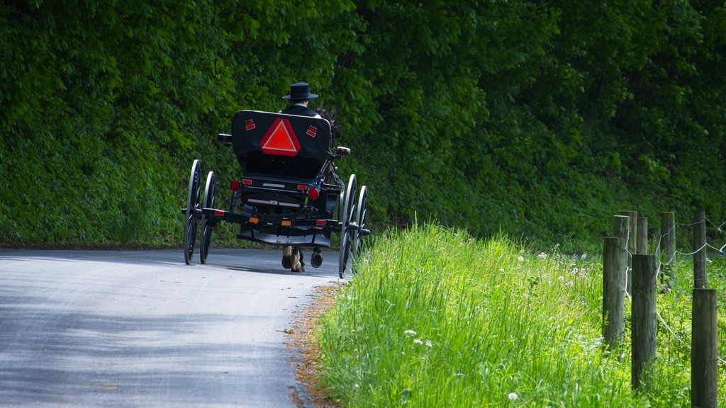
A day out in the rural areas of Lancaster County will provide many encounters with horse drawn buggies, whether in motion or stationery. Sundays tend to be particularly busy, with people going to church or visiting neighbors.


Today’s visit to Lancaster County includes some covered bridged and nearby views. First up is Weaver’s Mill Covered Bridge, which spans the Conestoga River. The 85-foot-long (26 m), 15-foot-wide (4.6 m) bridge was built in 1878 by B. C. Carter and J. F. Stauffer. It is also known as Isaac Shearer’s Mill Bridge. The bridge has a single span, wooden, double Burr arch trusses design with the addition of steel hanger rods. It is painted red, the traditional color of Lancaster County covered bridges, on both the inside and outside. Both approaches to the bridge are painted in the traditional white color. It was listed on the National Register of Historic Places in 1980.


The Bitzer’s Mill Covered Bridge is a covered bridge that is also on the Conestoga River. It is the oldest bridge in the county still in use. A county-owned and maintained bridge, it is also called Martin’s Mill Bridge, Eberly’s Cider Mill Covered Bridge, and Fiand’s/Fiantz’s Covered Bridge.
The bridge has a single span, wooden, double Burr arch trusses design with the addition of steel hanger rods. The deck is made from oak planks. Added later, secondary steel I-beams support the bridge from underneath. The bridge is currently unpainted. It was formerly painted red on the outside, and the inside of the bridge was not painted. Both approaches to the bridge were painted white. In July 2006, the bridge sustained some damage to its sides including some missing or broken panels. The bridge was added to the National Register of Historic Places in 1980.
The bridge was built in 1846 by George Fink and Sam Reamsnyder at a cost of $1,115. They used a single span, wooden, double Burr arch truss construction. The bridge has historically been referred to by a number of names that reflected the various mill owners. In 1962, it was proposed to replace the bridge with a concrete span, but the plan was discontinued after much public outcry.


The Keller’s Mill Covered Bridge is a covered bridge that spans Cocalico Creek. It is also sometimes known as Guy Bard Covered Bridge (after a local jurist) and Rettew’s Covered Bridge (after the person that Rettew’s Road is named). Due to heavy road traffic on the aging, one-lane bridge, construction on a new steel and concrete bridge to bypass the covered bridge occurred in the summer of 2006. The bridge was disassembled and reassembled a few miles downstream to replace an existing one lane bridge. It was located at 40°10′11.4″N 76°12′16.8″W (40.16983, −76.20467) before being disassembled.
Keller’s Mill Covered Bridge was originally built by Elias McMellen in 1873 at a cost of US$2,075. After being swept away in flooding, the bridge was rebuilt in 1891, again by McMellen. It stayed there until it was disassembled and moved in 2006. The bridge was reconstructed in 2009. The bridge was reopened on Middle Creek Road in December, 2010. Keller’s Mill Covered Bridge has a single span, wooden, double Burr arch trusses design with the addition of steel hanger rods. The deck is made from oak planks. The bridge is the only all white bridge in the county, with no red. In fact, just about all covered bridges were whitewashed both inside and out. It is the only bridge to have survived the transition from whitewashing to the red color commonly used in barns throughout the county. The bridge is not painted on the inside.


The Ephrata Cloister or Ephrata Community was a religious community, established in 1732 by Johann Conrad Beissel at Ephrata, Lancaster County. The grounds of the community are now owned by the Commonwealth of Pennsylvania and are administered by the Pennsylvania Historical and Museum Commission. The Cloister’s website can be found at https://ephratacloister.org and provides the following information:
Conrad Beissel, Ephrata’s founder, came to the site in 1732 seeking to live as a hermit following his own religious ideas. He believed earthly life should be spent preparing to achieve a spiritual union with God at the Second Coming he felt would soon occur. By the early 1750s, nearly 80 celibate Brothers and Sisters were housed in impressive Germanic log, stone, and half-timbered buildings. At the same time, nearly 200 family members known as Householders, occupied nearby homes and farms.
Celibate members followed a life of work balanced with hours of private prayer. Wearing white robes, they adopted sparse diets, and slept little, all in an effort to provide discipline as they prepared for an anticipated heavenly existence. Labors included farming, papermaking, carpentry, milling, and textile production. The Cloister was known for the German calligraphic art of Frakturschriften, created in a distinctive style considered the first of this folk art produced in America, self-composed a cappella music written using Beissel’s rules for four-part harmony (with over one-thousand original compositions), and an ambitious printing establishment creating works for the use of the community and neighbors, including the translation and publication of the 1500 page Martyrs Mirror for the Mennonites, the largest book printed in colonial America.
The Society declined after the death of the charismatic Beissel in 1768. The last celibate member died in 1813 and the next year the remaining Householders incorporated into the German Seventh Day Baptist Church. Members continued to live and worship in the Cloister buildings until the close of the Church in 1934. Marie Kachel Bucher, the last surviving resident of the Ephrata Cloister, died on July 27, 2008, at the age of 98.
Here is a look at the exterior of the buildings. There was an event going on that Day called “Charter Day” which was wrapping up as I was arriving in late afternoon.


This post features a quick series of covered bridges in northwestern Lancaster County, the home of the largest number of covered bridges in the state. The first up is Schenk’s Mill Covered Bridge (or Shenk’s Mill Covered Bridge). It is a covered bridge that spans Big Chiques Creek. The bridge has a single span, wooden, double Burr arch truss design with the addition of steel hanger rods. The deck is made from oak planks. It is painted red and both approaches to the bridge are painted white. It is one of only 3 covered bridges in the county with horizontal side boards. It is listed on the National Register of Historic Places. The bridge was built in 1847 by Charles Malhorn and Levi Fink. It was rebuilt in 1855 and is 80 feet long.

The Shearer’s Covered Bridge is a covered bridge that also spans Big Chiques Creek. The bridge has a single span, wooden, double Burr arch truss design. It is the only covered bridge in the county painted entirely in red in Lancaster County, on both the inside and outside, including both approaches. The other all red bridge, Pool Forge Covered Bridge, is only painted on the outside. It is one of only 3 covered bridges in the county with horizontal side boards. It is listed on the National Register of Historic Places. The bridge was built in 1847 by Jacob Clare. It was rebuilt in 1855 and stayed its original location until it was moved in 1971 to its present location in the Manheim Memorial Park. It is 86 feet long.


The Pinetown Bushong’s Mill Covered Bridge is a covered bridge that spans the Conestoga River. The bridge is also known as the Pinetown Amish Covered Bridge, Pinetown Covered Bridge, Nolte’s Point Mill Bridge and Bushong’s Mill Bridge.
The bridge has a single span, wooden, double Burr arch truss design with the addition of steel hanger rods. The deck is made from oak planks. It is listed on the National Register of Historic Places. The bridge was built in 1867 by Elias McMellen at a cost of $4,500. In 1972, it was destroyed as a result of flooding caused by Hurricane Agnes. Due to a tremendous response of area residents who signed a petition for its reconstruction, it was among the first covered bridges to be restored after Agnes. In the spring of 1973, the bridge was rebuilt by the nearby Amish. To prevent damage due to future flooding, they raised the bridge to 17 feet 6 inches above the average water line. Lititz Run joins the Conestoga River at this site. It is 124 feet long.

The Kauffman’s Distillery Covered Bridge, or Sporting Hill Bridge, is a covered bridge that spans Chiques Creek. The bridge has a single span, wooden, double Burr arch truss design with the addition of steel hanger rods. The deck is made from oak planks.
It is registered on the National Register of Historic Places. Kauffman’s Distillery Covered Bridge was originally built in 1857 at a cost of $1,185 by James C. Carpenter. The bridge was named after the Kauffman’s Distillery Mill which operated in the late 1800s. In 1874, the bridge was rebuilt by Elias McMellen at a cost of $1,620. It is 84 feet long.

Hunsecker’s Mill Covered Bridge is a covered bridge located in Lancaster County, Pennsylvania, United States. The bridge has a single span, wooden, double Burr arch truss design. The bridge, which spans the Conestoga River, is 180 feet long, making it the longest single span covered bridge in the county. The original bridge was built in 1843 by John Russell at a cost of $1,988. It is a double Burr Arch truss system. It has been swept away in flooding numerous times, most recently in 1972 after Hurricane Agnes. Waters lifted the original structure off its abutments and carried it downstream. In 1973, following destruction from the hurricane, it was rebuilt at a cost of $321,302. While Schenck’s covered bridge is one of 3 bridges with horizontal siding boards, the Hunsecker’s Mill bridge may be the only one in Lancaster County with horizontal floor boards which give a unique vibration upon crossing. A detailed scale model (~7′ long), complete with stone abutments, was donated to the Lancaster Mennonite Historical Society and may be available for viewing.

Erb’s Mill Covered Bridge is a covered bridge that spans Hammer Creek. The bridge has a single span, wooden, double Burr arch truss design with the addition of steel hanger rods. The deck is made from oak planks. It was added to the National Register of Historic Places in 1980. The bridge was originally built in 1849 for a cost of $700. It was built on the Erb family’s tract of land in the farming region along Hammer Creek. In 1887 the bridge was rebuilt by John G. Bowman for $1744. It is 70 feet long.

The Bucher’s Mill Covered Bridge (or Butcher’s Mill Covered Bridge) is a covered bridge that spans Cocalico Creek. After the Landis Mill Covered Bridge, it is the second shortest covered bridge in the county. The bridge has a single span, wooden, double Burr arch truss design with the addition of steel hanger rods. The deck is made from oak planks.
It is registered on the National Register of Historic Places. Bucher’s Mill Covered Bridge was built in 1891 by Elias McMellen, using single span, wooden, double Burr arch truss construction, at a cost of $1167. A year later, in 1892, the bridge was damaged heavily in a flood and was rebuilt by McMellen for $1025. At only 64 feet long, it is one of the shortest covered bridges in Lancaster County.

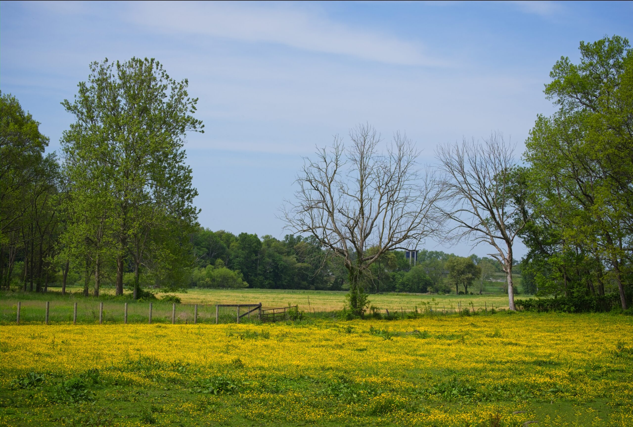
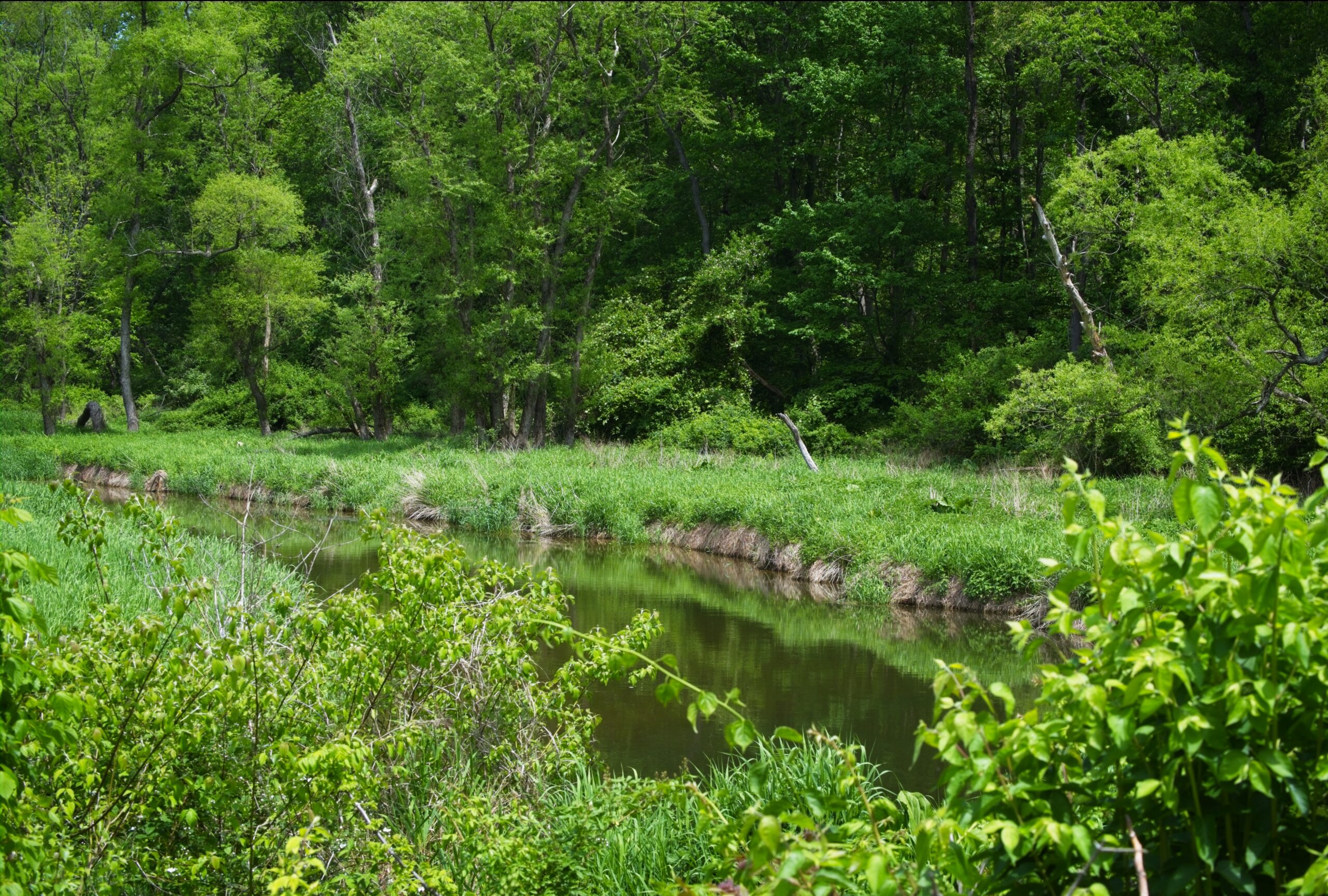
Below are a few photographs of a favorite corner of northwestern Chester County. I go here in hopes of finding some grassland species of birds that sometimes frequent farmers fields. So far I have just found horned larks, but there have been snow buntings, eastern meadowlarks and others spotted in the area, so you never know ….