Here are some photos of my November trip through west central Pennsylvania. Although the trip was primarily taken to view some state parks, there are always other interesting sights along the way. Featured are subjects in Blair, Bedford, Cambria, Indiana and Huntingdon counties.
Another westward trip in late fall gave me the opportunity to just about finish off my visits to Pennsylvania’s state parks. I headed north to Altoona from the Fort Littleton area and made a few stops along the way.
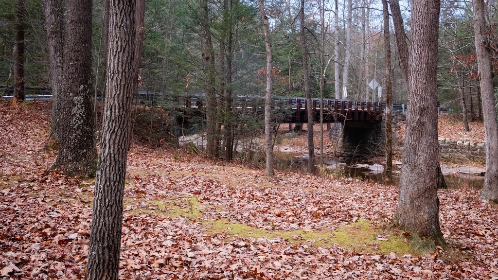
The first stop was actually a covered bridge – Hall’s Mill Covered Bridge. It is a wooden covered bridge which is located in Hopewell Township in Bedford County. It was listed on the National Register of Historic Places in 1980. The structure is a 91-foot-long (28 m), Burr Truss bridge with a medium pitched gable roof, and was built in 1872. It crosses Yellow Creek, and is one of fifteen historic covered bridges in Bedford County. It is one of several bridges that I saw in this area with open sides, except for the support beams.
After viewing the bridge, I made my way to Warrior’s Path State Park. This park is one of two near Raystown Lake that I visited. The 349-acre park lies very near the famous path used by the Iroquois in raids and wars with the Cherokees and other American Indians in southern Pennsylvania.
The park is a seasonal, day-use area open from mid-April through the end of October that is fairly small and undeveloped. At other times of the year, visitors must park near the main gate and walk into the park. The park provided opportunities for hiking, boating, fishing and picnicking, wildlife viewing and volleyball. This finger of land is bounded on three sides by the Raystown Branch of the Juniata River, which empties into Raystown Lake approximately one mile downstream. The unique shape of the park was formed as a result of river meandering. This section of the river exhibits some of the best examples of natural stream meandering in the state.
The Raystown branch of the Juniata.
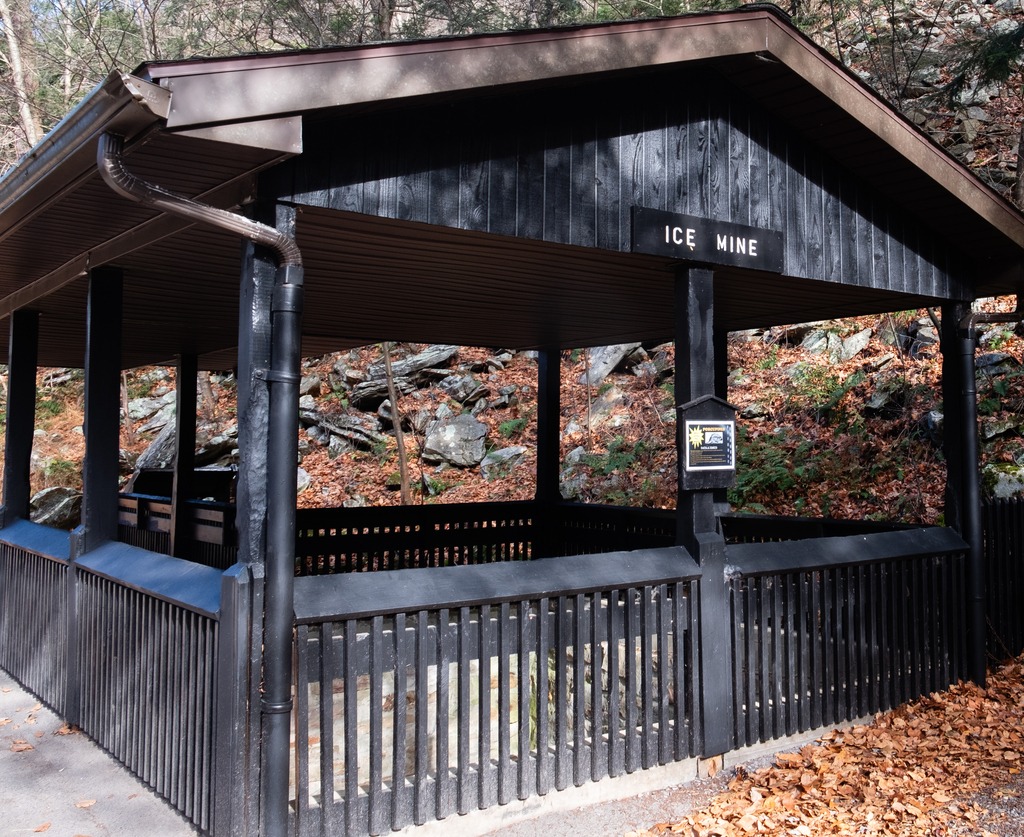
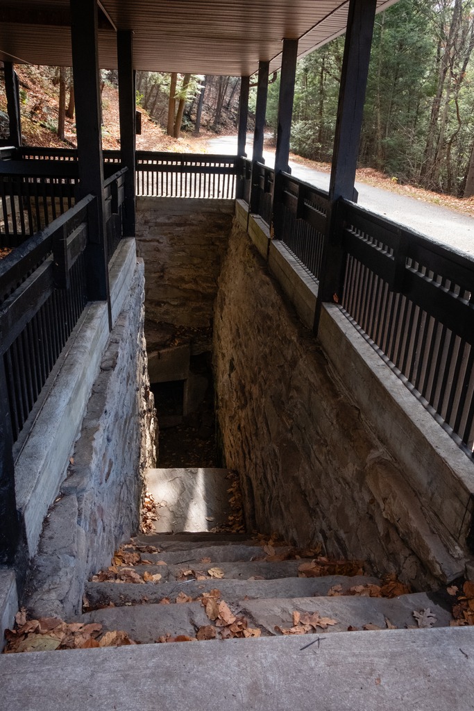
Trough Creek State Park in one of the loveliest in the Commonwealth. The 541-acre park is a scenic gorge formed as Great Trough Creek cuts through Terrace Mountain before emptying into Raystown Lake. Rugged hiking trails lead to wonders like Balanced Rock and Rainbow Falls. Rothrock State Forest and Raystown Lake border the park, making a large, contiguous area of public land for recreation. The park has a lovely campground and the usual state park activities.
The Balanced Rock is one of Trough Creek’s best know sites.Trough CreekThe Ice MineThis park is full of interesting rock formations.
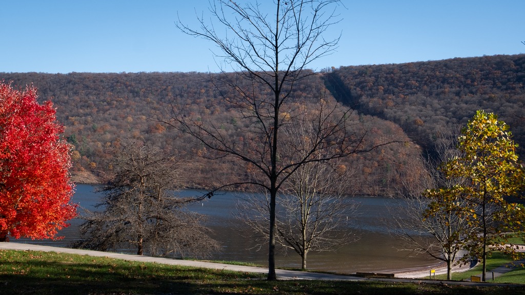
I finished my day with a brief visit to Raystown Lake, an Army Corp of Engineers facility. Raystown Lake is a reservoir in Huntingdon County, Pennsylvania. It is the largest lake that is entirely within Pennsylvania. The original lake was built by the Simpson family of Huntingdon as a hydroelectric project. The current 8,300-acre, 27 mile long Raystown Lake was completed in 1973 by the Army Corps of Engineers. The popular lake offers opportunities for boating, fishing, camping, hiking, swimming, and scenic beauty.
Greenwood Furnace and Penn-Roosevelt State Park may be close to one another, but they are very different in history and atmosphere. First up is Greenwood Furnace, which is one of those state parks with a lot of different activities available. It is in Huntingdon, PA.
In its 423 acres, the park offers a lake with swimming, small craft boating, hiking, camping, hunting, fishing, as well as a chance to view some local history. The park also provides access to the 80,000 acre Rothrock State Forest. However, a trip to the park begins with its historic district, which contains a blacksmith shop and the remains of an iron furnace. The community that existed on the site from 1834 to 1904 was a 19th century ironmaking complex.
The village blacksmith shop.An old iron furnace.The dam at the lake at Greenwood Furnace.Care for a dip?
Penn-Roosevelt is a 41-acre park is in an isolated area of the Seven Mountains region known as the Stone Creek Kettle. While the park is small in size, it is surrounded by a large block of Rothrock State Forest in Centre County.
Penn-Roosevelt is a good base for those seeking off the beaten track, low-density recreation in the State Forest. Activities include hiking on the Mid-State or other trails, gravel-riding on over 100 miles of Forestry roads, and mountain biking the nearby Cooper’s Gap area. There is also picnicking available. The small campground is rustic (tent camping only with latrines). However, one really does have the sense of being deep in the woods here. There is fishing in the streams in the park and access to hunting in the State Forest.
One of the most notable aspects of Penn-Roosevelt State Park is that it was constructed during the Great Depression by the Civilian Conservation Corps Camp S-62, which was built in Stone Creek Kettle. This was, unfortunately per CCC policy, a segregated camp. The members of the camp were all African-American and it was one of only 12 such CCC camps in Pennsylvania. The members of Camp S-62 constructed many of the facilities in use today at Penn-Roosevelt State Park. They constructed a log-crib dam that has since received a stone facing. They also built many of the roads and trails in the surrounding Rothrock State Forest. Remnants of the camp, including two stone fireplaces and a stone bake oven, can be seen today in the woods of Penn-Roosevelt State Park.