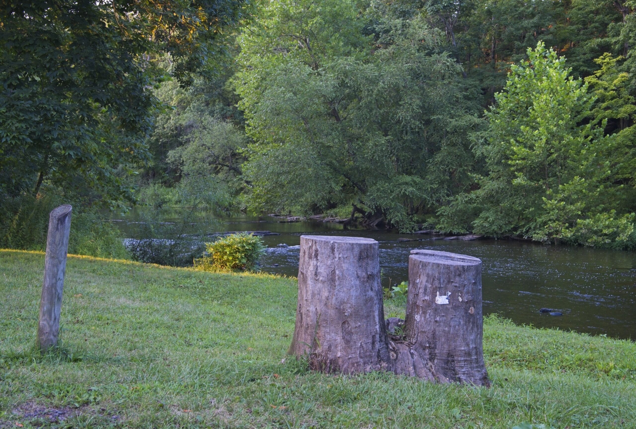
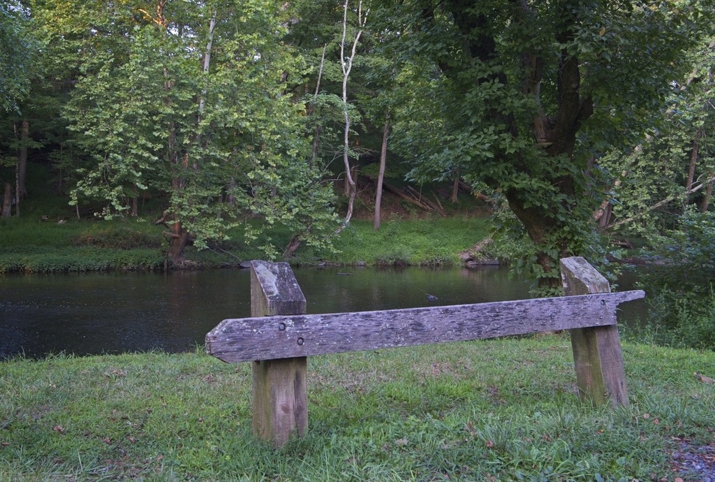
A trip into Bucks County led me to several covered bridges. Near the Cabin Run Covered Bridge is Tohickon Valley Park, a pleasnt spot with parking, picnic tables and fishing access to the Tohickon Creek. It is close to several other county parks. The 612-acre Tohickon park also has playgrounds,hiking, ball fields, and a swimming pool in season. Overnight stays include group and family camping and cabins on 22 campsites. It is deceptively large, which is why I missed a portion of it when I was there.
Views of Tohickon Creek.
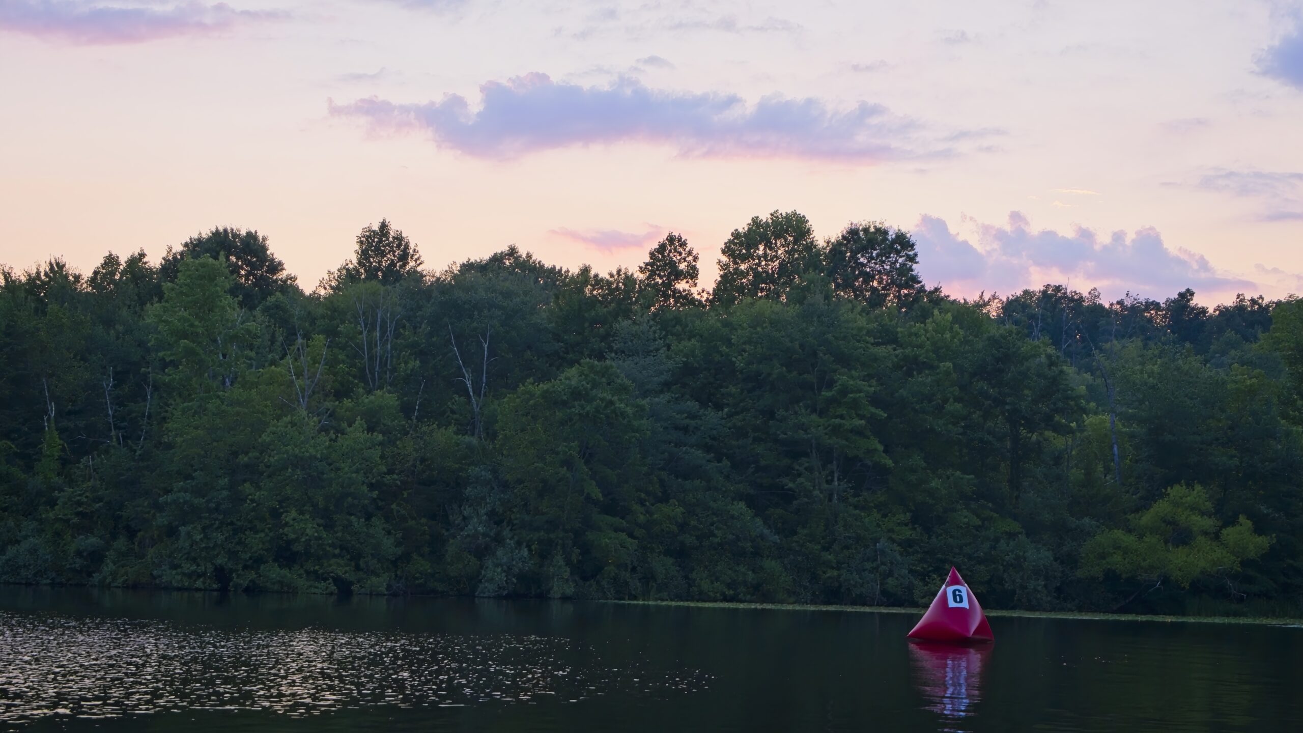
Nockamixon State Park has been featured on this blog before.so I will not go into detail here. It is a large park in Bucks County with a lake, full service marina, hiking, picnicking, hunting and fishing. It is actually a decent location for astronomy close to the city of Philadelphia. The Tohickon boat launch area is used for astronomy and provides fairly open horizons and a 20.10 mag/arssec^2 sky.
As you begin to learn anything about photogrpaphy, the concept of “golden hour” (the hour right before sunset or after sunrise) will certainly come up. It is considered to be an ideal time to photograph because of the attractive soft light. In fact, you will often find advice that taking photos any other time is “wrong” and that you shouldn’t bother. I find that taking photos at this time to be quite tricky and that it doesn’t necessarily lead to better results. This is especially true if you shoot without a tripod or have limited choices in terms of angle and framing.
As you can see from the photos of covered bridges below. there is a dramatic difference in lighting between the photos taken from one side of the bridge compared to the other. However, I still like to document both sides of a bridge, if possible, so I am stuck with shots that really aren’t that great. If the subject is backlit, as it is here in some photos, it can look terrible. At golden hour you can be fighting low light, back-lighting (but with the foreground not usable as a silhouette), harsh light and long shadows.
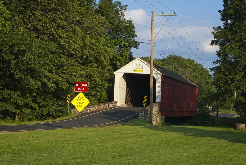
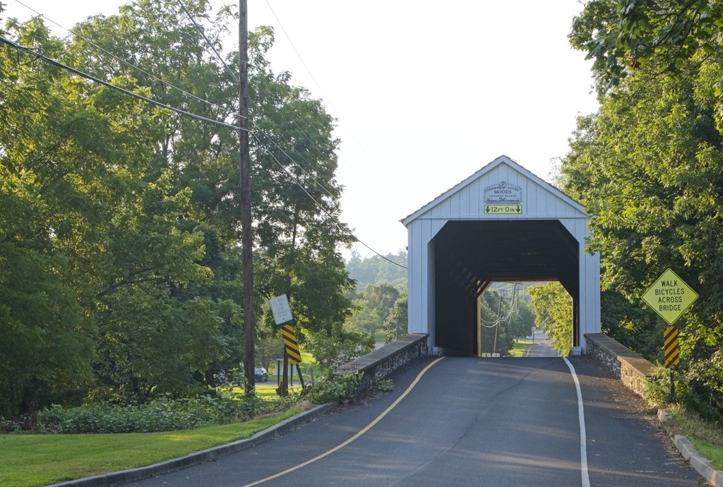
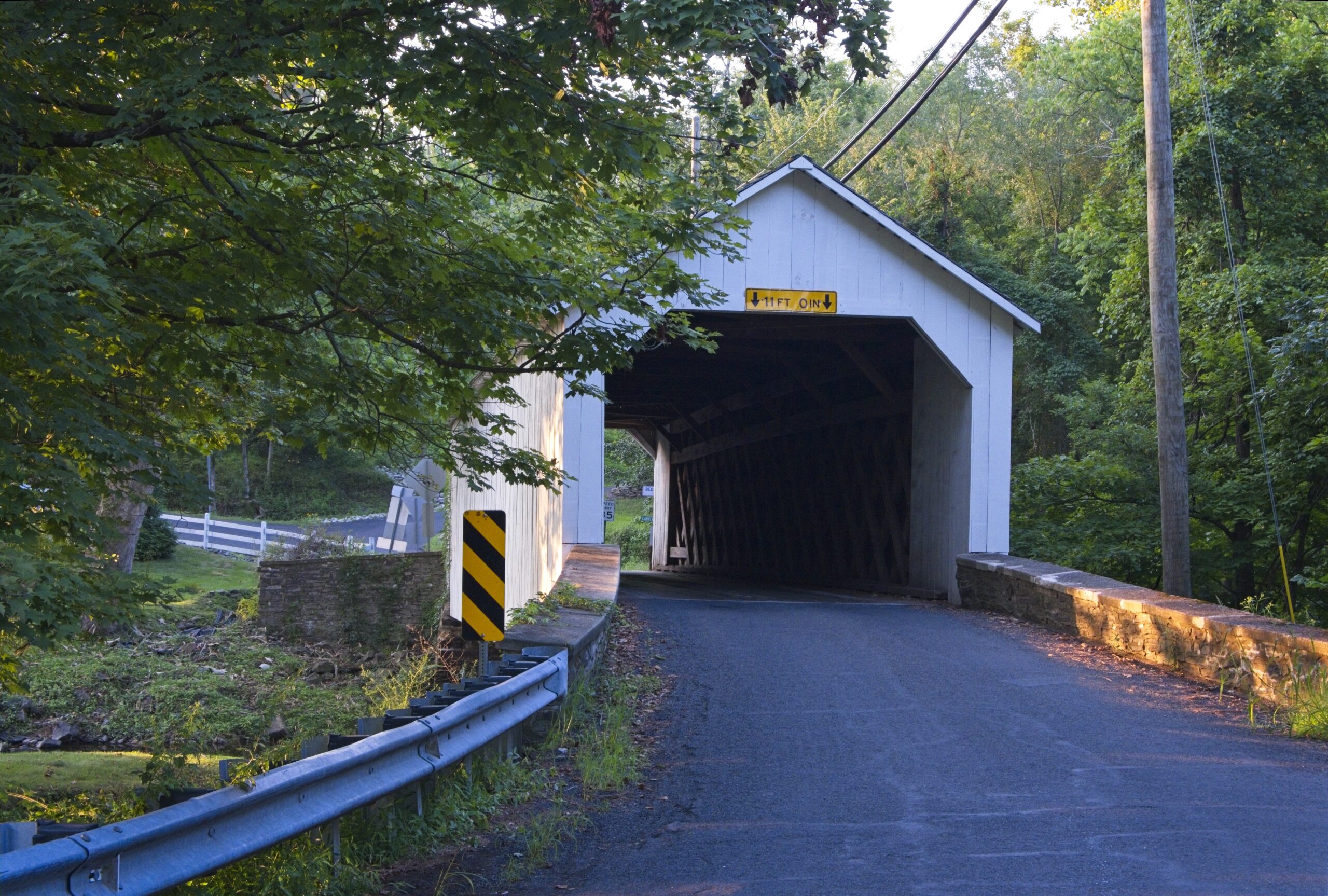
Rant over. I don’t get into Bucks County as often as I should. I took the opportunity of a trip to Nockamixon State Park for a star party to visit some covered bridges in the area. The first stop was Mood’s Covered Bridge, a historic covered bridge located in East Rockhill Township. It crosses the East Branch Perkiomen Creek.
Built in 1874 and designed in the town truss style, the bridge was 120 feet long and 15 feet wide. It was added to the National Register of Historic Places on December 1, 1980. It was destroyed by arson on June 22, 2004,and subsequently removed from the National Register of Historic Places. The wooden cover was subsequently rebuilt and the bridge reopened on February 15, 2008. It is an example of a one-way bridge and is open to vehicle traffic.
Moods Covered Briidge. Clearly one-way only.Moods Covered Bridge. Here is a photo froom the other side. See how washed out the sky is by comparison.
Below we have the all-white Loux Covered Bridge. A historic wooden covered bridge located on Wismer Road crossing Cabin Run upstream from the Cabin Run Covered Bridge in Bedminster Township and Plumstead Township. It was built in 1874 by David Sutton out of hemlock in the Town Truss style. This is one of the shorter covered bridges in Bucks County at only 60 feet (18 m) long. The bridge was added to the National Register of Historic Places on December 1, 1980. Bucks County obviously does not go for a uniform look for their covered bridges.
Loux Covered BridgeLoux Covered Bridge
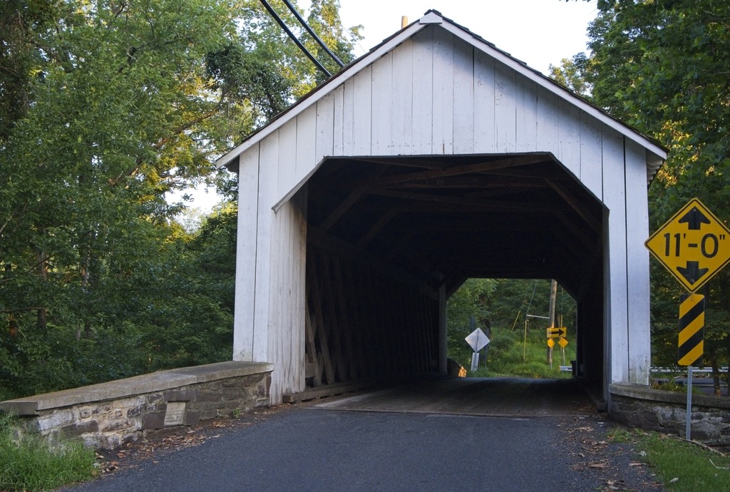
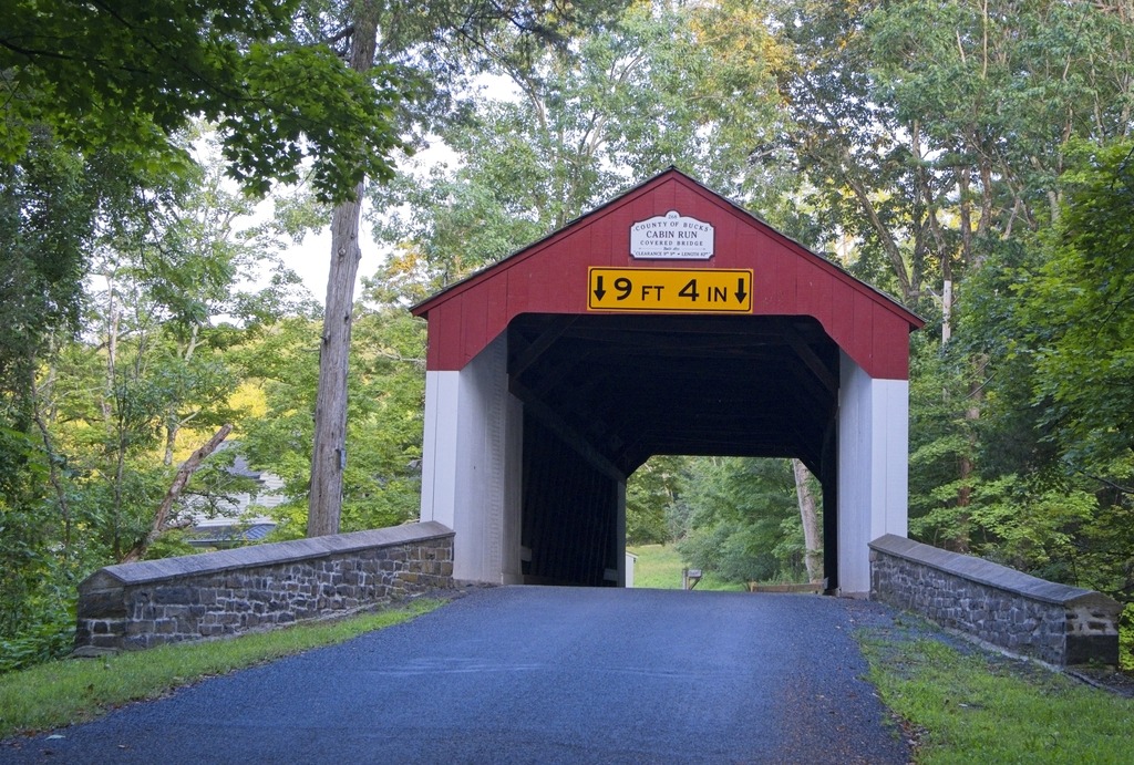
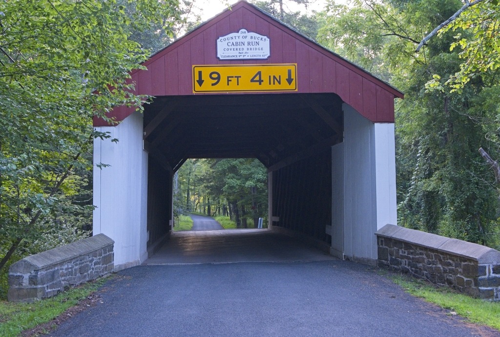
The Cabin Run Covered Bridge has a distinctive look. It is alsoo a historic covered bridge located in Point Pleasant, Plumstead Township. The bridge was built in 1871, and is 15 feet (4.6 m) wide and has a length of 82 feet (25 m). The Town truss bridge crosses Cabin Run (creek) downstream from the Loux Covered Bridge. It was added to the National Register of Historic Places on December 1, 1980. Together with the Loux Bridge, it is an example of a cluster or pair of bridges built over the same stream, as is found elsewhere in Pennsylvania.
Cabin Run Covered BridgeCabin Run Covered BridgeThis property is unusually close. You can even see the approach railing.Cabin Run Covered Bridge
The Sheards Mill Covered Bridge is very close to Lake Nockamixon and its State Park. The trip to see the bridge allowed to make another visit to the park and the surrounding area.
A very patriotic tractor.This door …… belongs to this barn.The Weisel Farm House and Barn at the High Bridge trailhead of Nockamixon State Park.
Another covered bridge in a scenic area, the Sheard’s Mill Covered Bridge is located in East Rockhill Township and Haycock Township, Bucks County next to the Levi Sheard Mill. The bridge was built in 1873, and is 15-foot-wide (4.6 m) and 130-foot-long (40 m), making it one of Bucks County’s longest bridges. The bridge crosses the Tohickon Creek on Covered Bridge Road. The bridge was added to the National Register of Historic Places on December 1, 1980.
I don’t see a Burr Arch truss. It looks like another Lattice Truss, like South Perkasie.
The bridge is near the Levi Sheard Mill. It is also known as Sheard’s Mill and the John S. Clymer Mill, and is an historic, American grist mill that is located in East Rockhill Township, Bucks County. It was placed on the National Register of Historic Places on December 18, 2006. The first section of this historic structure was built circa 1825, with three additions built into the early twentieth century. The mill was purchased by Levi Sheard in 1844. In 1916, ownership was transferred to brothers Rubin and John Clymer. The mill continued to operate until the 1970s.
The South Perkasie Covered Bridge is a covered bridge that is located in Perkasie, Bucks County. It is the oldest covered bridge in Bucks County and was added to the National Register of Historic Places on December 1, 1980. Built in 1832, this bridge is a 93-foot-long (28 m), Town truss covered bridge that once crossed Pleasant Spring Creek, but was moved and rededicated on August 15, 1959 as a feature in Lenape Park. It is the third oldest Town Lattice bridge in the country. The bridge was heavily damaged by the remnants of Hurricane Ida in September 2021. As you can see below, it is currently closed for repairs.
South Perkasie is adjacent to the town of Sellersville which was founded in the early 18th century. It is centered on a major road known as Bethlehem Pike that connected Philadelphia to Bethlehem and the Lehigh Valley. The town was very small and was called Sellers Tavern. Its most notable feature was a large inn. The present Washington House in Sellersville, however, was not Sellers Tavern. When the railroad expanded to the area in 1856, Sellersville experienced a population increase. After the borough’s incorporation in 1874, there was even more growth in the area. Cigar, textile, and other industries established companies in Sellersville, including Schulmerich Bells (one of the world’s largest producers of electronic carillons and hand bells). Today Sellersville is largely a commuter town.
One of the best know institutions in town is the Sellersville Theater.
The Washington House Hotel and Restaurant on Main Street.The historic train station.
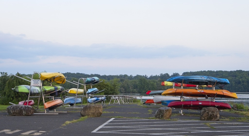
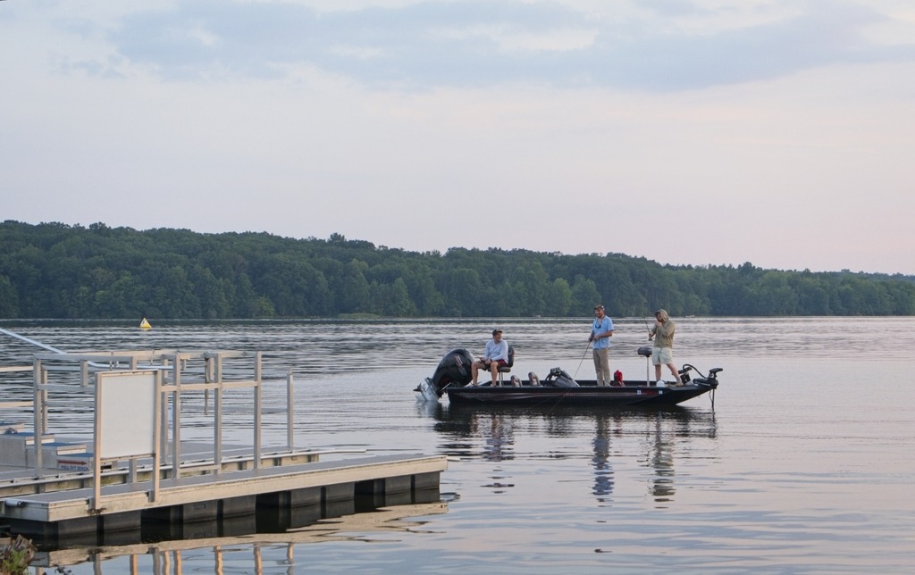
Here are a few shots from around Lake Nockamixon. I happened to stop there on my way home from Ralph Stover State Park. The 5,286-acre Nockamixon State Park is in Bucks County and is convenient to Philadelphia and its suburbs. Tohickon Creek, Three Mile Run, and Haycock Run feed the 1,450-acre Lake Nockamixon, which is a rest stop for migrating waterfowl and popular with boaters and anglers. There is a marina and 24 hour fishing in designated areas. You can stay the night in a cabin or enjoy the activities of the park for the day. Popular activities include picnicking, swimming in the pool, hiking, biking, disc golfing, hunting, fishing, birdwatching and boating.
The marina is one of my favorite areas of the park.I think I prefer the sailboat.An adaptive kayak launch to the right. A rare win for handicapped access in PA.Water looks a little choppy but still fun. A interesting barn I found on the way home.
Ralph Stover State Park provides access to Tohickon Creek, which flows through the 45-acre park. It contains a scenic picnic area, and the nearby High Rocks section is a lovely overlook of creek. When high water conditions exist, Tohickon Creek offers a challenging course for closed-deck canoes and kayaks, especially during the end of March and the beginning of November, when there are planned whitewater releases from Lake Nockamixon. Fishing is also available in Tohickon Creek.
This is also one of the most popular areas in southeastern Pennsylvania for climbing. The cliffs and trails at High Rocks are a joint ownership by the state and Bucks County. Within Ralph Stover and Tohickon Valley parks, the cliff faces are made of a common Bucks County rock, red Brunswick shale, which formed along an ancient fault line. Ranging from 30 ft to 150 ft high and extending about ¾ mile long, High Rocks offers close to 100 climbing routes consisting mostly of top rope and traditional climbing. Some areas along the trail closer to the creek edge may be conducive to bouldering.
Here comes the rant. While I am not particularly disabled, I do have tremendous difficulty walking on steep, uneven or eroded surfaces, even over short sections. I had hoped to see the view from High Rocks due to its short distance from the parking lot. It was my main objective in visiting here. I was very sad to discover, that due to trail conditions, even this short walk was inaccessible for someone with difficulty walking. This should be an ideal location for providing some type of handicapped access, at least to the first observation point. However, handicapped access seems to be a low priority of DCNR and the county park systems in this state and many types of opportunities are off limits. Whether this due to funding limitations, desire to limit access for environmental reasons, or indifference, enjoying the outdoors is limited to the able bodied or those that can hike on over uneven terrain. While I certainly don’t expect everything to be made accessible, I think there are specific spots where it could be easily done without substantially changing the experience of visiting those places. You can find the view from High Rocks through Google image search. That is what I had to settle for.
There is a road that runs through the park between High Rocks and main part of the park. This road, however, is impassable due to bridge construction. There were two signs directing you to High Rocks from the main picnic area, but they only got you about half way there and there was no signage at some key turns. If you are going to block a bridge, you need to clearly mark alternate routes.
This bridge, at least, was okay.As close to the view as I was able to get. So close but yet so far.Don’t even think about travelling through the park.
From Ralph Stover, I headed up River Road (Route 32), along the way I found the lovely Tinicum Park, which is part of the Buck County Parks system. The historic 126-acre Tinicum Park includes playgrounds, picnicking, hiking, ball fields, boating, fishing, ice skating, a disk golf course and group and family camping at eight campsites. You may even run into a polo match here.
The Erwin-Stover House is on the property.The barn is available as a rental.The grass must have gotten quite a haircut.Moving the bales.
River Road also provides access to entry points for Delaware Canal State Park and Delaware River boat access ramps.
Let’s take a look at some state parks in southeastern Pennsylvania from way back in mid September. Benjamin Rush State Park is in norheast Philadelphia and is the only state park within the city boundary. It has trails for hikers and bikers, good spots for wildlife and bird watchers and a model airplane field (like Valley Forge).
The park was named for Benjamin Rush, signer of the Declaration of Independence and attendee at the Continental Congress. He is the Father of American Psychiatry and published the first text book on the subject in the U.S. He advocated improved conditions for mental patients and careful clinical observation and study. Dr. Rush pioneered addiction therapies including treatment of alcoholism as a disease. The park was created out of land from a former state mental hospital.
I found its most notable feature to be its large community garden, however.
Community gardens flying the flag.
The next location was in Bristol, PA, Bucks County, for two of the many access points for Delaware Canal State Park. A walk along the entirety of the 60-mile-long towpath of the Delaware Canal State Park is a stroll back in time. Following the Delaware River between Easton and Bristol, this park contains an historic canal and towpath, a 50-acre pond, many miles of river shoreline, 11 river islands, and diverse scenery.
Boat along the Delaware River.The High Cross Monument to Irish immigration.Harriet Tubman.The Hispanic Monument.
Futher into town, we see the southern end of the canal.
The end of the line.A monument to Irish Civil War veterans and the basin at Bristol.
Finally, White Clay Creek Preserve along the Delaware border is the only property in the state park system called a “preserve.” Maybe because it adjoins White Clay Creek State Park in Delware. The 2,072-acre White Clay Creek Preserve is in southern Chester County. One can enjoy hiking, biking, fishing, and horseback riding in the Preserve. The area of White Clay Creek Preserve is part of a larger tract of land sold to William Penn in 1683 by Lenni Lenape Chief Kekelappen. It is thought that Kekelappen lived in Opasiskunk, an “Indian Town” which appears on a survey map of 1699 at the confluence of the Middle and East branches of White Clay Creek. The creek is named for the white clay found along its banks and used to make pottery.
The London Tract Baptist Meetinghouse, built in 1929, is at the intersection of Sharpless and London Tract roads. In its stone-walled cemetery rest many of the area’s earliest settlers including Dr. David Eaton.
The London Tract Baptist Meeting House, near the park office.The remains of the Sexton’s House across the road.
In 1984, the DuPont Company donated land to Pennsylvania and Delaware for the purpose of preserving the diverse and unique plant and animal species, and the rich cultural heritage of the area. Today, these lands form the bi-state White Clay Creek Preserve. Because White Clay Creek posses outstanding scenic, wildlife, recreational, and cultural value, it has been designated by Congress as a National Wild and Scenic River, and shall be preserved in free-flowing condition for the benefit and enjoyment of present and future generations.