Vosburg Neck State Park lies five miles west of Tunkhannock in Wyoming County. The park’s 669 acres feature historic buildings from the 1700 and 1800s, a canal bed and rail bed,, and a 1700s-era cemetery. Recreational activities include eight miles of trails, non-motorized boating access, and picnic areas.
The park is one of Pennsylvania’s three new state parks, and the most developed to date. The park was formerly the Howland Preserve. It is located in an oxbow on the north branch of the Susquehanna River known as the Vosburg Neck and features a diverse range of habitat.
The park office.The Riverside Barn seemed to have been in use for a private function before I arrived.Private residences dot the area. I also lust after one of these trailersThe boat launch.A lovely private home.The cemetery.
Harveys Lake, one of Pennsylvania’s few natural lakes, is found in Luzerne County. It has a surface area of approximately 621.5 acres, or nearly a square mile, and it is situated entirely within the borough of Harveys Lake. By volume, it is the largest natural lake in Pennsylvania, and by surface area, is the second-largest lake. It is a glacial lake surrounded by hills and is the source of Harveys Creek, a tributary of the Susquehanna River. Despite being a natural lake, it has a stone masonry dam. The lake’s watershed has an area of approximately 3600 acres. Nearly all of the developed land in the area is close to the lake itself, and the lake is surrounded entirely by a paved road. As you can see from the below photographs, the area around the lake is heavily developed with homes and other buildings built right up to the lakeshore around nearly the entire perimeter.
It is sad that few of Pennsylvania’s natural glacier lakes have been preserved in their natural, undammed state, with limited development. Few Pennsylvania residents will ever get an opportunity to experience a natural lake or learn about and appreciate their ecological importance. What has happened to Harveys Lake is, unfortunately, fairly typical of these lakes.
The day I visited, there was intermittent rain and heavily overcast skies, which do not make for the prettiest pictures.
I managed to take a short drive around Erie during the time I was there.
The Bicentennial Tower on the waterfront.The best view I could get of the brig Niagara since the maritime museum was closed at the time.The Erie Land Lighthouse.High and dry.The beautiful Russian Old Rite Orthodox Church.
The following two historic homes were moved and reconstructed on their current sites.
VON BUSECK HOUSE — C. 1815 This saltbox-style farmhouse was built c.1815 in west Millcreek on what is now known as 5021 West 38th Street, south of Wheaton Road. The land was owned by Irish immigrant John Nicholson (1764–1828), and the family of John Wheaton owned the building for a time. For over 150 years it was owned by Louis Von Buseck (1812–1893) and his descendants. Louis was born Ludwig Heinrich Von Buseck in Germany, the second son of Baron Carl Philip Von Buseck.
The Von Buseck House.
HON. JUDAH COLT HOUSE — C. 1820 One of Erie County’s earliest citizens, Hon. Judah Colt (1761–1832), settled at what is now known as Colt Station in 1796. He moved to the Borough of Erie in 1804 as the agent for the county’s first land developer, Pennsylvania Population Company. Colt served as burgess of Erie in 1813 and 1820–1821. He built this Federal-style house c.1820 at the southwest corner of East 4th and French streets where he entertained the Marquis De Lafayette (1757–1834) on June 3, 1825. This was also home to his nephew Thomas G. Colt (1805–1861), the last Burgess and the first mayor for the city of Erie. The house was moved to 345 East Front St. in 1890.
Moraine State Park in Butler County, which features the 3,225-acre Lake Arthur with 42 miles of shoreline, is a landscape that has endured the effects of continental glaciers and massive mineral extraction. This popular park hosts more than one million boaters, picnickers, hikers, bikers, horseback riders, cabin renters, and swimmers each year. The 16,725-acre park was restored from prior coal mining and oil and gas drilling practices. Unfortunately, it was not a very nice day when I visited in early May.
Jennings Environmental Education Center is one of several state parks specifically dedicated to providing environmental education and recreational programs to the community. This site provides a unique combination of prairie and forest environs, which offer a wide array of resource and educational opportunities. One of the park’s main features, the 20-acre prairie ecosystem, is home to distinctive prairie plants and the endangered massasauga rattlesnake. The most noteworthy and spectacular prairie flower is the blazing star. Jennings was the first reserve established in Pennsylvania to protect an individual plant species and remains the only public and protected prairie in the commonwealth.
The prairie wildflowers are best enjoyed in late July and early August. I did not get very good shots at this site, due to the weather and the time of year.
My trip through western Pennsylvania led me through two parks with some of the largest lakes in the state.
Maurice K. Goddard State Park in Mercer County contains the 1,680-acre Lake Wilhelm, which is popular with anglers and boaters. Many recreational activities, such as hiking, hunting, cycling, skating and picnicking, attract visitors in all seasons. The large lake, abundant wetlands, old fields, and mature forests provide a diversity of habitats for wildlife, especially waterfowl, eagle, and osprey.
Pymatuning State Park in Crawford County, at 16,892 acres, is one of the largest state parks. The 17,088-acre Pymatuning Reservoir (partially shared with Ohio) is the largest lake in the commonwealth. It is one of the most visited state parks in Pennsylvania. The many recreational opportunities include boating, fishing, swimming, and camping. In addition to the state park facilities, the Pennsylvania Fish and Boat Commission operates a fish hatchery and visitor center, and the Pennsylvania Game Commission has wildlife viewing areas.
My first stop was the dam at the southern end of the lake. It is the largest earthen dam that I have seen. The area around the lake is one of the few places that bald eagles nested continuously during their years of decline.
Shikellamy State Park is an unusual park in that it contains two distinctly different sections. It also affords great views of the two branches of the Susquehanna River (the West Branch and the North Branch ). The Park is in both Union and Northumberland counties. The 54-acre Shikellamy Marina is on the southern tip of Packers Island at the confluence of the West Branch and North Branch Susquehanna River, and offers hiking and biking trails, a marina, and boat launch. The 78-acre Shikellamy Overlook is on the western shore of the Susquehanna River. A 360-foot cliff overlooks the confluence of the two branches of the river.
Although the marina area seemed more popular with Labor Day party goers, I was more impressed with the views on the overlook side.
A look toward the Marina.A look down over the edge.The West Branch on the left.The town of Northumberland.
The Marina Section provides great access to the water as well as picnicking opportunities.
While in New England and Canada, I took a day trip to the popular village of Peggy’s Cove. This tourist attractions is a quaint Nova Scotia fishing village with one of the most photographed lighthouses in Canada.
Finally, here a some photos of Georges Island National Historic Site in Halifax, Nova Scotia.
This October I was fortunate to take a trip to Maine, Nova Scotia and Quebec. Much of the topography of the inland areas, and the fall color, remind me of Pennsylvania. First up is a boat trip from Bar Harbor, Maine. This part of the Maine coast from Bar Harbor to Somes Sound is dotted with the “cottages” of the rich and famous.
The trip was themed around the lighthouses of the Bay of Maine near the Mount Desert Island shore.
Here are some boats, buoys, and critters along the way, along with a few looks at Mount Desert Island from the sea.
There are some fantastic locations in Pennsylvania that have escaped my notice, even after all these years. Perhaps, in the case of our next location, it is because it’s almost all the way to the New York State line.
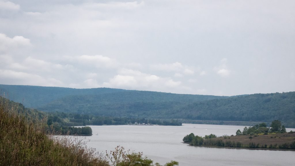
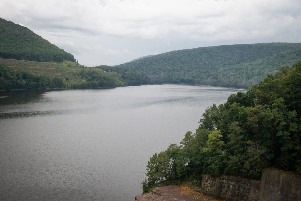
Tioga-Hammond Lakes are twin lakes in north central Pennsylvania with overnight and day use facilities in a scenic environment, southwest of Tioga, PA and north of Wellsboro on PA on Route 287. The recreation area has camping, a swimming beach, sand volleyball court, playground, boat launches, field sports area, a camp store, trails hunting, display gardens, archery trail, scenic overlooks and picnic facilities including grills and picnic shelters. There area is administered by the US Army Corps of Engineers.
The lakes were formed by the building of two separate dams, one on the Tioga River and one on Crooked Creek. They are connected by a channel cut through the rock which has its own weir on the Tioga Reservoir side. This unusual arrangements allows acid polluted water to mix with cleaner water from the other stream, increasing overall water quality downstream.
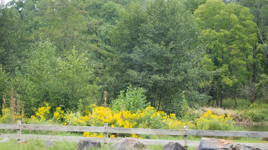
A view of the channel.Near one of the boat launches at the Ives Run Beach Area and campground.Some looks out over the reservoirs.Tioga Reservoir Overlook.The recreation area abuts state game lands near Crooked Creek.Unusual and nice osprey nest platform viewing area.Fishing the Tioga.The goldenrod was everywhere that weekend.